东北地区30m分辨率主要作物分布数据集(2017-2021年)
收藏国家地球系统科学数据中心2024-08-30 更新2024-03-04 收录
下载链接:
https://www.geodata.cn/data/datadetails.html?dataguid=173186863434307&docId=2782
下载链接
链接失效反馈官方服务:
资源简介:
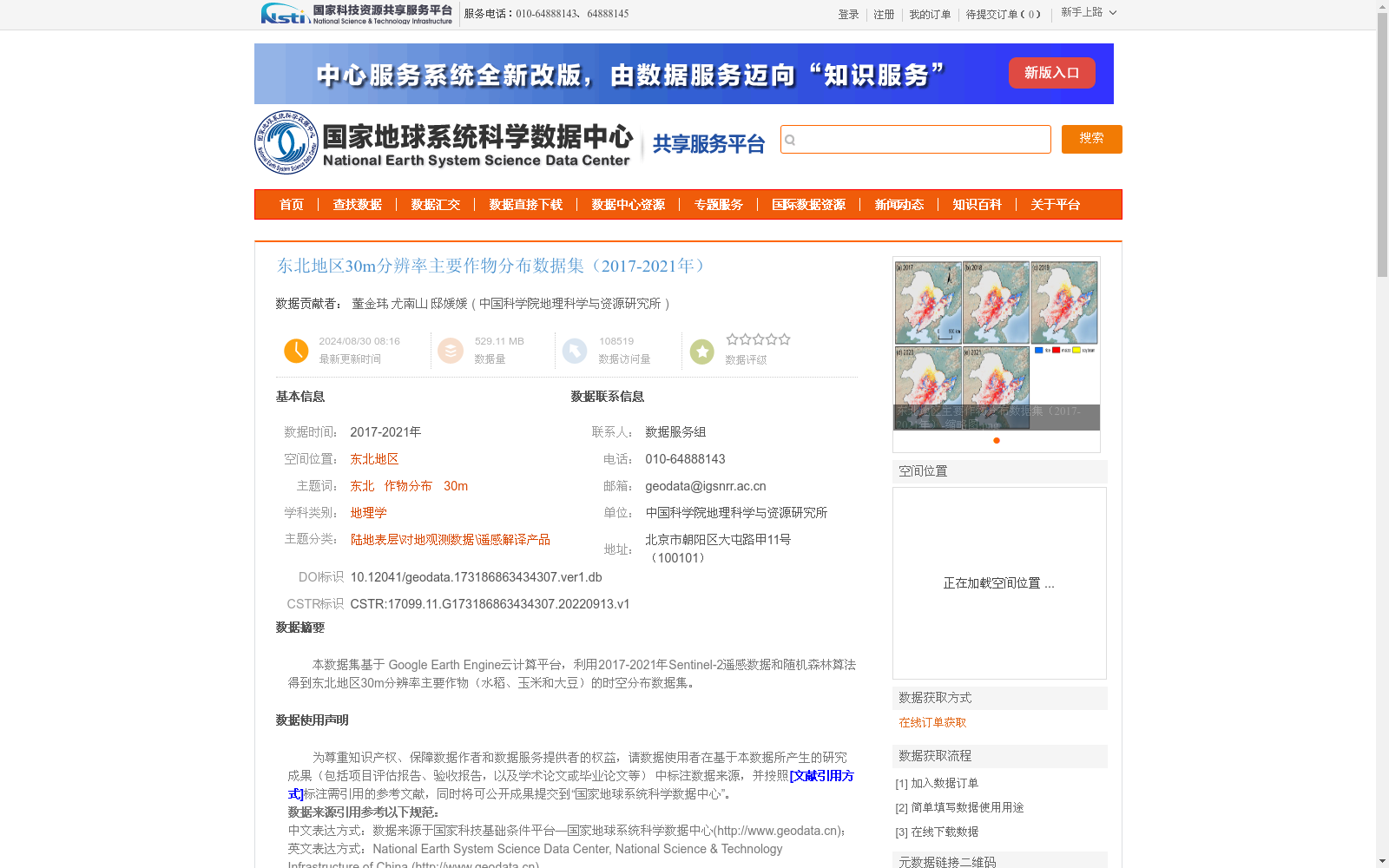
本数据集基于 Google Earth Engine云计算平台,利用2017-2021年Sentinel-2遥感数据和随机森林算法得到东北地区30m分辨率主要作物(水稻、玉米和大豆)的时空分布数据集。
Based on the Google Earth Engine cloud computing platform, this dataset is a 30-meter resolution spatiotemporal distribution dataset of major crops (rice, maize, and soybean) in Northeast China, derived using Sentinel-2 remote sensing data from 2017 to 2021 and the random forest algorithm.
提供机构:
中国科学院地理科学与资源研究所
创建时间:
2022-09-13
搜集汇总
数据集介绍
背景与挑战
背景概述
该数据集提供了2017-2021年东北地区30米分辨率的主要作物(水稻、玉米和大豆)时空分布信息,基于Google Earth Engine云计算平台和Sentinel-2遥感影像,采用随机森林算法生成。数据经过地面样本验证,2017-2020年总体精度达82.4%至95.6%,Kappa系数为0.775至0.936,并与市级统计数据高度相关,确保了数据的可靠性和实用性。
以上内容由遇见数据集搜集并总结生成


