中国地表水体、大坝、水库和湖泊数据集(2019年)
收藏国家地球系统科学数据中心2023-02-09 更新2024-03-04 收录
下载链接:
https://www.geodata.cn/data/datadetails.html?dataguid=280938386673992&docId=6351
下载链接
链接失效反馈资源简介:
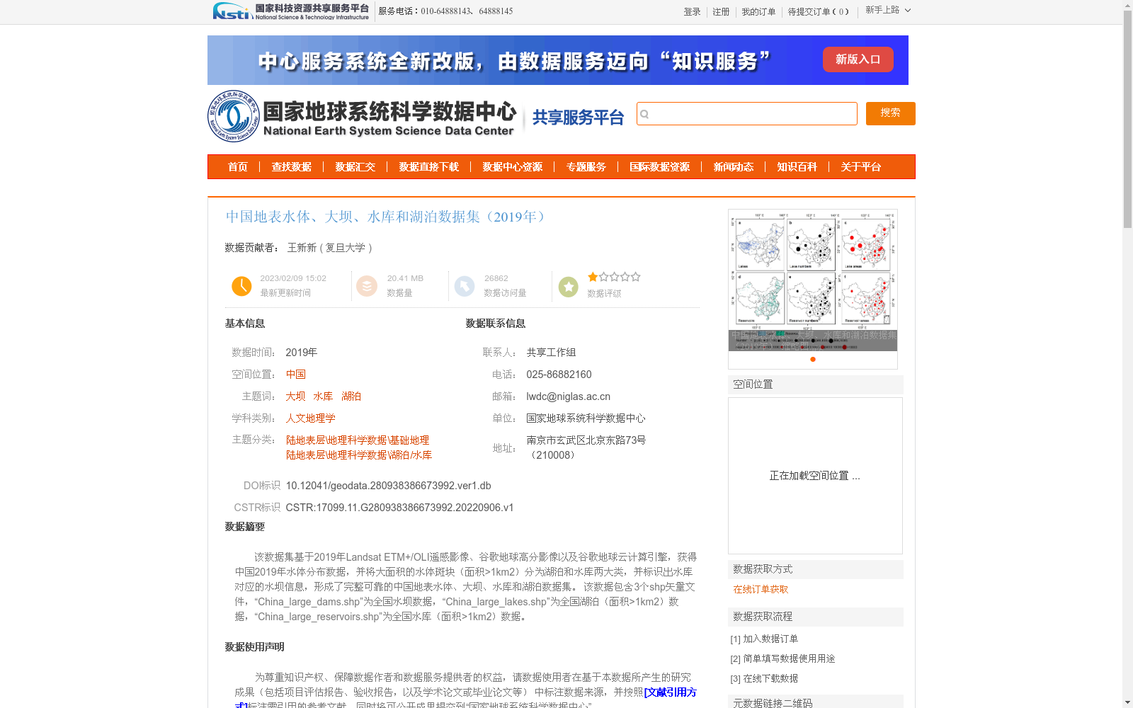
该数据集基于2019年Landsat ETM+/OLI遥感影像、谷歌地球高分影像以及谷歌地球云计算引擎,获得中国2019年水体分布数据,并将大面积的水体斑块(面积>1km2)分为湖泊和水库两大类,并标识出水库对应的水坝信息,形成了完整可靠的中国地表水体、大坝、水库和湖泊数据集。
该数据包含3个shp矢量文件,“China_large_dams.shp”为全国水坝数据,“China_large_lakes.shp”为全国湖泊(面积>1km2)数据,“China_large_reservoirs.shp”为全国水库(面积>1km2)数据。
This dataset is constructed based on 2019 Landsat ETM+/OLI remote sensing imagery, high-resolution Google Earth imagery, and the Google Earth Engine. It derives the 2019 water body distribution dataset of China, classifies large water body patches with an area greater than 1 km² into two categories: lakes and reservoirs, and identifies the associated dam information for each reservoir, thereby creating a comprehensive and reliable dataset covering China's surface water bodies, dams, reservoirs, and lakes.
This dataset includes three shapefile vector files: "China_large_dams.shp" stores the national dam dataset, "China_large_lakes.shp" contains the national lake dataset (area > 1 km²), and "China_large_reservoirs.shp" holds the national reservoir dataset (area > 1 km²).
提供机构:
复旦大学
创建时间:
2022-09-06
AI搜集汇总
数据集介绍
背景与挑战
背景概述
该数据集是基于2019年遥感影像和谷歌地球云计算引擎生成的中国地表水体资源专题数据,覆盖全国范围,重点包含面积大于1平方公里的湖泊、水库及其对应水坝的矢量信息。数据通过目视解译方法确保准确性,适用于地理科学、水资源管理等领域的研究,但未涵盖小面积水体。
以上内容由AI搜集并总结生成


