藏南卡鲁雄峰冰川分布数据集(1987-2024)
收藏国家青藏高原科学数据中心2024-09-18 更新2024-09-21 收录
下载链接:
https://data.tpdc.ac.cn/zh-hans/data/a885dcf0-cca9-4315-9e84-43f43ca89f37
下载链接
链接失效反馈官方服务:
资源简介:
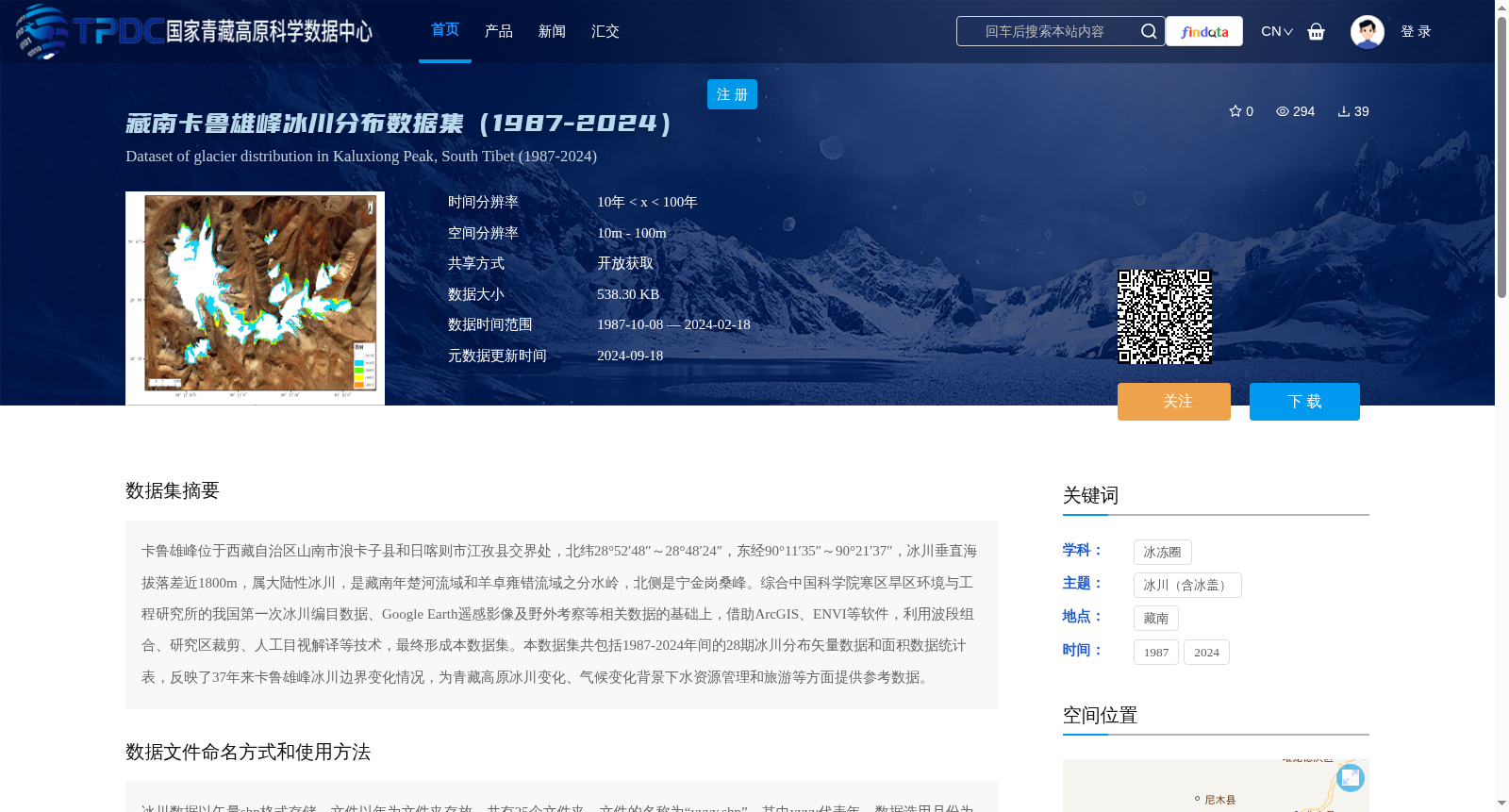
卡鲁雄峰位于西藏自治区山南市浪卡子县和日喀则市江孜县交界处,北纬28°52′48″~28°48′24″,东经90°11′35″~90°21′37″,冰川垂直海拔落差近1800m,属大陆性冰川,是藏南年楚河流域和羊卓雍错流域之分水岭,北侧是宁金岗桑峰。综合中国科学院寒区旱区环境与工程研究所的我国第一次冰川编目数据、Google Earth遥感影像及野外考察等相关数据的基础上,借助ArcGIS、ENVI等软件,利用波段组合、研究区裁剪、人工目视解译等技术,最终形成本数据集。本数据集共包括1987-2024年间的28期冰川分布矢量数据和面积数据统计表,反映了37年来卡鲁雄峰冰川边界变化情况,为青藏高原冰川变化、气候变化背景下水资源管理和旅游等方面提供参考数据。
Located at the border between Langkazi County, Shannan City and Gyangze County, Shigatse City, Tibet Autonomous Region, Kalu Xiong Peak has geographic coordinates ranging from 28°48′24″N to 28°52′48″N and 90°11′35″E to 90°21′37″E. Its glaciers feature a vertical elevation difference of nearly 1800 meters and are classified as continental glaciers. The peak serves as the watershed between the Nyang Chu River Basin and the Yamdrok Tso Basin in southern Tibet, with its northern flank adjoining Noijin Kangsang Peak. This dataset was developed by integrating multi-source data including the first national glacier inventory of China from the Cold and Arid Regions Environmental and Engineering Research Institute, Chinese Academy of Sciences, remote sensing imagery from Google Earth, and field survey data. We utilized software such as ArcGIS and ENVI, and applied techniques including band combination, study area clipping, and manual visual interpretation to generate the final dataset. This dataset contains 28 phases of glacier distribution vector data and area statistics tables spanning the period from 1987 to 2024, which records the changes in the glacier boundaries of Kalu Xiong Peak over the past 37 years. It provides reference data for studies on glacier changes on the Qinghai-Tibet Plateau, water resource management under the context of climate change, and tourism development, among other relevant fields.
提供机构:
扎西欧珠,格桑旦增,平措旺旦
创建时间:
2024-09-03
搜集汇总
数据集介绍
背景与挑战
背景概述
该数据集提供了1987-2024年间藏南卡鲁雄峰冰川的28期分布矢量数据和面积统计表,空间分辨率为10m-100m,时间分辨率超过10年。数据通过遥感影像和野外考察结合ArcGIS等软件处理生成,适用于冰川变化和气候变化研究。
以上内容由遇见数据集搜集并总结生成


