Debris-flow and Flood Video Files, Chalk Cliffs, Colorado, USA, 2016
收藏资源简介:
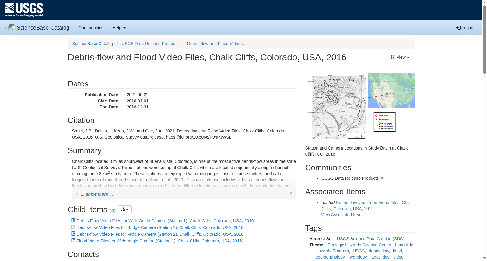
Chalk Cliffs located 8 miles southwest of Buena Vista, Colorado, is one of the most active debris-flow areas in the state (U.S. Geological Survey). Three stations were set up at Chalk Cliffs which are located sequentially along a channel draining the 0.3 km2 study area. These stations are equipped with rain gauges, laser distance meters, and data loggers to record rainfall and stage data (Kean, et al., 2020). This data release includes videos of debris-flows and floods captured by high-definition cameras placed at three different locations, associated with the monitoring stations, along the study area at Chalk Cliffs during 2016. Near the Upper Station (Station 1) there are two cameras, one located at the bridge cross section at the channel (Bridge Camera) and another on the opposite side of the basin with a broad view of the channel (Wide-angle Camera). The third camera (Middle Camera) is located near Station 2. The attached figure "station_and_camera_locations.png" provides an overview figure with the location of the three cameras and three stations along the channel. The videos and their audio are used to record information on flow type and velocity of debris flows. They can also be used to interpret how the flow characteristics, such as sediment concentration, vary with time to compare to seismic observations. Video recording for all cameras is triggered using a rainfall threshold, derived from rainfall measurements from rain gauges (Michel et al., 2019). The complete videos for all the cameras are downloaded manually during site visits. More detailed information about the cameras and settings used can be found in the metadata file under "Process steps" in "Data quality information." During 2016, several debris flows and floods were captured by the three cameras. The videos can currently be viewed in the individual 'Child item' pages accessible below. The 'Child item' pages contain either flood or debris flow video files for each camera described above. The following citations relate to reports that provide background information for this data release: Michel, A., Kean, J.W., Smith, J.B., Allstadt, K.E., Coe, J.A. (2019). Taking the pulse of debris flows: Extracting debris-flow dynamics from good vibrations in southern California and central Colorado. Debris-flow hazards mitigation: Mechanics, Monitoring, Modeling, and Assessment. http://dx.doi.org/10.25676/11124/173224 U.S. Geological Survey Landslide Hazards Program. (2020). Chalk Cliffs, Colorado. U.S Geological Survey, https://www.usgs.gov/natural-hazards/landslide-hazards/science/chalk-cliffs-colorado?qt-science_center_objects=0#qt-science_center_objects Kean, J.W., Smith, J.B., and Coe, J.A., 2020, Debris-flow monitoring data, Chalk Cliffs, Colorado, USA, 2014: U.S. Geological Survey data release, https://doi.org/10.5066/P9MUWDFN
粉笔崖(Chalk Cliffs)位于美国科罗拉多州布埃纳维斯塔西南8英里处,是该州泥石流活动最为频繁的区域之一(美国地质调查局(U.S. Geological Survey))。 研究团队沿覆盖0.3平方千米研究区域的河道,在粉笔崖依次布设了3个监测站点。上述站点均配备雨量计、激光测距仪与数据记录仪,可同步记录降雨与水位数据(Kean等,2020)。 本次数据发布包含2016年期间,布设在粉笔崖研究区内与监测站点配套的3处高清摄像机所捕获的泥石流与洪水视频。在上游站点(站点1)附近布设了2台摄像机:一台位于河道桥断面处(桥载摄像机),另一台设于流域对岸,可获取河道全景视野(广角摄像机)。第三台摄像机(中游摄像机)布设于站点2附近。附件图"station_and_camera_locations.png"展示了3处摄像机与3个监测站点沿河道的分布概况。 这些视频及其音频可用于记录泥石流的流态与流速特征,还可用于解析泥沙浓度等流动参数随时间的变化规律,以便与地震观测结果开展对比分析。所有摄像机的视频录制均通过基于雨量计观测数据确定的降雨阈值触发(Michel等,2019)。所有摄像机的完整视频均在野外实地考察期间手动下载获取。关于摄像机及拍摄参数的更多详细信息,可参阅"数据质量信息"模块下"处理步骤"中的元数据文件。 2016年期间,3台摄像机共捕获多场泥石流与洪水事件。当前用户可通过下方对应的"子项"页面查看相关视频,各"子项"页面分别包含前文所述各摄像机拍摄的洪水或泥石流视频文件。 以下文献为本次数据发布提供了背景信息支撑: 1. Michel, A., Kean, J.W., Smith, J.B., Allstadt, K.E., Coe, J.A. (2019). 解析泥石流脉动:从南加州与科罗拉多中部的有效振动中提取泥石流动力学特征. 泥石流灾害减灾:力学机制、监测技术、模拟建模与风险评估. http://dx.doi.org/10.25676/11124/173224 2. 美国地质调查局滑坡灾害项目组(U.S. Geological Survey Landslide Hazards Program). (2020). 科罗拉多州粉笔崖. 美国地质调查局, https://www.usgs.gov/natural-hazards/landslide-hazards/science/chalk-cliffs-colorado?qt-science_center_objects=0#qt-science_center_objects 3. Kean, J.W., Smith, J.B., & Coe, J.A., 2020, 2014年美国科罗拉多州粉笔崖泥石流监测数据集:美国地质调查局数据发布, https://doi.org/10.5066/P9MUWDFN