青藏高原生态系统水源涵养服务数据集(1990-2020)
收藏国家青藏高原科学数据中心2024-11-12 更新2024-11-30 收录
下载链接:
https://data.tpdc.ac.cn/zh-hans/data/59174a10-1b6e-4e19-a63d-eeb9bc919507
下载链接
链接失效反馈官方服务:
资源简介:
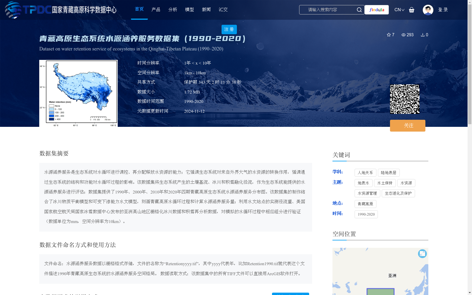
水源涵养服务是生态系统对水循环进行调控、再分配释放水资源的能力;它强调生态系统对来自外界大气的水资源的转换作用,强调通过生态系统的结构和功能对水循环过程的影响。该数据集将生态系统产生的土壤基流、冰川和积雪融化径流,作为生态系统能提供的水源涵养服务进行评估;数据集提供了1990年、2000年、2010年和2020年四期青藏高原生态系统水源涵养服务分布图。该数据集的制作结合了冰川物质平衡模型和可变下渗能力水文模型,刻画青藏高原水循环过程和计算水源涵养服务量;利用水文站点的实测径流量、美国国家航空航天局国家冰雪数据中心发布的亚洲高山地区栅格化冰川数据和积雪再分析数据,对模拟的水循环过程中相应组分进行验证(数据单位为mm,空间分辨率为10km)。
Water conservation service refers to the ability of ecosystems to regulate the water cycle and redistribute and release water resources. It emphasizes the transformation of external atmospheric water resources by ecosystems, as well as the impact of ecosystem structure and function on the water cycle process. This dataset assesses the water conservation services provided by ecosystems using soil base flow, glacial melt runoff and snowmelt runoff generated by ecosystems as core evaluation indicators. The dataset provides distribution maps of ecosystem water conservation services on the Qinghai-Tibet Plateau for four periods: 1990, 2000, 2010 and 2020. This dataset was developed by combining the glacial mass balance model and the Variable Infiltration Capacity (VIC) hydrological model, which simulates the water cycle process on the Qinghai-Tibet Plateau and calculates the volume of water conservation services. It uses the measured runoff from hydrological stations, rasterized glacial data and snow reanalysis data for the Asian high mountain regions released by the National Snow and Ice Data Center (NSIDC) of the National Aeronautics and Space Administration (NASA) to validate the corresponding components in the simulated water cycle. The data unit is mm, and the spatial resolution is 10 km.
提供机构:
应凌霄,郑华
创建时间:
2024-11-11
搜集汇总
数据集介绍
背景与挑战
背景概述
该数据集提供了1990年至2020年间青藏高原生态系统水源涵养服务的四期(1990、2000、2010、2020年)空间分布图,评估了包括土壤基流、冰川和积雪融化径流在内的水源涵养能力。数据集基于冰川物质平衡模型和可变下渗能力水文模型制作,空间分辨率为10km,并经过实测径流和遥感数据验证,适用于研究青藏高原水循环和生态服务功能。
以上内容由遇见数据集搜集并总结生成


