青藏地区高等级公路多年冻土段两侧10km缓冲区1:25万重大灾害风险性分区(2023)
收藏国家青藏高原科学数据中心2024-10-29 更新2024-11-30 收录
下载链接:
https://data.tpdc.ac.cn/zh-hans/data/6e59b763-f4a7-4c83-a71f-7fec7a84883c
下载链接
链接失效反馈官方服务:
资源简介:
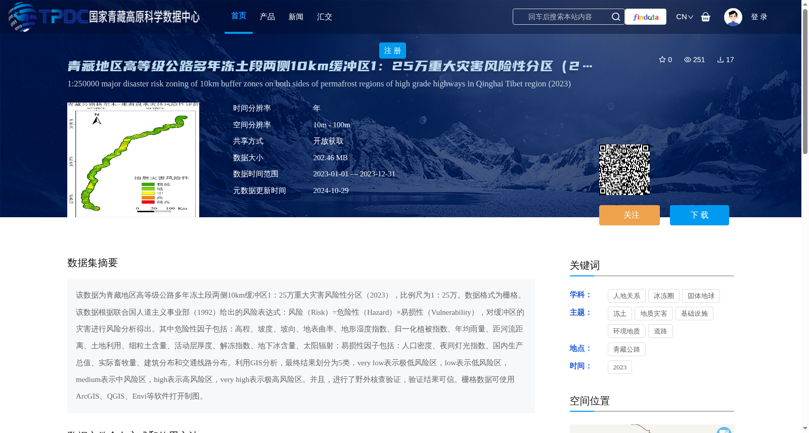
该数据为青藏地区高等级公路多年冻土段两侧10km缓冲区1:25万重大灾害风险性分区(2023),比例尺为1:25万。数据格式为栅格。该数据根据联合国人道主义事业部(1992)给出的风险表达式:风险(Risk)=危险性(Hazard)×易损性(Vulnerability),对缓冲区的灾害进行风险分析得出。其中危险性因子包括:高程、坡度、坡向、地表曲率、地形湿度指数、归一化植被指数、年均雨量、距河流距离、土地利用、细粒土含量、活动层厚度、解冻指数、地下冰含量、太阳辐射;易损性因子包括:人口密度、夜间灯光指数、国内生产总值、实际畜牧量、建筑分布和交通线路分布。利用GIS分析,最终结果划分为5类,very low表示极低风险区,low表示低风险区,medium表示中风险区,high表示高风险区,very high表示极高风险区。并且,进行了野外核查验证,验证结果可信。栅格数据可使用ArcGIS、QGIS、Envi等软件打开制图。
This dataset is the 1:250,000 major disaster risk zoning (2023) within the 10-kilometer buffer zones on both sides of the permafrost sections of high-grade highways in the Qinghai-Tibet Region, with a scale of 1:250,000. The data is in raster format. It was derived through disaster risk analysis of the buffer zones based on the risk formula proposed by the United Nations Department of Humanitarian Affairs in 1992: Risk = Hazard × Vulnerability. The hazard factors include elevation, slope, aspect, surface curvature, topographic wetness index (TWI), normalized difference vegetation index (NDVI), annual average precipitation, distance to rivers, land use, fine soil content, active layer thickness, thaw index, subsurface ice content, and solar radiation. The vulnerability factors include population density, nighttime light index, gross domestic product (GDP), actual livestock quantity, building distribution, and transportation route distribution. Using GIS analysis, the final results are divided into 5 categories: "very low" refers to extremely low risk zones, "low" to low risk zones, "medium" to medium risk zones, "high" to high risk zones, and "very high" to extremely high risk zones. Field verification has been conducted, and the verification results are credible. The raster data can be opened and mapped using software such as ArcGIS, QGIS, ENVI, etc.
提供机构:
孟兴民,陈冠,张毅,金佳成,李恒源,马开启
创建时间:
2024-10-28
搜集汇总
数据集介绍
背景与挑战
背景概述
该数据集是2023年青藏地区高等级公路多年冻土段两侧10公里缓冲区的1:25万重大灾害风险性分区栅格数据,基于风险=危险性×易损性的模型,综合20个环境和社会经济因子,将风险划分为五个等级,并经过野外验证,适用于ArcGIS等地理信息系统软件进行灾害风险评估和制图。
以上内容由遇见数据集搜集并总结生成


