青藏高原土壤质地数据集(2010)
收藏国家青藏高原科学数据中心2021-04-19 更新2024-03-01 收录
下载链接:
https://data.tpdc.ac.cn/zh-hans/data/183574cd-cc69-440e-afa1-eb82ce3032e0
下载链接
链接失效反馈官方服务:
资源简介:
无论从全球尺度亦或是局地尺度而言,土壤数据极其重要,而由于缺乏可靠的土壤数据,土地退化评估、环境影响研究和可持续的土地管理干预措施受到了极大的瓶颈阻碍。鉴于土壤信息数据在全世界的迫切需要,特别是在气候变化公约的背景下,国际应用系统分析研究所(IIASA)及联合国粮农组织(FAO)和京都协议对土壤碳测量和联合国粮农组织/国际全球农业生态评价研究(GAEZ v3.0)共同倡导下建立了新一代世界土壤数据库(Harmonized World Soil Database version 1.2 )(HWSD V1.2)。
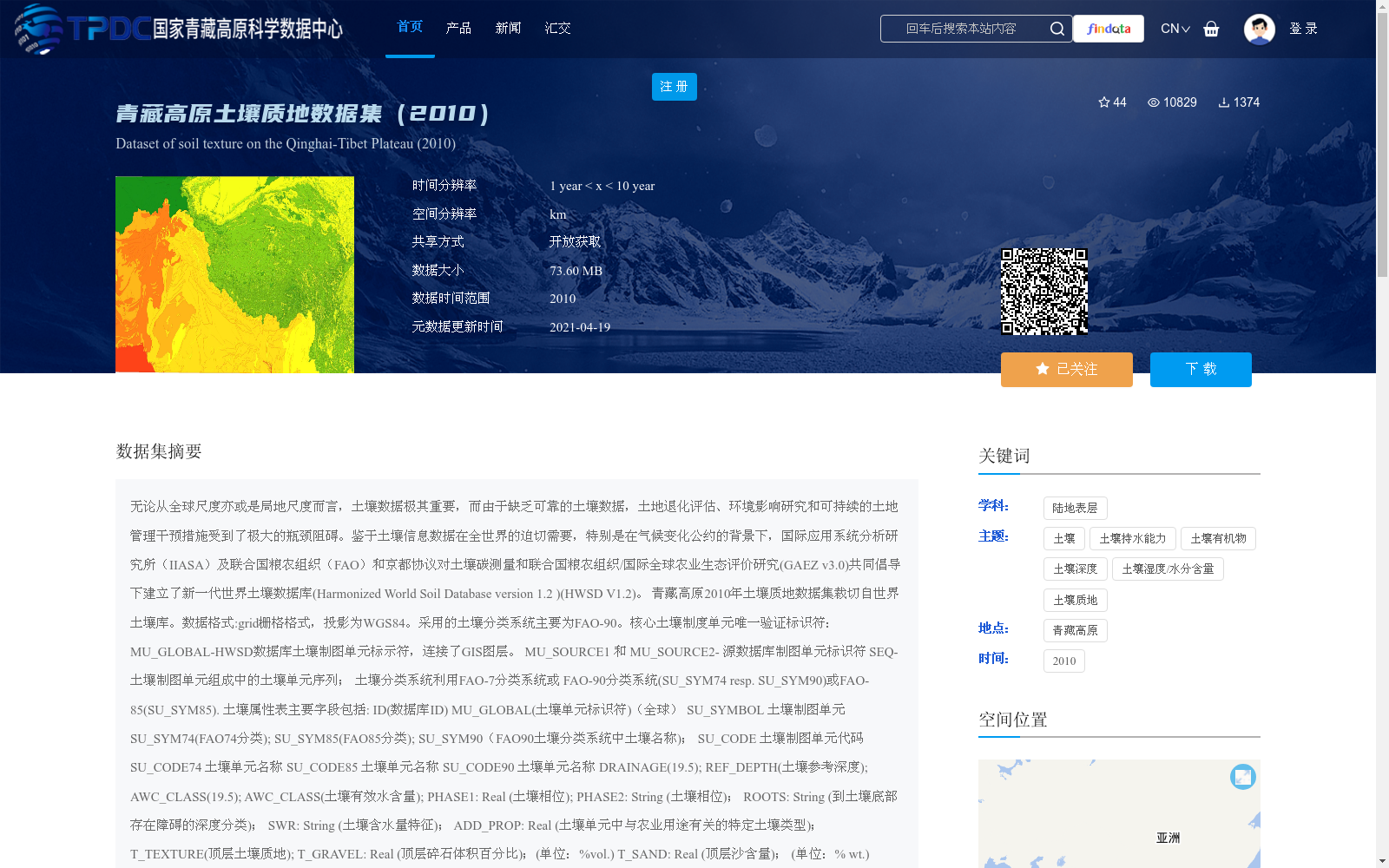
青藏高原2010年土壤质地数据集裁切自世界土壤库。数据格式:grid栅格格式,投影为WGS84。采用的土壤分类系统主要为FAO-90。核心土壤制度单元唯一验证标识符:
MU_GLOBAL-HWSD数据库土壤制图单元标示符,连接了GIS图层。
MU_SOURCE1 和 MU_SOURCE2- 源数据库制图单元标识符
SEQ-土壤制图单元组成中的土壤单元序列;
土壤分类系统利用FAO-7分类系统或 FAO-90分类系统(SU_SYM74 resp. SU_SYM90)或FAO-85(SU_SYM85).
土壤属性表主要字段包括:
ID(数据库ID)
MU_GLOBAL(土壤单元标识符)(全球)
SU_SYMBOL 土壤制图单元
SU_SYM74(FAO74分类);
SU_SYM85(FAO85分类);
SU_SYM90(FAO90土壤分类系统中土壤名称);
SU_CODE 土壤制图单元代码
SU_CODE74 土壤单元名称
SU_CODE85 土壤单元名称
SU_CODE90 土壤单元名称
DRAINAGE(19.5);
REF_DEPTH(土壤参考深度);
AWC_CLASS(19.5);
AWC_CLASS(土壤有效水含量);
PHASE1: Real (土壤相位);
PHASE2: String (土壤相位);
ROOTS: String (到土壤底部存在障碍的深度分类);
SWR: String (土壤含水量特征);
ADD_PROP: Real (土壤单元中与农业用途有关的特定土壤类型);
T_TEXTURE(顶层土壤质地);
T_GRAVEL: Real (顶层碎石体积百分比);(单位:%vol.)
T_SAND: Real (顶层沙含量); (单位:% wt.)
T_SILT: Real (表层粉沙粒含量); (单位:% wt.)
T_CLAY: Real (顶层粘土含量); (单位:% wt.)
T_USDA_TEX: Real (顶层USDA土壤质地分类); (单位:name)
T_REF_BULK: Real (顶层土壤容重); (单位:kg/dm3.)
T_OC: Real (顶层有机碳含量); (单位:% weight)
T_PH_H2O: Real (顶层酸碱度) (单位:-log(H+))
T_CEC_CLAY: Real (顶层粘性层土壤的阳离子交换能力); (单位:cmol/kg)
T_CEC_SOIL: Real (顶层土壤的阳离子交换能力) (单位:cmol/kg)
T_BS: Real (顶层基本饱和度); (单位:%)
T_TEB: Real (顶层交换性盐基);(单位:cmol/kg)
T_CACO3: Real (顶层碳酸盐或石灰含量) (单位:% weight)
T_CASO4: Real (顶层硫酸盐含量);(单位:% weight)
T_ESP: Real (顶层可交换钠盐);(单位:%)
T_ECE: Real (顶层电导率)。 (单位:dS/m)
S_GRAVEL: Real (底层碎石体积百分比);(单位:%vol.)
S_SAND: Real (底层沙含量); (单位:% wt.)
S_SILT: Real (底层淤泥含量); (单位:% wt.)
S_CLAY: Real (底层粘土含量); (单位:% wt.)
S_USDA_TEX: Real (底层USDA土壤质地分类); (单位:name)
S_REF_BULK: Real (底层土壤容重); (单位:kg/dm3.)
S_OC: Real (底层有机碳含量); (单位:% weight)
S_PH_H2O: Real (底层酸碱度) (单位:-log(H+))
S_CEC_CLAY: Real (底层粘性层土壤的阳离子交换能力); (单位:cmol/kg)
S_CEC_SOIL: Real (底层土壤的阳离子交换能力) (单位:cmol/kg)
S_BS: Real (底层基本饱和度); (单位:%)
S_TEB: Real (底层交换性盐基);(单位:cmol/kg)
S_CACO3: Real (底层碳酸盐或石灰含量) (单位:% weight)
S_CASO4: Real (底层硫酸盐含量);(单位:% weight)
S_ESP: Real (底层可交换钠盐);(单位:%)
S_ECE: Real (底层电导率)。 (单位:dS/m)
本数据库分两层,其中以顶层(T)土壤厚度为(0-30cm),底层(S)土壤厚度为(30-100cm)。
其他属性值请参考说明HWSD1.2_documentation文档.pdf,The Harmonized World Soil Database (HWSD V1.2) Viewer-中文说明及HWSD.mdb。
Soil data is of critical importance at both global and local scales. However, land degradation assessments, environmental impact studies, and sustainable land management interventions have been severely hampered by bottlenecks due to the lack of reliable soil data.
In view of the urgent global demand for soil information, particularly in the context of climate change conventions, the Harmonized World Soil Database version 1.2 (HWSD V1.2) — a new generation of global soil database — was jointly established under the advocacy of the International Institute for Applied Systems Analysis (IIASA), the Food and Agriculture Organization of the United Nations (FAO), the soil carbon measurement initiative under the Kyoto Protocol, and the FAO/International Global Agro-ecological Assessment (GAEZ v3.0) research project.
The 2010 soil texture dataset of the Qinghai-Tibet Plateau was cropped from the global soil repository. The dataset is stored in grid raster format with the WGS84 projection. The FAO-90 soil classification system is primarily adopted for this dataset.
Unique verified identifiers for core soil mapping units:
MU_GLOBAL: the soil mapping unit identifier of the HWSD database, which links to GIS layers.
MU_SOURCE1 and MU_SOURCE2: identifiers of the source database mapping units;
SEQ: the soil unit sequence within the soil mapping unit composition.
Soil classification systems include the FAO-7 classification system, FAO-90 classification system (SU_SYM74 resp. SU_SYM90), and FAO-85 classification system (SU_SYM85).
The main fields of the soil attribute table are as follows:
ID (Database ID)
MU_GLOBAL (Global soil unit identifier)
SU_SYMBOL: Soil mapping unit
SU_SYM74: FAO-74 classification
SU_SYM85: FAO-85 classification
SU_SYM90: Soil name in the FAO-90 soil classification system
SU_CODE: Soil mapping unit code
SU_CODE74: Soil unit name
SU_CODE85: Soil unit name
SU_CODE90: Soil unit name
DRAINAGE (19.5);
REF_DEPTH: Soil reference depth
AWC_CLASS (19.5);
AWC_CLASS: Soil available water capacity
PHASE1: Real (Soil phase);
PHASE2: String (Soil phase);
ROOTS: String (Depth classification with barriers to the soil bottom);
SWR: String (Soil water content characteristics);
ADD_PROP: Real (Specific soil types in the soil unit related to agricultural use);
T_TEXTURE: Topsoil texture;
T_GRAVEL: Real (Volume percentage of topsoil gravel); (Unit: %vol.)
T_SAND: Real (Topsoil sand content); (Unit: % wt.)
T_SILT: Real (Topsoil silt content); (Unit: % wt.)
T_CLAY: Real (Topsoil clay content); (Unit: % wt.)
T_USDA_TEX: Real (Topsoil USDA soil texture classification); (Unit: name)
T_REF_BULK: Real (Topsoil bulk density); (Unit: kg/dm³)
T_OC: Real (Topsoil organic carbon content); (Unit: % weight)
T_PH_H2O: Real (Topsoil pH); (Unit: -log(H+))
T_CEC_CLAY: Real (Cation exchange capacity of topsoil clay layer); (Unit: cmol/kg)
T_CEC_SOIL: Real (Cation exchange capacity of topsoil); (Unit: cmol/kg)
T_BS: Real (Topsoil base saturation); (Unit: %)
T_TEB: Real (Topsoil exchangeable bases); (Unit: cmol/kg)
T_CACO3: Real (Topsoil carbonate or lime content); (Unit: % weight)
T_CASO4: Real (Topsoil sulfate content); (Unit: % weight)
T_ESP: Real (Topsoil exchangeable sodium percentage); (Unit: %)
T_ECE: Real (Topsoil electrical conductivity); (Unit: dS/m)
S_GRAVEL: Real (Volume percentage of subsoil gravel); (Unit: %vol.)
S_SAND: Real (Subsoil sand content); (Unit: % wt.)
S_SILT: Real (Subsoil silt content); (Unit: % wt.)
S_CLAY: Real (Subsoil clay content); (Unit: % wt.)
S_USDA_TEX: Real (Subsoil USDA soil texture classification); (Unit: name)
S_REF_BULK: Real (Subsoil bulk density); (Unit: kg/dm³)
S_OC: Real (Subsoil organic carbon content); (Unit: % weight)
S_PH_H2O: Real (Subsoil pH); (Unit: -log(H+))
S_CEC_CLAY: Real (Cation exchange capacity of subsoil clay layer); (Unit: cmol/kg)
S_CEC_SOIL: Real (Cation exchange capacity of subsoil); (Unit: cmol/kg)
S_BS: Real (Subsoil base saturation); (Unit: %)
S_TEB: Real (Subsoil exchangeable bases); (Unit: cmol/kg)
S_CACO3: Real (Subsoil carbonate or lime content); (Unit: % weight)
S_CASO4: Real (Subsoil sulfate content); (Unit: % weight)
S_ESP: Real (Subsoil exchangeable sodium percentage); (Unit: %)
S_ECE: Real (Subsoil electrical conductivity); (Unit: dS/m)
This database is divided into two layers: the top layer (T) corresponds to topsoil with a thickness of 0-30 cm, and the bottom layer (S) corresponds to subsoil with a thickness of 30-100 cm.
For other attribute values, please refer to the documents "HWSD1.2_documentation.pdf", "The Harmonized World Soil Database (HWSD V1.2) Viewer - Chinese Instructions", and "HWSD.mdb".
提供机构:
Food and Agriculture Organization of the United Nations(FAO)
创建时间:
2019-02-08
搜集汇总
数据集介绍
背景与挑战
背景概述
青藏高原土壤质地数据集(2010)是从世界土壤数据库(HWSD V1.2)中裁切得到的,包含土壤的多种物理和化学属性,采用FAO-90分类系统,数据格式为栅格格式,适用于土地退化评估和可持续土地管理研究。
以上内容由遇见数据集搜集并总结生成


