黄河流域不同灌溉方式下小麦生产水足迹数据集(2000-2014年)
收藏国家地球系统科学数据中心2021-09-27 更新2024-03-04 收录
下载链接:
https://www.geodata.cn/data/datadetails.html?dataguid=104986482997280&docId=10657
下载链接
链接失效反馈官方服务:
资源简介:
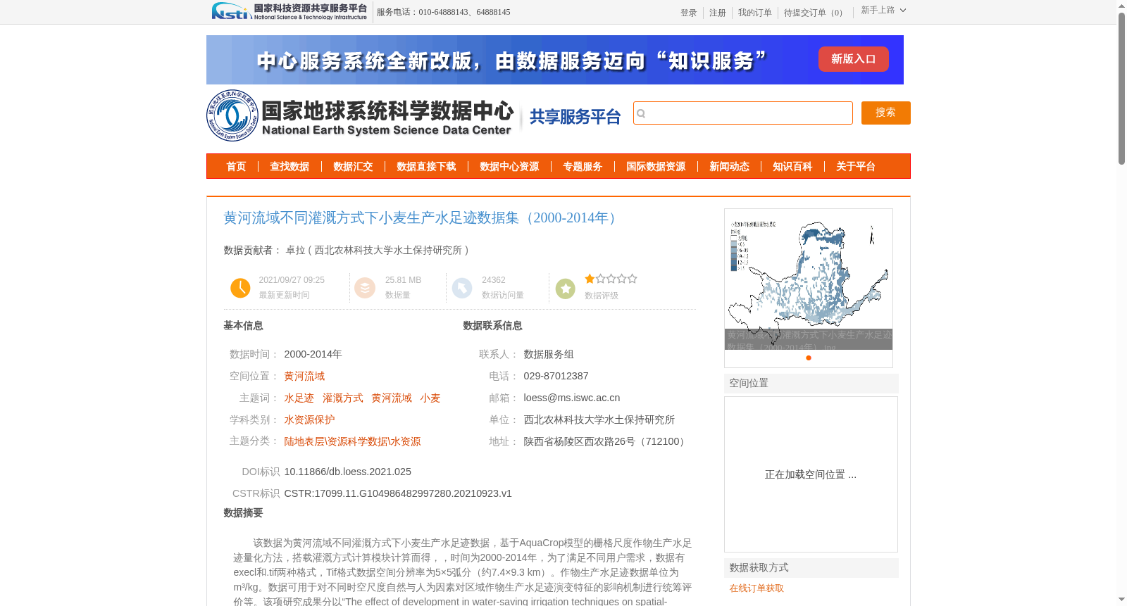
该数据为黄河流域不同灌溉方式下小麦生产水足迹数据,基于AquaCrop模型的栅格尺度作物生产水足迹量化方法,搭载灌溉方式计算模块计算而得,,时间为2000-2014年,为了满足不同用户需求,数据有execl和.tif两种格式,Tif格式数据空间分辨率为5×5弧分(约7.4×9.3 km)。作物生产水足迹数据单位为m³/kg。数据可用于对不同时空尺度自然与人为因素对区域作物生产水足迹演变特征的影响机制进行统筹评价等。该项研究成果分以“The effect of development in water-saving irrigation techniques on spatial-temporal variations in crop water footprint and benchmarking.”为题发表于Journal of Hydrology期刊上,论文链接https://doi.org/10.1016/j.jhydrol.2019.123916;以“黄河流域小麦生产水足迹量化与评价“为题发表于《 农业机械学报》2019年第9期上。
This dataset contains crop water footprint data of wheat under different irrigation modes in the Yellow River Basin. The data was calculated using a grid-scale crop water footprint quantification method based on the AquaCrop model, integrated with an irrigation mode calculation module. The temporal coverage of the dataset is from 2000 to 2014. To meet the needs of various users, the dataset is provided in two formats: Excel and .TIFF. The spatial resolution of the TIFF-format data is 5×5 arcminutes (approximately 7.4×9.3 km). The unit of the crop water footprint data is m³/kg. This dataset can be used for comprehensive evaluations of the impact mechanisms of natural and anthropogenic factors at different spatio-temporal scales on the evolutionary characteristics of regional crop water footprints, among other relevant applications. The related research findings have been published in two papers: one titled "The effect of development in water-saving irrigation techniques on spatial-temporal variations in crop water footprint and benchmarking" in the *Journal of Hydrology*, with the DOI link: https://doi.org/10.1016/j.jhydrol.2019.123916; the other titled "Quantification and Evaluation of Wheat Production Water Footprint in the Yellow River Basin" in *Transactions of the Chinese Society for Agricultural Machinery*, Issue 9, 2019.
提供机构:
西北农林科技大学水土保持研究所
创建时间:
2021-09-23
搜集汇总
数据集介绍
背景与挑战
背景概述
该数据集包含黄河流域2000-2014年不同灌溉方式下小麦生产水足迹数据,采用AquaCrop模型计算,提供Excel和TIF格式,空间分辨率为5×5弧分。数据可用于分析作物生产水足迹的时空变化及影响因素。
以上内容由遇见数据集搜集并总结生成


