中亚平均风速分布图(2017)
收藏国家青藏高原科学数据中心2021-04-19 更新2024-03-01 收录
下载链接:
https://data.tpdc.ac.cn/zh-hans/data/2117c864-a1b6-46f3-a39e-db7a1f175892
下载链接
链接失效反馈官方服务:
资源简介:
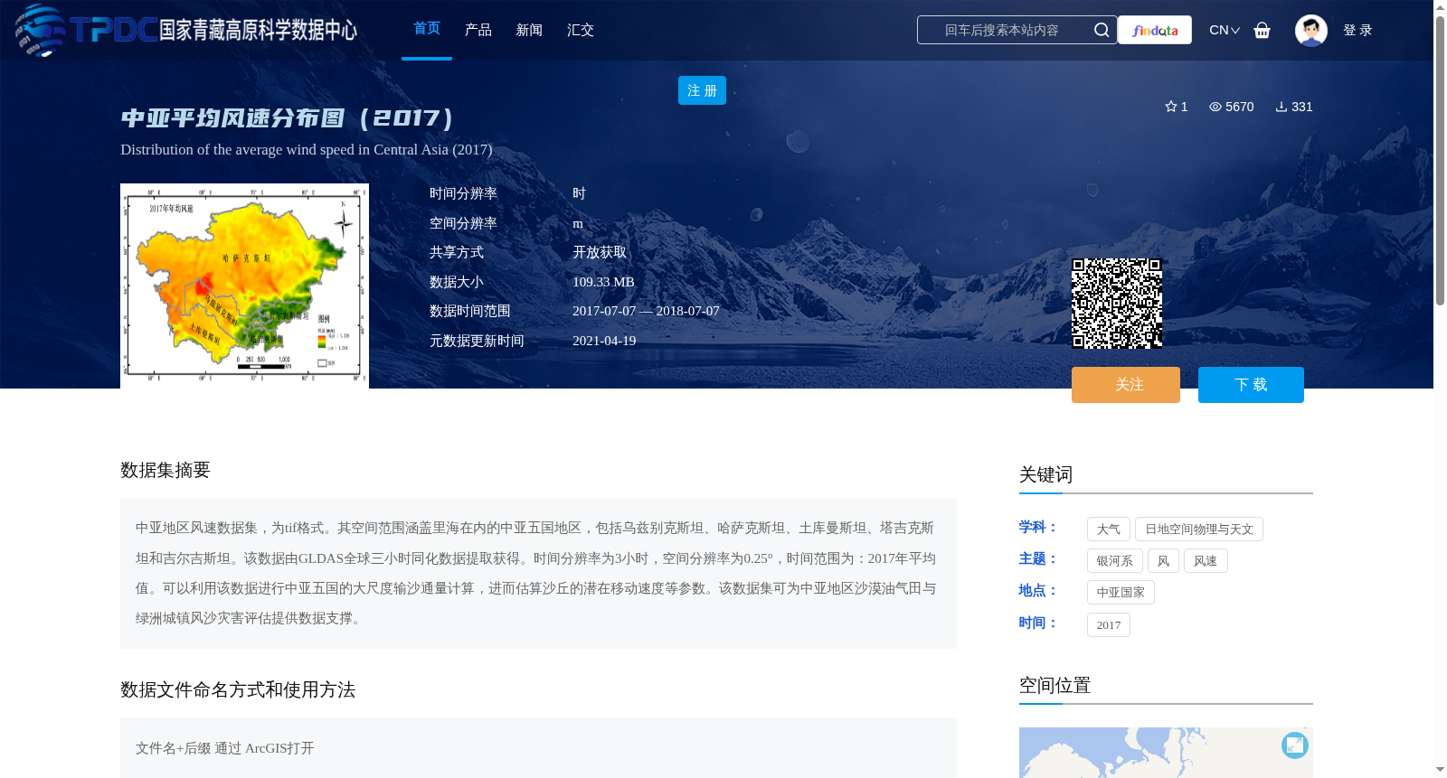
中亚地区风速数据集,为tif格式。其空间范围涵盖里海在内的中亚五国地区,包括乌兹别克斯坦、哈萨克斯坦、土库曼斯坦、塔吉克斯坦和吉尔吉斯坦。该数据由GLDAS全球三小时同化数据提取获得。时间分辨率为3小时,空间分辨率为0.25°,时间范围为:2017年平均值。可以利用该数据进行中亚五国的大尺度输沙通量计算,进而估算沙丘的潜在移动速度等参数。该数据集可为中亚地区沙漠油气田与绿洲城镇风沙灾害评估提供数据支撑。
Central Asia Wind Speed Dataset is stored in TIFF format. Its spatial coverage encompasses the five Central Asian countries (Uzbekistan, Kazakhstan, Turkmenistan, Tajikistan and Kyrgyzstan) as well as the Caspian Sea region. This dataset is extracted from the 3-hourly assimilated data of the Global Land Data Assimilation System (GLDAS). It has a temporal resolution of 3 hours, a spatial resolution of 0.25°, and its temporal coverage corresponds to the 2017 annual average values. This dataset can be used to calculate the large-scale sediment transport flux in the five Central Asian countries, and further estimate parameters such as the potential migration velocity of sand dunes. It can provide data support for wind-sand disaster assessment of desert oil and gas fields and oasis towns in Central Asia.
提供机构:
高鑫
创建时间:
2019-07-15
搜集汇总
数据集介绍
背景与挑战
背景概述
该数据集为中亚地区2017年平均风速分布图,采用tif格式,空间覆盖中亚五国及里海地区,时间分辨率为3小时,空间分辨率为0.25°。数据可用于大尺度输沙通量计算和风沙灾害评估,为研究提供重要支撑。
以上内容由遇见数据集搜集并总结生成


