中亚-西亚地区荒漠化风险等级评估图(2015)
收藏地球大数据科学工程2024-03-04 收录
下载链接:
https://data.casearth.cn/sdo/detail/5feae825819aec33049b7bf9
下载链接
链接失效反馈官方服务:
资源简介:
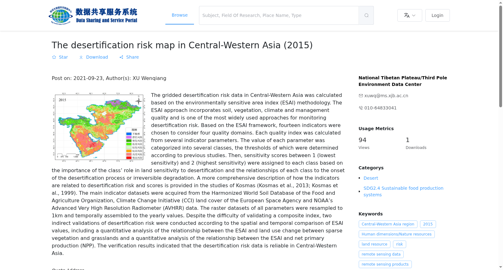
基于环境敏感区指数(ESAI)方法,计算获得中西亚的栅格荒漠化风险数据。ESAI方法考虑土壤,植被,气候和管理质量,是监测荒漠化风险最广泛的方法之一。根据ESAI指标框架,选择了14个指标计算四个质量领域,每个质量指数均由几个指标参数计算获得。参考前人研究,确定每个参数分类及其阀值。然后,根据每个类别在荒漠化的敏感性中的重要性以及与荒漠化过程的开始或不可逆转的退化关系,把每个类别分配了1(最低敏感度)和2(最高敏感度)之间的敏感性得分。关于如何选取指标以及与荒漠化风险和得分相关性,在Kosmas的研究中提供了更全面的描述。主要指标数据集来源于联合国粮农组织的世界土壤数据,欧空局的土地覆盖数据和AVHRR数据。所有栅格数据集重采样到1km并合成年度值。尽管验证综合评估指数存在困难,但根据ESAI值的时空比较,对荒漠化风险进行了间接验证,包括对ESAI与稀疏植被和草地转变关系的定量分析和分析ESAI与植被净初级生产力之间的关系。验证结果表明中西亚地区的荒漠化风险数据精度可靠。
Raster desertification risk data for Central and West Asia was calculated using the Environmental Sensitivity Area Index (ESAI) method. The ESAI method, which considers soil, vegetation, climate and management quality, is one of the most widely used approaches for monitoring desertification risk. Based on the ESAI indicator framework, 14 indicators were selected to compute four quality domains, with each quality index derived from multiple indicator parameters. The classification and thresholds of each parameter were determined by referring to previous studies. Subsequently, each category was assigned a sensitivity score ranging from 1 (lowest sensitivity) to 2 (highest sensitivity), based on its importance in desertification sensitivity and its association with the onset of desertification processes or irreversible degradation. A more comprehensive account of indicator selection and their correlations with desertification risk and scores is provided in Kosmas' research. The primary indicator datasets were sourced from the Food and Agriculture Organization of the United Nations' World Soil Data, the European Space Agency's Land Cover Data, and AVHRR data. All raster datasets were resampled to a 1 km resolution and synthesized into annual values. Although validating the comprehensive assessment index poses challenges, indirect validation of desertification risk was conducted via spatial-temporal comparisons of ESAI values, including quantitative analysis of the relationship between ESAI and transitions of sparse vegetation and grassland, as well as the correlation between ESAI and vegetation net primary productivity. The validation results demonstrate that the accuracy of the desertification risk data for Central and West Asia is reliable.
提供机构:
国家青藏高原科学数据中心
搜集汇总
数据集介绍
背景与挑战
背景概述
中亚-西亚地区2015年荒漠化风险等级评估图基于ESAI方法,综合土壤、植被、气候和管理质量等14个指标,以1km分辨率栅格数据呈现,并通过间接验证确保数据可靠性。
以上内容由遇见数据集搜集并总结生成


