中国1000米分辨率DEM(2000年)
收藏国家地球系统科学数据中心2018-06-25 更新2024-03-04 收录
下载链接:
https://www.geodata.cn/data/datadetails.html?dataguid=173007919035888&docId=20216
下载链接
链接失效反馈官方服务:
资源简介:
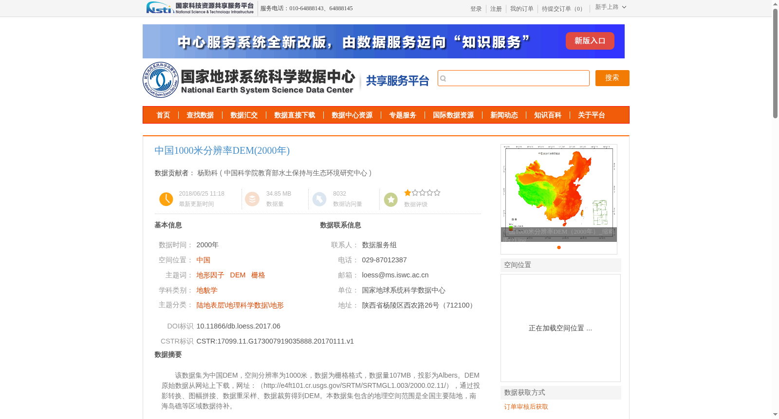
该数据集为中国DEM,空间分辨率为1000米,数据为栅格格式,数据量107MB,投影为Albers。DEM原始数据从网站上下载,网址:(http://e4ft101.cr.usgs.gov/SRTM/SRTMGL1.003/2000.02.11/),通过投影转换、图幅拼接、数据重采样、数据裁剪得到DEM。本数据集包含的地理空间范围是全国主要陆地,南海岛礁等区域数据待补。
This dataset is a China-wide Digital Elevation Model (DEM) with a spatial resolution of 1000 meters, stored in raster format, with a total data volume of 107 MB, and adopts the Albers projection. The raw DEM data was downloaded from the website: http://e4ft101.cr.usgs.gov/SRTM/SRTMGL1.003/2000.02.11/, and the finalized DEM was generated via projection transformation, map sheet mosaic, data resampling, and data clipping. The geographic coverage of this dataset includes most of China's mainland; data for regions such as the South China Sea islands and reefs is yet to be supplemented.
提供机构:
中国科学院教育部水土保持与生态环境研究中心
创建时间:
2017-01-11
搜集汇总
数据集介绍
背景与挑战
背景概述
中国1000米分辨率DEM(2000年)数据集是全国范围的数字高程模型,空间分辨率为1公里,采用Albers投影。数据通过处理SRTM原始数据获得,包含全国主要陆地地形信息,适用于地貌学等相关研究。
以上内容由遇见数据集搜集并总结生成


