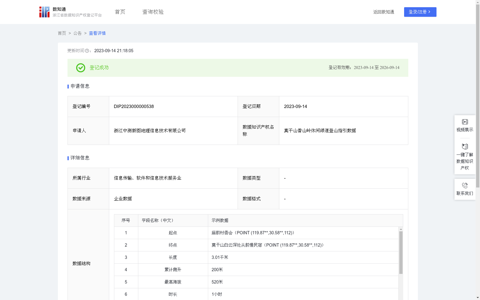
莫干山香山岭休闲绿道登山指引数据
收藏浙江省数据知识产权登记平台2023-09-14 更新2024-05-08 收录
下载链接:
https://www.zjip.org.cn/home/announce/trends/2846
下载链接
链接失效反馈官方服务:
资源简介:
通过用户授权共享的手机定位功能推送用户当前所处位置相应的登山指引数据,为用户提供便携的登山指引服务。基于国家地理信息公共服务平台(“天地图”)公开的遥感影像和地图等基础数据,提取路网矢量数据,收集用户在登山过程中轨迹位置信息,通过叠加分析、拓扑分析、最短路径分析、坡度分析等算法规则计算生成公开服务登山指引数据,包括登山路径、难易程度、路况、累计爬升、最高海拔、长度、时长、危险点、拐点、公共服务点等精细化登山步道信息数据,存储在空间数据库中,通过用户授权共享的手机定位功能推送用户当前所处位置相应的登山指引数据。
This dataset provides convenient mountaineering guidance services by pushing targeted mountaineering guidance data matching the user’s current location through the mobile positioning function authorized and shared by the user. Based on publicly available basic data including remote sensing imagery and maps from the National Geographic Information Public Service Platform ("Tianditu"), the dataset extracts road network vector data and collects trajectory location information generated by users during their mountaineering activities. It then generates publicly accessible mountaineering guidance data via a series of algorithmic analyses including overlay analysis, topological analysis, shortest path analysis, and slope analysis. The generated dataset encompasses refined hiking trail information such as mountaineering routes, difficulty levels, road conditions, cumulative elevation gain, maximum altitude, total length, estimated travel duration, dangerous points, turning points, and public service points. All data is stored in a spatial database and pushed to users matching their current location through the authorized shared mobile positioning function.
提供机构:
浙江中测新图地理信息技术有限公司
创建时间:
2023-08-30
搜集汇总
数据集介绍
特点
莫干山香山岭休闲绿道登山指引数据提供了详细的登山路径信息,包括起点、终点、长度、累计爬升、最高海拔、时长等,适用于通过手机定位功能为用户提供登山指引服务。数据由企业采集,更新频次为每次重新采集后覆盖。
以上内容由遇见数据集搜集并总结生成


