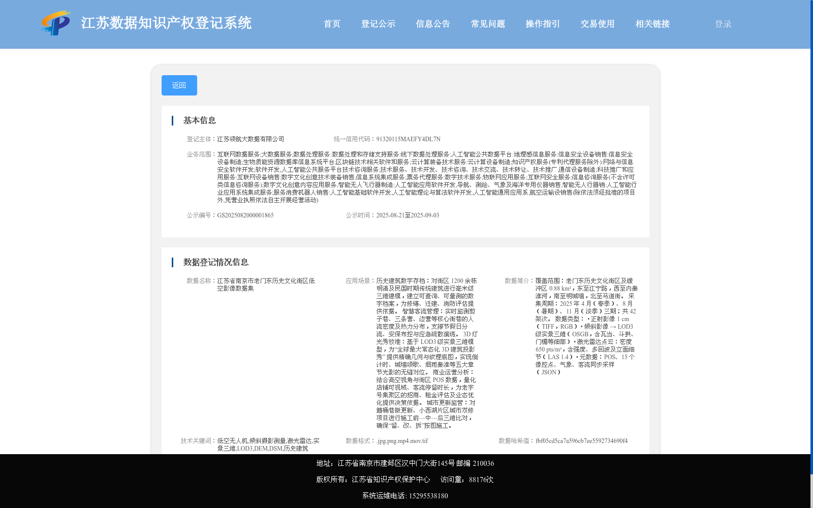
江苏省南京市老门东历史文化街区低空影像数据集
收藏江苏数据知识产权登记系统2025-08-20 更新2025-09-06 收录
下载链接:
https://dataip.jsipp.cn/#/changeDetialCertical?pType=登记&cType=登记&id=58908f08b3e14836c8f8e966c59989fd
下载链接
链接失效反馈官方服务:
资源简介:
覆盖范围:老门东历史文化街区及缓冲区 0.88 km²,东至江宁路,西至内秦淮河,南至明城墙,北至马道街。
采集周期:2025 年 4 月(春季)、8 月(暑期)、11 月(淡季)三期;共 42 架次。
数据类型:
• 正射影像 1 cm(TIFF,RGB)
• 倾斜影像 → LOD3 级实景三维(OSGB,含瓦当、斗拱、门楣等细部)
• 激光雷达点云:密度 650 pts/m²,含强度、多回波及立面细节(LAS 1.4)
• 元数据:POS、15 个像控点、气象、客流同步采样(JSON)
Coverage: 0.88 km² of Laomendong Historical and Cultural Block and its buffer zone, bounded by Jiangning Road to the east, the Inner Qinhuai River to the west, the Ming City Wall to the south, and Madao Street to the north.
Data Collection Period: Three survey phases conducted in April (spring), August (summer vacation) and November (off-season) of 2025, with a total of 42 sorties.
Data Types:
- Orthophoto with 1 cm resolution, TIFF format (RGB)
- Oblique imagery-derived LOD3 real-scene 3D model, OSGB format, including detailed architectural features such as eave tiles, dougong, lintels, etc.
- LiDAR point cloud: density of 650 pts/m², with intensity information, multiple echoes and facade details, LAS 1.4 format
- Metadata: POS data, 15 ground control points, synchronized sampling data of meteorology and passenger flow, JSON format
提供机构:
江苏领航大数据有限公司
搜集汇总
数据集介绍
背景与挑战
背景概述
该数据集包含江苏省南京市老门东历史文化街区的低空影像数据,主要用于记录和分析该街区的建筑与环境特征。其关键特点在于高分辨率图像采集,支持历史文化保护和城市规划应用。
以上内容由遇见数据集搜集并总结生成


