中亚地震构造图和中亚地震危险性区划图(1960-2020)
收藏国家青藏高原科学数据中心2022-04-18 更新2024-03-01 收录
下载链接:
https://data.tpdc.ac.cn/zh-hans/data/905c8ae3-9c47-40d1-b3a3-1f95b43725b2
下载链接
链接失效反馈官方服务:
资源简介:
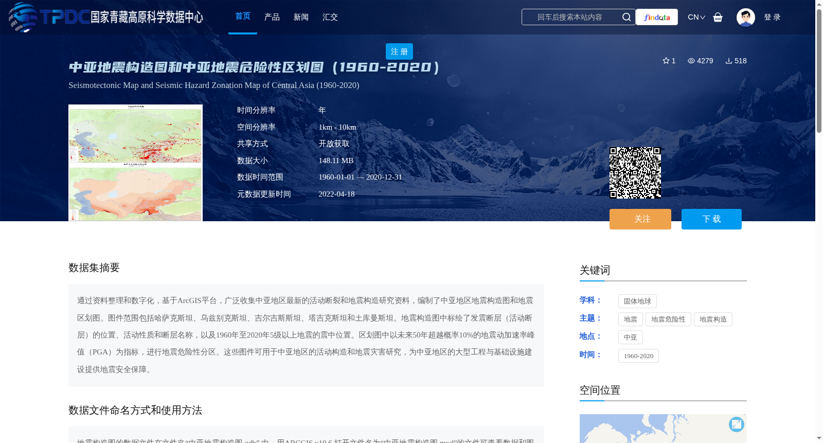
通过资料整理和数字化,基于ArcGIS平台,广泛收集中亚地区最新的活动断裂和地震构造研究资料,编制了中亚地区地震构造图和地震区划图。图件范围包括哈萨克斯坦、乌兹别克斯坦、吉尔吉斯斯坦、塔吉克斯坦和土库曼斯坦。地震构造图中标绘了发震断层(活动断层)的位置、活动性质和断层名称,以及1960年至2020年5级以上地震的震中位置。区划图中以未来50年超越概率10%的地震动加速率峰值(PGA)为指标,进行地震危险性分区。这些图件可用于中亚地区的活动构造和地震灾害研究,为中亚地区的大型工程与基础设施建设提供地震安全保障。
Based on the ArcGIS platform, through data collation and digitization, we extensively collected the latest research data on active faults and seismotectonics in Central Asia, and compiled the seismotectonic map and seismic zoning map of Central Asia. The coverage of these maps includes Kazakhstan, Uzbekistan, Kyrgyzstan, Tajikistan and Turkmenistan. The seismotectonic map marks the locations, activity characteristics and names of seismogenic faults (active faults), as well as the epicenters of earthquakes with magnitude ≥5.0 from 1960 to 2020. The seismic zoning map conducts seismic hazard zoning using the peak ground acceleration (PGA) with a 10% probability of exceedance in 50 years as the indicator. These maps can be used for active tectonics and seismic hazard research in Central Asia, and provide seismic safety guarantees for the construction of large-scale projects and infrastructure in the region.
提供机构:
罗浩
创建时间:
2021-05-18
搜集汇总
数据集介绍
背景与挑战
背景概述
该数据集包含中亚地区(哈萨克斯坦、乌兹别克斯坦、吉尔吉斯斯坦、塔吉克斯坦和土库曼斯坦)的地震构造图和地震危险性区划图,时间跨度为1960年至2020年。地震构造图标绘了活动断裂的位置、性质和名称,以及5级以上地震震中;地震危险性区划图以未来50年超越概率10%的地震动加速率峰值(PGA)为指标进行分区,旨在支持中亚地区的活动构造研究、地震灾害评估和大型工程的地震安全保障。
以上内容由遇见数据集搜集并总结生成


