华北平原农作物种植区分布图(2001-2018)
收藏国家青藏高原科学数据中心2024-08-13 更新2024-03-01 收录
下载链接:
https://data.tpdc.ac.cn/zh-hans/data/b0f1d740-0928-4c47-8085-11f55d16f735
下载链接
链接失效反馈官方服务:
资源简介:
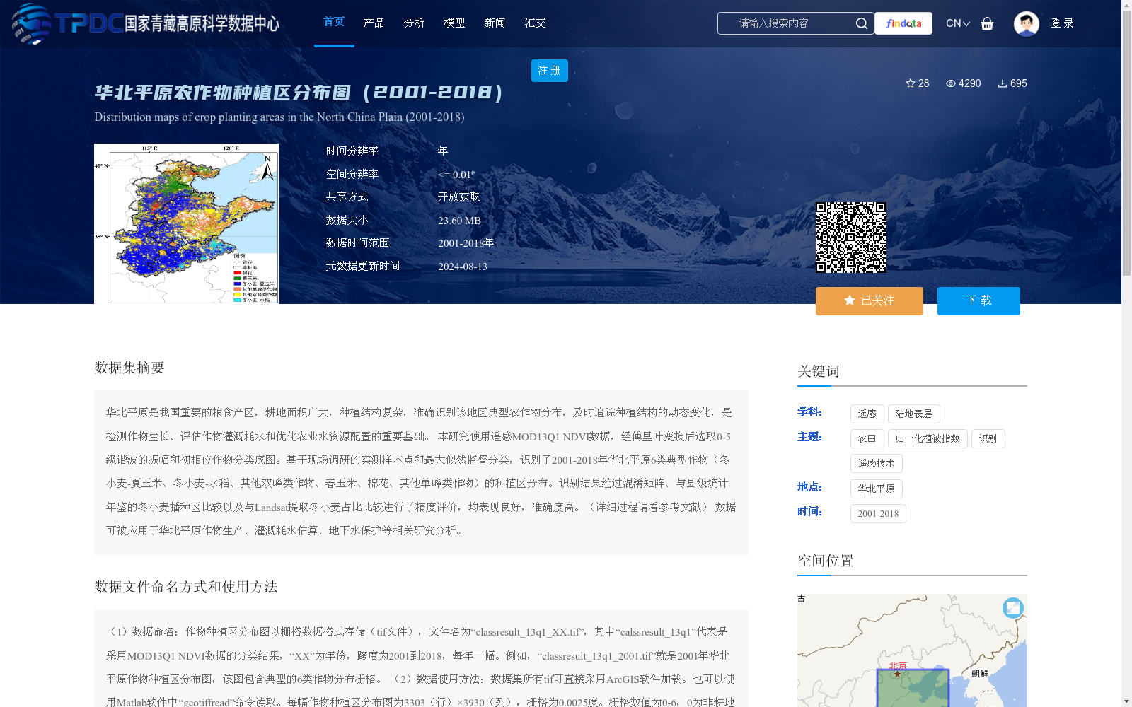
华北平原是我国重要的粮食产区,耕地面积广大,种植结构复杂,准确识别该地区典型农作物分布,及时追踪种植结构的动态变化,是检测作物生长、评估作物灌溉耗水和优化农业水资源配置的重要基础。
本研究使用遥感MOD13Q1 NDVI数据,经傅里叶变换后选取0-5级谐波的振幅和初相位作物分类底图。基于现场调研的实测样本点和最大似然监督分类,识别了2001-2018年华北平原6类典型作物(冬小麦-夏玉米、冬小麦-水稻、其他双峰类作物、春玉米、棉花、其他单峰类作物)的种植区分布。识别结果经过混淆矩阵、与县级统计年鉴的冬小麦播种区比较以及与Landsat提取冬小麦占比比较进行了精度评价,均表现良好,准确度高。(详细过程请看参考文献)
数据可被应用于华北平原作物生产、灌溉耗水估算、地下水保护等相关研究分析。
The North China Plain is a key grain-producing region in China, boasting vast cultivated land area and complex cropping structures. Accurate identification of the distribution of typical crops in this region and timely tracking of dynamic changes in cropping structures serve as a critical foundation for crop growth monitoring, crop irrigation water consumption assessment, and optimization of agricultural water resource allocation.
This study utilized remote sensing MOD13Q1 NDVI data. After Fourier transformation, the amplitudes and initial phases of 0th to 5th order harmonics were selected to construct the base map for crop classification. Based on field-collected ground truth sampling points and Maximum Likelihood Supervised Classification, the planting area distributions of six typical crop types in the North China Plain from 2001 to 2018 were identified, including winter wheat-summer maize, winter wheat-rice, other double-peak crops, spring maize, cotton, and other single-peak crops. The classification results were evaluated for accuracy via three approaches: confusion matrices, comparison with winter wheat sowing areas from county-level statistical yearbooks, and comparison with the proportion of winter wheat extracted from Landsat imagery, all of which exhibited good performance and high accuracy. (For detailed procedures, please refer to the references)
This dataset can be applied to relevant research and analysis such as crop production in the North China Plain, irrigation water consumption estimation, and groundwater protection.
提供机构:
雷慧闽
创建时间:
2022-09-26
搜集汇总
数据集介绍
背景与挑战
背景概述
该数据集提供了2001年至2018年华北平原农作物种植区的年度分布图,空间分辨率约为0.0025度(<=0.01º),覆盖冬小麦-夏玉米、冬小麦-水稻等6类典型作物。数据基于MOD13Q1 NDVI遥感数据,通过傅里叶变换和最大似然监督分类方法生成,经过精度验证,适用于作物生产、灌溉耗水估算等相关研究。
以上内容由遇见数据集搜集并总结生成


