太湖叶绿素反演产品数据集(2018年)
收藏国家地球系统科学数据中心2026-01-27 更新2024-03-04 收录
下载链接:
https://www.geodata.cn/data/datadetails.html?dataguid=247831562715703&docId=158
下载链接
链接失效反馈官方服务:
资源简介:
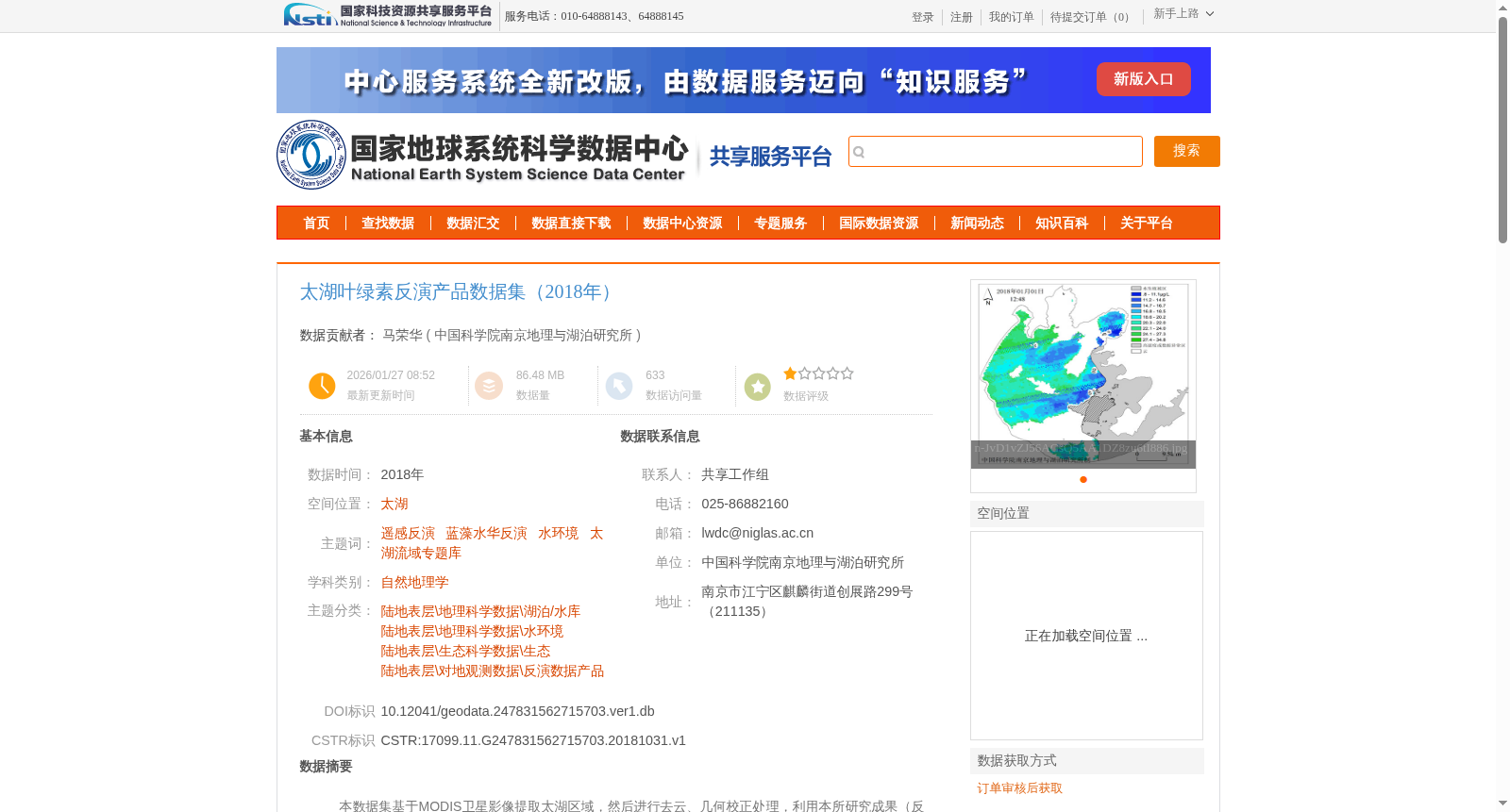
本数据集基于MODIS卫星影像提取太湖区域,然后进行去云、几何校正处理,利用本所研究成果(反演模型),提取太湖的叶绿素浓度。该数据集格式为jpg图片格式,为叶绿素浓度反演的出图产品,有实际反演值的栅格数据格式为img格式,可查看湖内任意点的具体叶绿素反演值信息。
数据集包含2个文件夹,分别为太湖叶绿素反演产品栅格数据集(2018年)及太湖叶绿素反演产品图数据集(2018年), 其中产品图文件夹包含了109个jpg图片文件,栅格数据文件夹包含了109个img栅格文件。
This dataset is constructed by extracting the Lake Taihu region from MODIS satellite imagery, followed by cloud removal and geometric correction. Chlorophyll concentration in Lake Taihu is then retrieved using the inversion model developed by our institute's research.
The dataset has two format types: the JPG images are the visualization products of chlorophyll concentration inversion, while the raster data with actual inversion values are stored in IMG format, which allows users to view the specific chlorophyll inversion values at any point within the lake.
The dataset consists of two folders, namely the raster dataset of Lake Taihu chlorophyll inversion products (2018) and the visualization image dataset of Lake Taihu chlorophyll inversion products (2018). The visualization image folder contains 109 JPG image files, and the raster data folder contains 109 IMG raster files.
提供机构:
中国科学院南京地理与湖泊研究所
创建时间:
2018-10-31
搜集汇总
数据集介绍
背景与挑战
背景概述
该数据集基于MODIS卫星影像提取太湖区域叶绿素浓度,包含109个jpg图片文件和109个img栅格文件,用于研究太湖的水环境状况。数据经过大气校正和模型反演,质量可靠,适用于科学研究。
以上内容由遇见数据集搜集并总结生成


