三江流域外动力因素年降雨量空间分布数据集(2007-2018平均)
收藏国家青藏高原科学数据中心2022-03-23 更新2024-03-01 收录
下载链接:
https://data.tpdc.ac.cn/zh-hans/data/2b8d5e5f-0300-4f65-af77-4f4477427b12
下载链接
链接失效反馈官方服务:
资源简介:
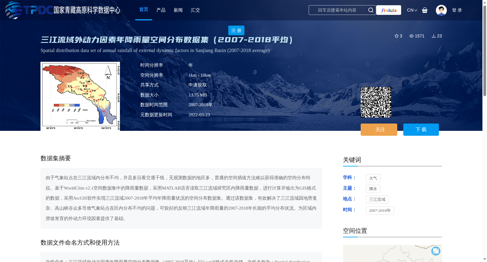
由于气象站点在三江流域内分布不均,并且多沿着交通干线,无观测数据的地区多,普通的空间插值方法难以获得准确的空间分布特征。基于WorldClim v2.1空间数据集中的降雨量数据,采用MATLAB语言读取三江流域研究区内降雨量数据,进行计算并输出为GIS格式的数据,采用ArcGIS软件实现三江流域2007-2018年平均年降雨量状况的空间分布数据集。通过该数据集,有效解决了三江流域因地势复杂、高山峡谷众多导致气象站点在区内分布不均的问题,可较好的反映三江流域年降雨量的2007-2018年长期的平均分布状况。为区域内滑坡发育的外动力环境因素提供了基础。
Meteorological stations in the Three-River Basin are unevenly distributed, mostly along traffic trunk lines, leaving large areas without observation data. Conventional spatial interpolation methods thus fail to generate accurate spatial distribution characteristics of rainfall. Based on the rainfall dataset from WorldClim v2.1, MATLAB was used to read, process and export the rainfall data within the study area of the Three-River Basin into GIS-compatible format. Subsequently, ArcGIS software was applied to construct the spatial distribution dataset of average annual rainfall in the Three-River Basin for the period 2007–2018. This dataset effectively addresses the challenges posed by the uneven distribution of meteorological stations caused by the complex terrain and numerous alpine canyons in the Three-River Basin, and accurately reflects the long-term average annual rainfall distribution pattern of the basin from 2007 to 2018. It serves as a fundamental dataset for studying the exogenous dynamic environmental factors associated with landslide development in the region.
提供机构:
刘明浩
创建时间:
2022-03-20
搜集汇总
数据集介绍
背景与挑战
背景概述
该数据集是三江流域2007-2018年平均年降雨量的空间分布数据,基于WorldClim v2.1数据通过MATLAB和ArcGIS处理生成,以Geotiff格式存储,空间分辨率为1km-10km。它解决了因气象站点分布不均导致的降雨量空间插值难题,能准确反映该区域长期降雨分布状况,主要用于滑坡发育的外动力环境因素研究。
以上内容由遇见数据集搜集并总结生成


