耕地“非农非粮化”遥感监测
收藏郑州数据交易中心2025-04-09 更新2025-04-11 收录
下载链接:
https://market.zzbdex.com/trade/service/1909869607916257282
下载链接
链接失效反馈官方服务:
资源简介:
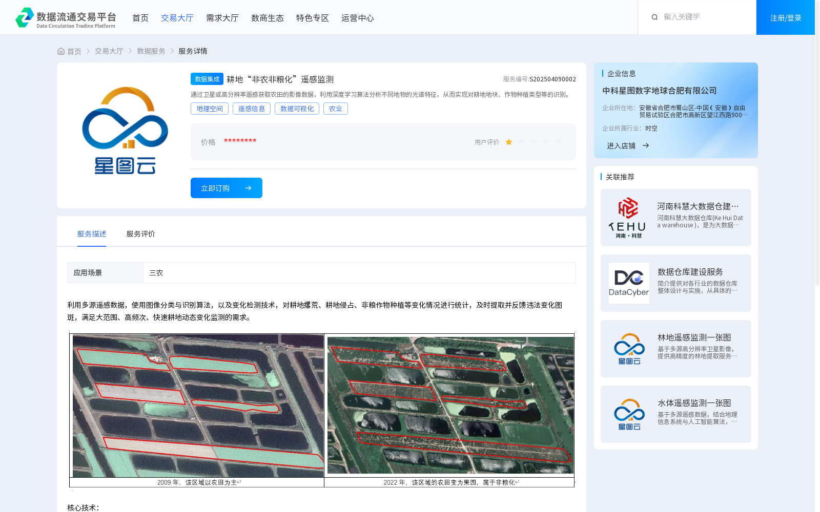
通过卫星或高分辨率遥感获取农田的影像数据,利用深度学习算法分析不同地物的光谱特征,从而实现对耕地地块、作物种植类型等的识别。
This dataset acquires farmland imagery data through satellite or high-resolution remote sensing, analyzes the spectral characteristics of different ground features using deep learning algorithms, thereby enabling the identification of cultivated land parcels, crop planting types and other relevant categories.
提供机构:
中科星图数字地球合肥有限公司
创建时间:
2025-04-09
搜集汇总
数据集介绍
背景与挑战
背景概述
该数据集通过遥感技术和深度学习算法监测耕地‘非农非粮化’情况,包括耕地撂荒、侵占和非粮作物种植等变化,适用于农业和土地管理领域。
以上内容由遇见数据集搜集并总结生成


