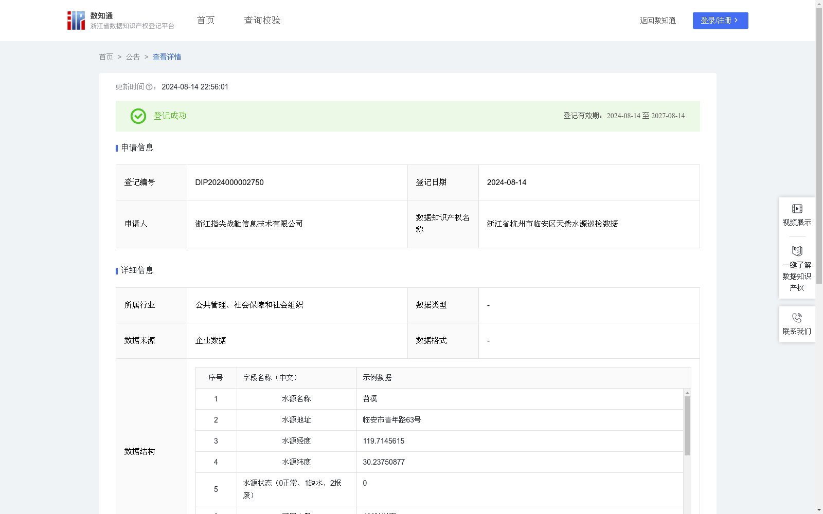
浙江省杭州市临安区天然水源巡检数据
收藏资源简介:
通过采集杭州市临安区天然水源消防巡检地图数据,提供多维度基础数据协助指挥调度员进行决策,分析指定地点消防车的取水方式,包括是消防车是否可取水以及水泵是否可以取水,精确指导选取最适宜的抽水策略,最大化利用自然资源,提升应急供水效率。 (1)数据采集:通过人工采集与外部数据录入的方式,集成为浙江省杭州市临安区天然水源巡检数据,包括水源名称、水源地址、水源经度、水源纬度、水源状态、可用水量、停车位宽度、水面落差、巡检地址、巡检经度、巡检纬度等数据。 (2)数据处理:将采集到的天然水源巡检点数据进行标准化处理,分析指定地点消防车的取水方式, 消防车是否可取水的判断依据是:辖区消防车车辆宽度、停靠位宽度: 水泵是否可以取水的判断依据是:需要计算总扬程并将其与水泵扬程进行比较,总扬程等于水面落差加上摩擦损失(多数情况下可忽略),其中水泵扬程是水泵能够提升水的最大高度,这个数据通常由制造商提供。 (3)应用场景:通过集成浙江省杭州市临安区天然水源消防巡检地图数据,在实际灭火救援时,能够瞬时映射出周边最优化的天然水源解决方案,以高清晰度动态地图的形式直观展示给前线消防指挥官与救援队伍,借助先进的算法模型,科学匹配消防泵的性能参数,精确指导选取最适宜的抽水策略,最大化利用自然资源,提升应急供水效率。
This dataset collects natural water source fire patrol map data from Lin'an District, Hangzhou City, providing multi-dimensional basic data to assist command and dispatch officers in decision-making. It analyzes the water intake methods of fire trucks at designated locations, including whether the fire truck can intake water and whether the water pump can intake water, to accurately guide the selection of the most appropriate water pumping strategy, maximize the use of natural resources, and improve emergency water supply efficiency. (1) Data Collection: The collected data is integrated into the natural water source patrol data of Lin'an District, Hangzhou City, Zhejiang Province through manual collection and external data entry. The data includes water source name, water source address, longitude and latitude of the water source, water source status, available water volume, parking space width, water surface drop, patrol address, patrol longitude and patrol latitude, etc. (2) Data Processing: The collected natural water source patrol point data is standardized, and the water intake methods of fire trucks at designated locations are analyzed. The judgment criteria for whether a fire truck can intake water are: the width of the fire truck under the jurisdiction and the width of the parking space. The judgment criteria for whether a water pump can intake water are: the total head needs to be calculated and compared with the pump head. The total head is equal to the water surface drop plus friction loss (which can be ignored in most cases), where the pump head is the maximum height that the pump can lift water, and this data is usually provided by the manufacturer. (3) Application Scenarios: By integrating the natural water source fire patrol map data of Lin'an District, Hangzhou City, Zhejiang Province, during actual fire fighting and rescue operations, the optimal surrounding natural water source solutions can be instantaneously mapped out, and intuitively displayed to frontline fire commanders and rescue teams in the form of high-definition dynamic maps. With the help of advanced algorithm models, the performance parameters of fire pumps are scientifically matched, accurately guiding the selection of the most appropriate water pumping strategy, maximizing the use of natural resources, and improving emergency water supply efficiency.