青藏高原2017年暖季降水数据集(2017年)
收藏国家地球系统科学数据中心2024-12-13 更新2024-12-14 收录
下载链接:
https://www.geodata.cn/data/datadetails.html?dataguid=37150288595300&docId=1984
下载链接
链接失效反馈官方服务:
资源简介:
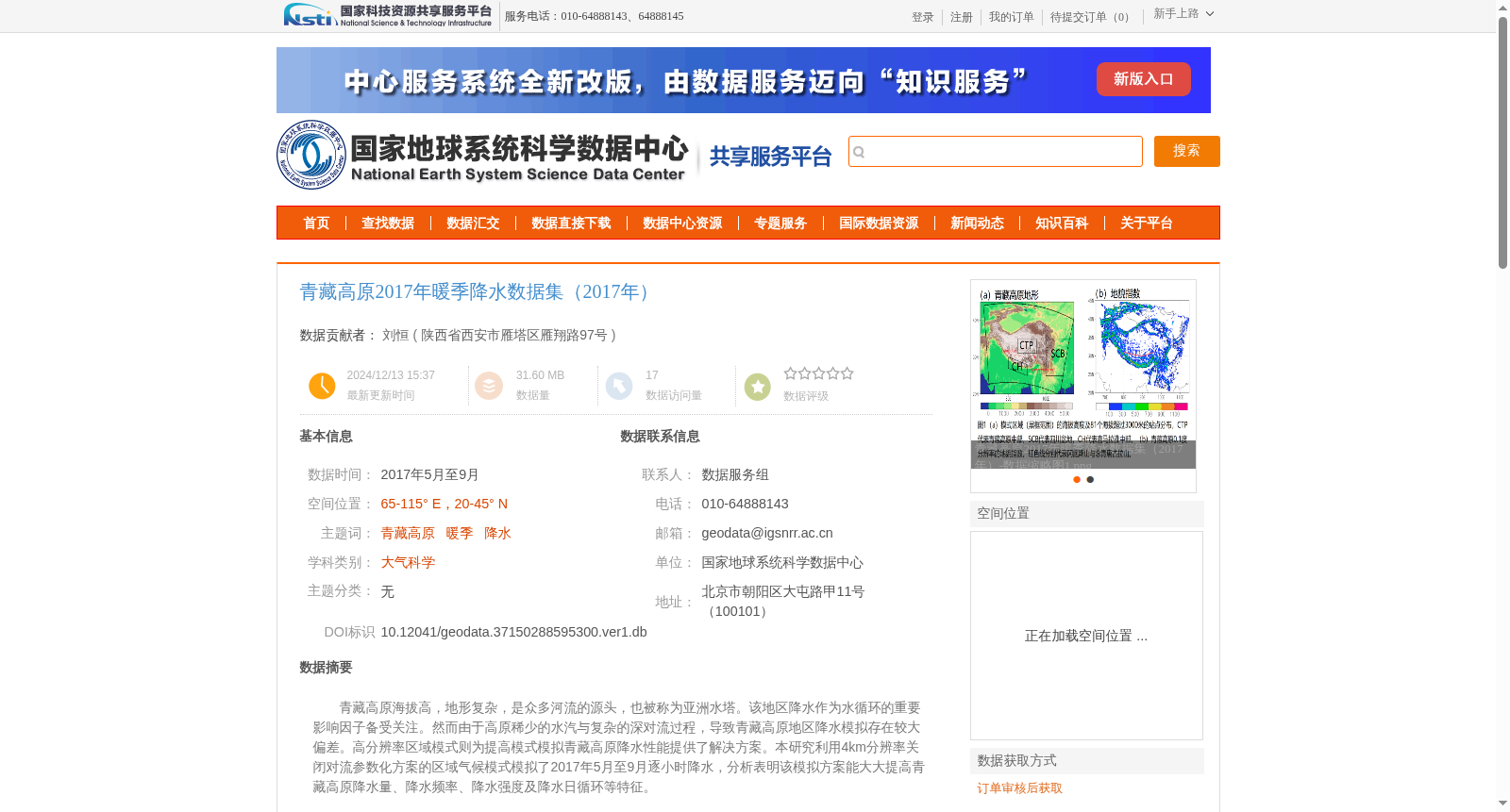
青藏高原海拔高,地形复杂,是众多河流的源头,也被称为亚洲水塔。该地区降水作为水循环的重要影响因子备受关注。然而由于高原稀少的水汽与复杂的深对流过程,导致青藏高原地区降水模拟存在较大偏差。高分辨率区域模式则为提高模式模拟青藏高原降水性能提供了解决方案。本研究利用4km分辨率关闭对流参数化方案的区域气候模式模拟了2017年5月至9月逐小时降水,分析表明该模拟方案能大大提高青藏高原降水量、降水频率、降水强度及降水日循环等特征。
The Qinghai-Tibet Plateau, known as the "Asian Water Tower", boasts high elevations and complex terrain, and serves as the source of numerous major rivers. Precipitation over this region has drawn considerable scholarly attention as a critical influencing factor of the water cycle. However, large biases persist in precipitation simulations for the Qinghai-Tibet Plateau due to the scarce water vapor and complex deep convective processes over the plateau. High-resolution regional climate models provide a viable solution to improving the performance of precipitation simulations over this area. In this study, we conducted hourly precipitation simulations from May to September 2017 using a 4-km resolution regional climate model with the convective parameterization scheme disabled. The analysis results show that this simulation framework can greatly improve the reproduction of key precipitation characteristics over the Qinghai-Tibet Plateau, including total precipitation amount, precipitation frequency, precipitation intensity, and the diurnal precipitation cycle.
提供机构:
陕西省西安市雁塔区雁翔路97号
创建时间:
2024-12-13
搜集汇总
数据集介绍
背景与挑战
背景概述
该数据集为青藏高原2017年5月至9月的暖季降水数据,覆盖65-115° E,20-45° N范围,采用4km分辨率WRF区域气候模式模拟逐小时降水,旨在提高降水模拟精度。数据由中国科学院战略性先导科技专项支持,适用于大气科学研究。
以上内容由遇见数据集搜集并总结生成


