祁连山-阿尔金山区250m多灾种灾害综合危险性数据(2020年)
收藏国家青藏高原科学数据中心2023-10-06 更新2024-03-01 收录
下载链接:
https://data.tpdc.ac.cn/zh-hans/data/4553a2ad-983e-474c-9fbc-6084b3cbb256
下载链接
链接失效反馈官方服务:
资源简介:
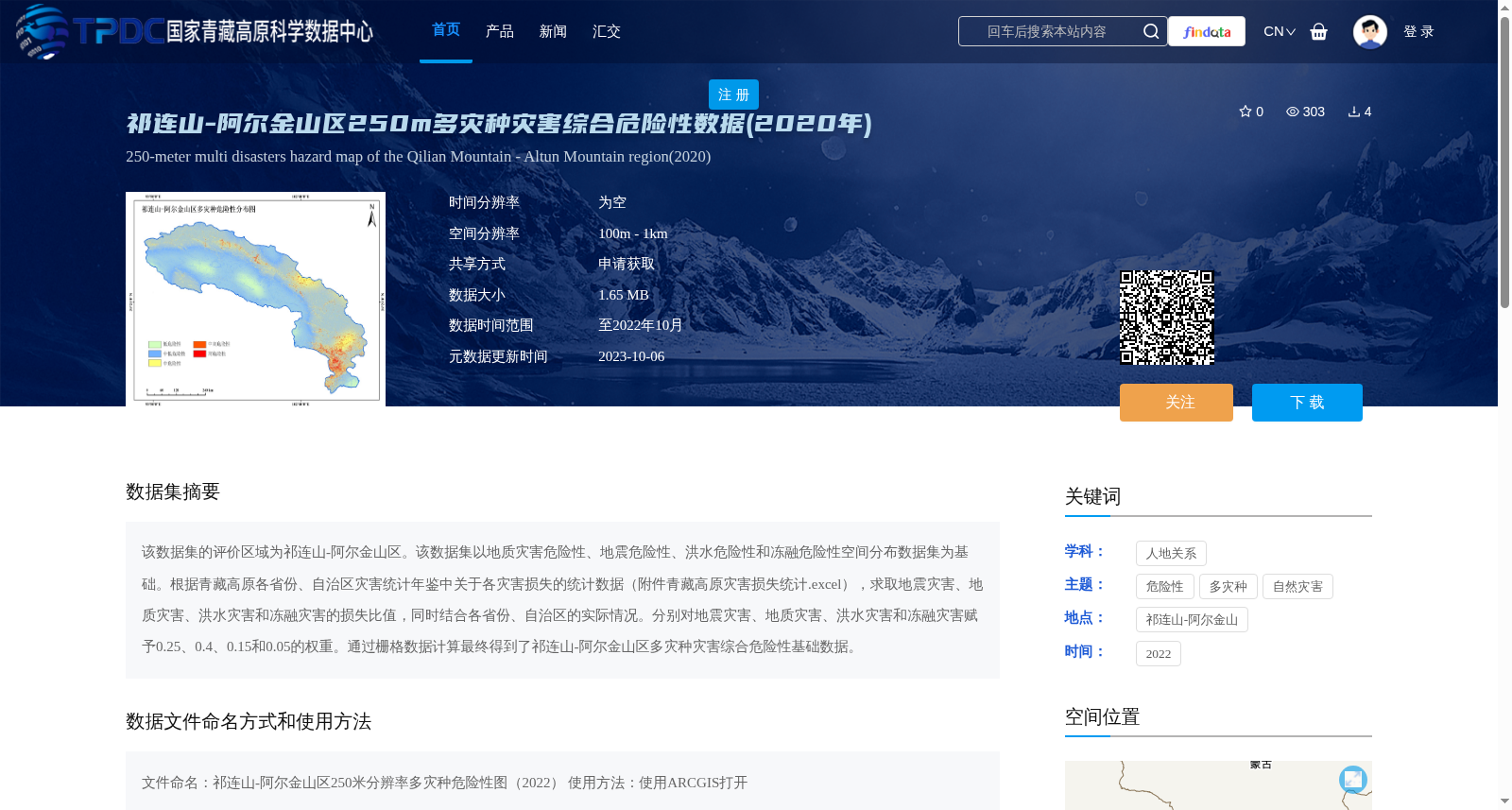
该数据集的评价区域为祁连山-阿尔金山区。该数据集以地质灾害危险性、地震危险性、洪水危险性和冻融危险性空间分布数据集为基础。根据青藏高原各省份、自治区灾害统计年鉴中关于各灾害损失的统计数据(附件青藏高原灾害损失统计.excel),求取地震灾害、地质灾害、洪水灾害和冻融灾害的损失比值,同时结合各省份、自治区的实际情况。分别对地震灾害、地质灾害、洪水灾害和冻融灾害赋予0.25、0.4、0.15和0.05的权重。通过栅格数据计算最终得到了祁连山-阿尔金山区多灾种灾害综合危险性基础数据。
The evaluation scope of this dataset is the Qilian Mountains-Altun Mountains region. This dataset is developed based on spatial distribution datasets of four hazard risks, namely geological hazard risk, earthquake hazard risk, flood hazard risk, and freeze-thaw hazard risk. Based on the statistical data of disaster losses from the disaster statistical yearbooks of all provinces and autonomous regions on the Qinghai-Tibet Plateau (Appendix: Statistical Data of Disaster Losses on the Qinghai-Tibet Plateau.xlsx), combined with the actual conditions of each province and autonomous region, the loss ratios of the four types of disasters were calculated. We assigned weights of 0.25, 0.4, 0.15, and 0.05 to earthquake disasters, geological disasters, flood disasters, and freeze-thaw disasters respectively. Finally, the basic data of comprehensive multi-hazard risk in the Qilian Mountains-Altun Mountains region was derived via raster data computation.
提供机构:
刘连友
创建时间:
2023-02-04
搜集汇总
数据集介绍
背景与挑战
背景概述
该数据集是祁连山-阿尔金山区2020年的多灾种灾害综合危险性数据,空间分辨率为250米。它基于地质灾害、地震、洪水和冻融危险性数据,结合青藏高原灾害损失统计,通过权重分配(地震0.25、地质灾害0.4、洪水0.15、冻融0.05)进行栅格计算,生成综合危险性基础图,适用于自然灾害风险评估和地理信息系统分析。
以上内容由遇见数据集搜集并总结生成


