黄土高原地区30m分辨率的坡向数据集(2014年)
收藏国家地球系统科学数据中心2023-04-07 更新2024-04-21 收录
下载链接:
https://www.geodata.cn/data/datadetails.html?dataguid=216956762922249&docId=6037
下载链接
链接失效反馈官方服务:
资源简介:
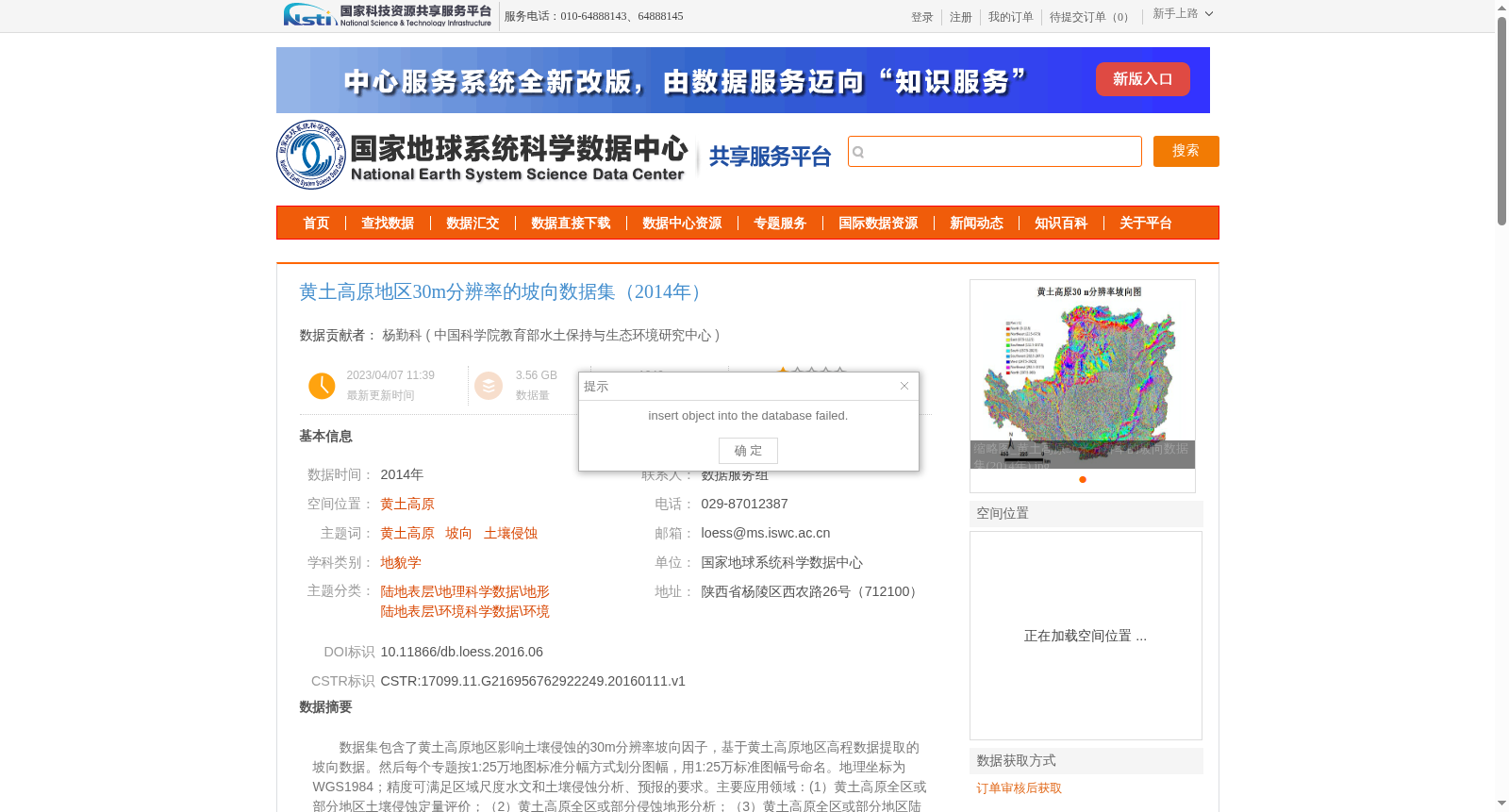
数据集包含了黄土高原地区影响土壤侵蚀的30m分辨率坡向因子,基于黄土高原地区高程数据提取的坡向数据。然后每个专题按1:25万地图标准分幅方式划分图幅,用1:25万标准图幅号命名。地理坐标为WGS1984;精度可满足区域尺度水文和土壤侵蚀分析、预报的要求。主要应用领域:(1)黄土高原全区或部分地区土壤侵蚀定量评价;(2)黄土高原全区或部分侵蚀地形分析;(3)黄土高原全区或部分地区陆地水文分析、植被适宜性评等;(4)基于GIS地表过程定量模拟、地形分析的教学;(5)规划、环评等工程需要。
This dataset contains 30-meter resolution aspect factors influencing soil erosion in the Loess Plateau, which were extracted from the local elevation data of the Loess Plateau. Each thematic layer is divided into map sheets according to the 1:250,000 standard map sheet division standard, and named with their respective standard map sheet numbers. The adopted geographic coordinate system is WGS1984. Its accuracy meets the requirements of regional-scale hydrological analysis and soil erosion assessment and forecasting. The main application fields include:
1. Quantitative soil erosion assessment for the entire Loess Plateau or its partial regions;
2. Erosional terrain analysis for the entire Loess Plateau or its partial regions;
3. Terrestrial hydrological analysis and vegetation suitability assessment for the entire Loess Plateau or its partial regions;
4. Teaching of quantitative surface process simulation and terrain analysis based on GIS;
5. Engineering requirements such as planning and environmental impact assessment (EIA).
提供机构:
中国科学院教育部水土保持与生态环境研究中心
创建时间:
2016-01-11
搜集汇总
数据集介绍
背景与挑战
背景概述
该数据集提供了黄土高原地区2014年30米分辨率的坡向数据,基于ASTER GDEM高程数据生成,采用WGS1984地理坐标系统。数据适用于区域尺度的土壤侵蚀分析、地形研究和水文模拟等科学应用。
以上内容由遇见数据集搜集并总结生成


