青藏高原现今构造隆升速率场
收藏国家青藏高原科学数据中心2025-05-12 更新2025-06-07 收录
下载链接:
https://data.tpdc.ac.cn/zh-hans/data/47fce2b2-aa1a-433d-a997-ef301d72cf97
下载链接
链接失效反馈官方服务:
资源简介:
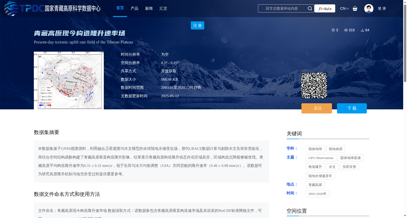
本数据集基于GNSS观测资料,利用融合卫星观测与水文模型的全球陆地水储变化场,替代GRACE数据计算与剔除水文负荷形变效应,再结合空间结构函数构建了青藏高原垂直构造隆升影像。结果显示青藏高原构造隆升状态存在区域差异,区域构造沉降能够被发现。青藏高原平均构造隆升速率为0.31 ± 0.32 mm/yr,低于负荷与冰川均衡调整(GIA)共同贡献的隆升速率(0.46 ± 0.08 mm/yr)。该数据可为研究高原隆升机制与地壳形变过程提供重要参考。
This dataset is constructed based on GNSS observation data, where the global terrestrial water storage change fields fused with satellite observations and hydrological models are employed to replace GRACE data for calculating and eliminating hydrological loading deformation effects, and then combined with spatial structure functions to generate the vertical tectonic uplift images of the Tibetan Plateau. The results demonstrate that the tectonic uplift status of the Tibetan Plateau exhibits regional differences, and regional tectonic subsidence has been detected. The average tectonic uplift rate of the Tibetan Plateau is 0.31 ± 0.32 mm/yr, which is lower than the uplift rate jointly contributed by hydrological loading and Glacial Isostatic Adjustment (GIA) (0.46 ± 0.08 mm/yr). This dataset can serve as an important reference for researching the plateau uplift mechanism and crustal deformation processes.
提供机构:
饶维龙
创建时间:
2025-05-11
搜集汇总
数据集介绍
背景与挑战
背景概述
该数据集基于GNSS观测资料,结合卫星与水文模型,提供了青藏高原2003年至2020年间的构造隆升速率场,空间分辨率为0.1° - 0.25°,揭示了区域差异和平均隆升速率(0.31 ± 0.32 mm/yr)。数据以NetCDF格式存储,适用于研究高原隆升机制和地壳形变过程,并支持开放获取。
以上内容由遇见数据集搜集并总结生成


