青藏高原牧草品质空间数据及图集(2019-2022)
收藏国家青藏高原科学数据中心2025-06-26 更新2025-03-22 收录
下载链接:
https://data.tpdc.ac.cn/zh-hans/data/667bdd9e-3b34-4341-8bb8-002f65eaa9da
下载链接
链接失效反馈官方服务:
资源简介:
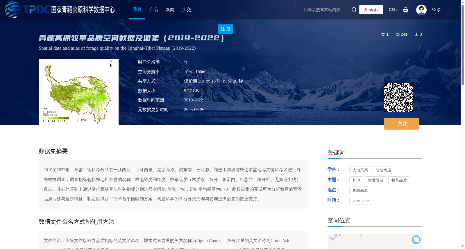
2019至2022年,草蓄平衡科考分队在一江两河、可可西里、羌塘高原、藏东南、三江源、祁连山南坡与柴达木盆地等关键科考区进行野外样方调查,调查指标包括样地所在县的名称、样地经度和纬度、牧草品质(木质素、灰分、粗蛋白、粗脂肪、粗纤维、无氮浸出物)数据。并在此基础上通过随机森林算法对各指标分别进行空间化(单位:%),得到平均精度为0.79。此数据集的完成可为分析牧草的营养品质亏缺与盈余特征,制定区域水平的草畜平衡区划方案,构建科学的草地分类治理与管理提供必要的数据支持。
From 2019 to 2022, the Grass-Livestock Balance Scientific Expedition Team carried out field quadrat surveys in key research areas including the Yarlung Zangbo River and its two tributaries, Hoh Xil, Qiangtang Plateau, Southeast Tibet, Three-River Source Region, southern slope of the Qilian Mountains, and Qaidam Basin. The survey indicators covered the name of the county where the sampling plot was located, the longitude and latitude of the plot, as well as forage quality data including lignin, ash, crude protein, crude fat, crude fiber, and nitrogen-free extract. Based on the collected survey data, spatialization was conducted for each individual indicator using the Random Forest algorithm, with the unit of % and an average accuracy of 0.79. This dataset can provide essential data support for analyzing the deficit and surplus characteristics of forage nutritional quality, formulating regional-level grass-livestock balance zoning plans, and establishing scientific grassland classification governance and management systems.
提供机构:
王军邦,明茹,李以康,贾倩民,张翔飞,赵新全
创建时间:
2025-02-26
搜集汇总
数据集介绍
背景与挑战
背景概述
该数据集提供了2019至2022年青藏高原牧草品质的空间数据和图集,涵盖木质素、灰分、粗蛋白等关键营养指标,通过野外样方调查和随机森林算法空间化生成,空间分辨率为10m-100m,平均精度达0.79。数据以TIF和JPG格式存储,旨在支持牧草营养品质分析、草畜平衡区划和草地科学管理,适用于农业资源和人地关系研究领域。
以上内容由遇见数据集搜集并总结生成


