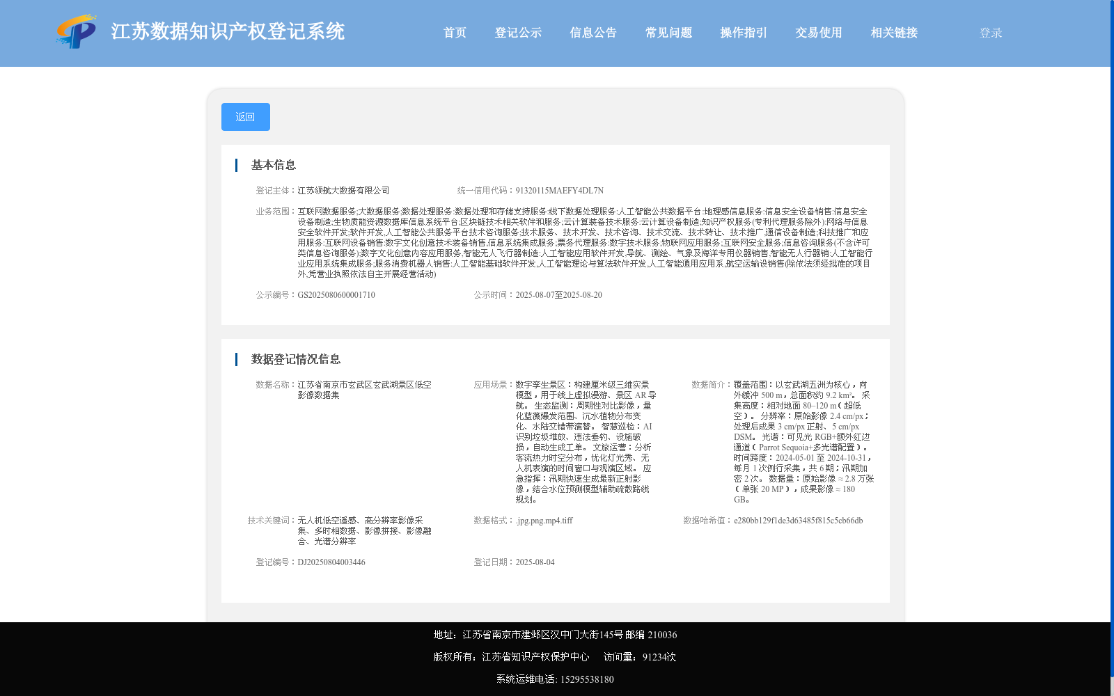
江苏省南京市玄武区玄武湖景区低空影像数据集
收藏江苏数据知识产权登记系统2025-08-06 更新2025-09-06 收录
下载链接:
https://dataip.jsipp.cn/#/changeDetialCertical?pType=登记&cType=登记&id=fea4c70ff86309815d96fb19d2ac0261
下载链接
链接失效反馈官方服务:
资源简介:
覆盖范围:以玄武湖五洲为核心,向外缓冲 500 m,总面积约 9.2 km²。
采集高度:相对地面 80–120 m(超低空)。
分辨率:原始影像 2.4 cm/px;处理后成果 3 cm/px 正射、5 cm/px DSM。
光谱:可见光 RGB+额外红边通道(Parrot Sequoia+多光谱配置)。
时间跨度:2024-05-01 至 2024-10-31,每月 1 次例行采集,共 6 期;汛期加密 2 次。
数据量:原始影像 ≈ 2.8 万张(单张 20 MP),成果影像 ≈ 180 GB。
Coverage: Centered on the five islets of Xuanwu Lake, with a 500-meter outward buffer zone, covering a total area of approximately 9.2 km².
Acquisition Altitude: 80–120 m above ground level (ultra-low altitude aerial survey).
Resolution: The original imagery has a spatial resolution of 2.4 cm per pixel; the processed products include 3 cm/px orthophotos and 5 cm/px DSMs.
Spectrum: Visible RGB bands plus an additional red edge band, configured with the Parrot Sequoia+ multispectral camera system.
Time Span: From May 1, 2024 to October 31, 2024. Routine acquisitions were conducted once per month, totaling 6 sessions; 2 intensified supplementary acquisitions were carried out during the flood season.
Data Volume: Approximately 28,000 original imagery files (each with 20 MP resolution), with the total size of processed product imagery amounting to around 180 GB.
提供机构:
江苏领航大数据有限公司
搜集汇总
数据集介绍
以上内容由遇见数据集搜集并总结生成


