中亚五国农业格局数据集(V1.0,2020)
收藏国家青藏高原科学数据中心2022-11-12 更新2024-03-01 收录
下载链接:
https://data.tpdc.ac.cn/zh-hans/data/0113573f-492b-4e1e-8237-25f9ccb82fb9
下载链接
链接失效反馈官方服务:
资源简介:
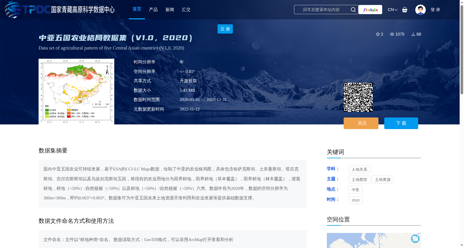
面向中亚五国农业可持续发展,基于ESA的CCI-LC Maps数据,绘制了中亚的农业格局图,具体包含哈萨克斯坦、土库曼斯坦、塔吉克斯坦、吉尔吉斯斯坦以及乌兹别克斯坦五国,将现有的农业用地分为雨养耕地,雨养耕地(草本覆盖),雨养耕地(林木覆盖),灌溉耕地,耕地(>50%)/自然植被(<50%)以及耕地(<50%)/自然植被(>50%)六类。数据年份为2020年,数据的空间分辨率为300m×300m,即约0.003°×0.003°。数据集可为中亚五国未来土地资源开发利用和农业发展等提供基础数据支撑。
For the sustainable agricultural development of the five Central Asian countries, this dataset is developed using ESA CCI-LC Maps data, and depicts the agricultural landscape pattern of Central Asia, covering Kazakhstan, Turkmenistan, Tajikistan, Kyrgyzstan and Uzbekistan. The existing agricultural land types are divided into six categories: rainfed cropland, rainfed cropland (herbaceous cover), rainfed cropland (tree cover), irrigated cropland, cropland (>50%)/natural vegetation (<50%), and cropland (<50%)/natural vegetation (>50%). The dataset employs 2020 vintage data, with a spatial resolution of 300 m × 300 m, approximately equal to 0.003° × 0.003°. This dataset can provide basic data support for future land resource development, utilization and agricultural development of the five Central Asian countries.
提供机构:
张俊俊,蒋晓辉
创建时间:
2022-11-01
搜集汇总
数据集介绍
背景与挑战
背景概述
该数据集基于ESA的CCI-LC Maps绘制,覆盖中亚五国(哈萨克斯坦、土库曼斯坦、塔吉克斯坦、吉尔吉斯斯坦、乌兹别克斯坦),将2020年的农业用地分为六类,包括雨养耕地和灌溉耕地等,空间分辨率约为300米。数据集旨在为中亚地区的土地资源开发利用和农业可持续发展提供基础数据支撑。
以上内容由遇见数据集搜集并总结生成


