中国1公里土壤质地数据(2010-2018,60-100cm)
收藏国家地球系统科学数据中心2022-03-15 更新2024-03-04 收录
下载链接:
https://www.geodata.cn/data/datadetails.html?dataguid=8207678387723&docId=9812
下载链接
链接失效反馈官方服务:
资源简介:
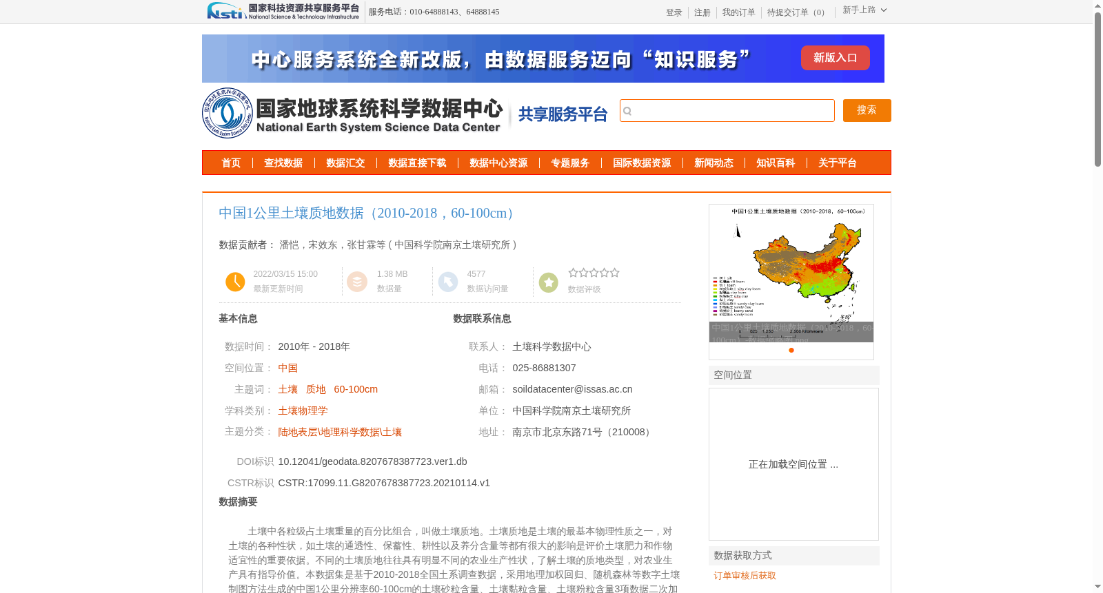
土壤中各粒级占土壤重量的百分比组合,叫做土壤质地。土壤质地是土壤的最基本物理性质之一,对土壤的各种性状,如土壤的通透性、保蓄性、耕性以及养分含量等都有很大的影响是评价土壤肥力和作物适宜性的重要依据。不同的土壤质地往往具有明显不同的农业生产性状,了解土壤的质地类型,对农业生产具有指导价值。本数据集是基于2010-2018全国土系调查数据,采用地理加权回归、随机森林等数字土壤制图方法生成的中国1公里分辨率60-100cm的土壤砂粒含量、土壤黏粒含量、土壤粉粒含量3项数据二次加工生成,质地分类使用美国制标准;
The combination of percentages by weight of various particle size fractions in soil is defined as soil texture. Soil texture is one of the most fundamental physical properties of soil, which exerts a significant influence on various soil characteristics including aeration and permeability, water retention and storage, tillability, and nutrient content, and serves as a critical basis for evaluating soil fertility and crop suitability. Distinct soil textures typically exhibit markedly different agricultural production traits, and thus understanding soil texture categories provides valuable guidance for agricultural production. This dataset was secondarily processed and generated based on national soil series survey data collected between 2010 and 2018, using digital soil mapping methods such as Geographically Weighted Regression (GWR) and Random Forest (RF). It encompasses three datasets across China at 1-kilometer resolution for the 60-100 cm soil depth interval: soil sand content, soil clay content, and soil silt content. The soil texture classification follows the USDA standard.
提供机构:
中国科学院南京土壤研究所
创建时间:
2021-01-14
搜集汇总
数据集介绍
背景与挑战
背景概述
该数据集提供了中国2010-2018年期间60-100厘米深度土壤质地的1公里分辨率空间数据,基于全国土系调查数据,采用地理加权回归和随机森林等数字土壤制图方法生成,包括土壤砂粒、黏粒和粉粒含量,并按照美国制标准进行质地分类。数据覆盖全国范围,质量可靠(各省至少有100个样点参与建模),适用于土壤物理学研究和农业应用。
以上内容由遇见数据集搜集并总结生成


