印度洋海域海洋真光层深度的遥感产品
收藏地球大数据科学工程2024-03-04 收录
下载链接:
https://data.casearth.cn/sdo/detail/5da578ac329b5613607cc994
下载链接
链接失效反馈官方服务:
资源简介:
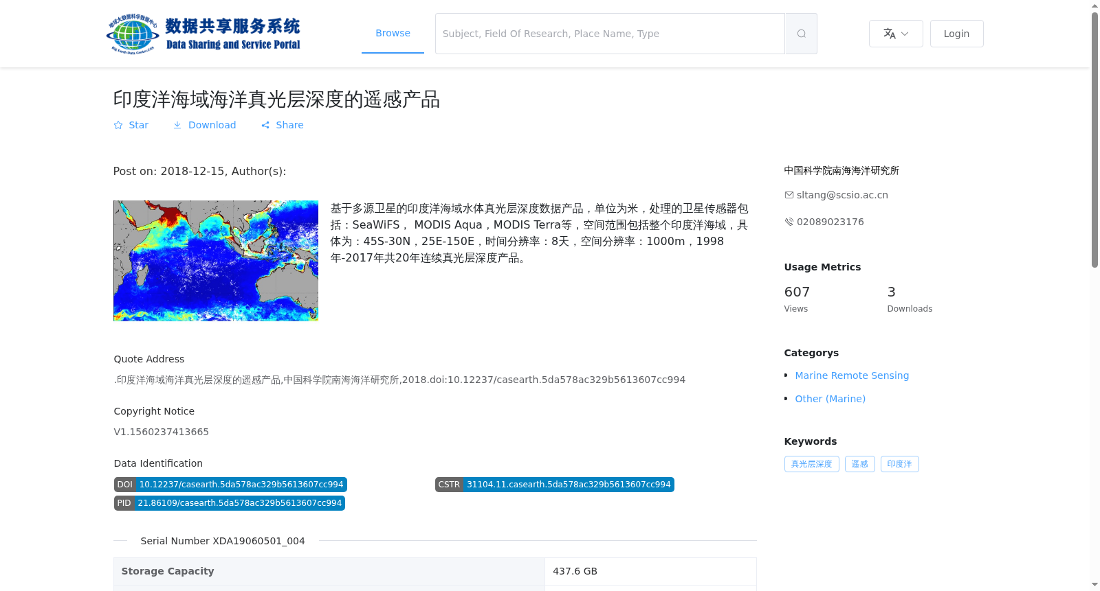
基于多源卫星的印度洋海域水体真光层深度数据产品,单位为米,处理的卫星传感器包括:SeaWiFS, MODIS Aqua,MODIS Terra等,空间范围包括整个印度洋海域,具体为:45S-30N,25E-150E,时间分辨率:8天,空间分辨率:1000m,1998年-2017年共20年连续真光层深度产品。
Euphotic depth dataset of the Indian Ocean derived from multi-source satellites, with unit of meters. The satellite sensors used for data processing include SeaWiFS, MODIS Aqua, MODIS Terra, etc. The spatial coverage covers the entire Indian Ocean, specifically ranging from 45°S to 30°N and 25°E to 150°E. The temporal resolution is 8 days, and the spatial resolution is 1000 m. This dataset provides 20 consecutive years of euphotic depth products from 1998 to 2017.
提供机构:
中国科学院南海海洋研究所
搜集汇总
数据集介绍
背景与挑战
背景概述
该数据集是基于多源卫星(如SeaWiFS、MODIS Aqua和Terra)的印度洋海域真光层深度遥感产品,覆盖范围45S-30N、25E-150E,时间跨度为1998年至2017年,提供8天时间分辨率和1000米空间分辨率的连续数据。
以上内容由遇见数据集搜集并总结生成


