新疆维吾尔族自治区30米分辨率土壤可蚀性因子数据集
收藏国家地球系统科学数据中心2020-06-22 更新2024-04-21 收录
下载链接:
https://www.geodata.cn/data/datadetails.html?dataguid=12587939042363&docId=12968
下载链接
链接失效反馈官方服务:
资源简介:
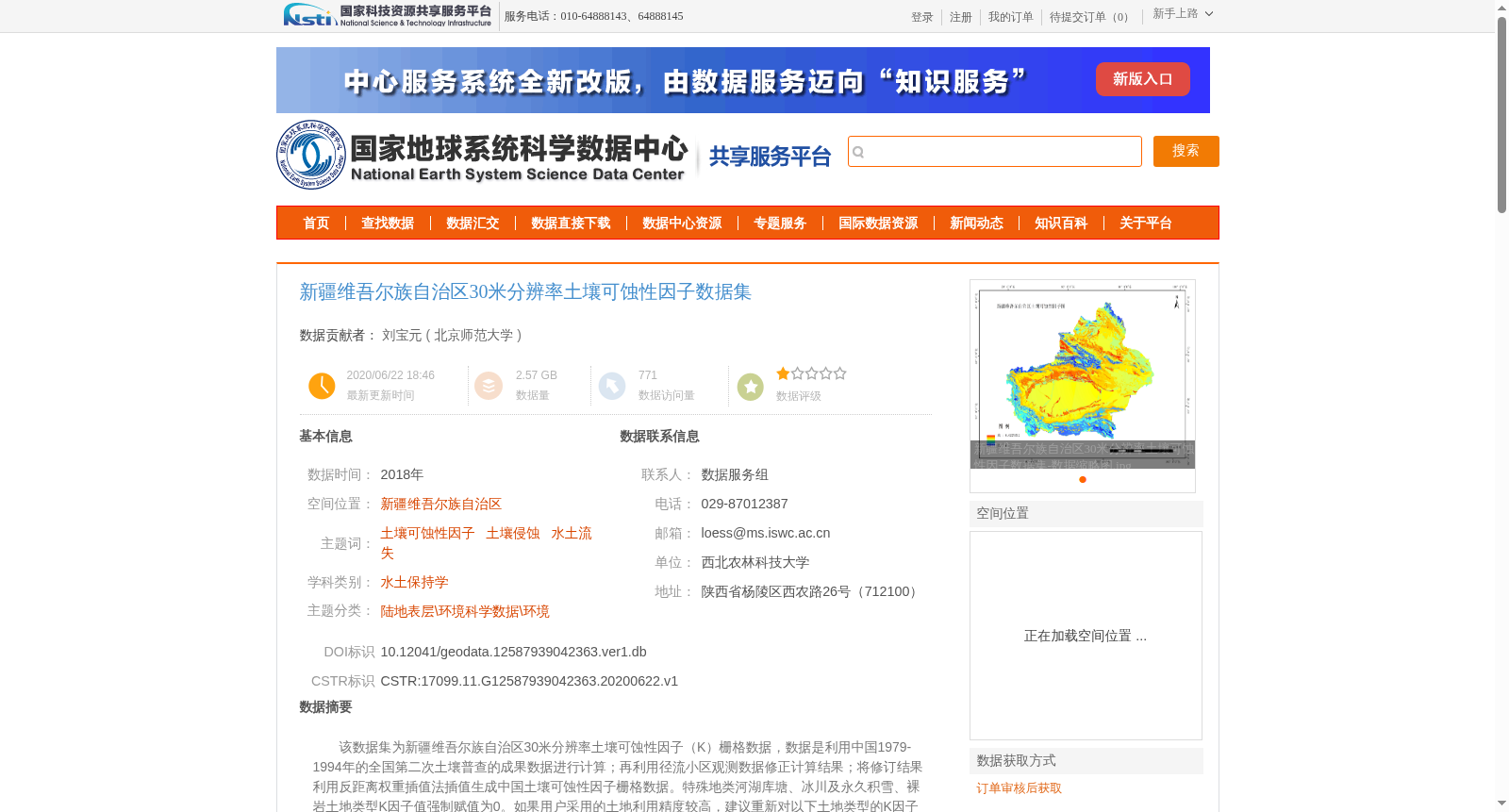
该数据集为新疆维吾尔族自治区30米分辨率土壤可蚀性因子(K)栅格数据,数据是利用中国1979-1994年的全国第二次土壤普查的成果数据进行计算;再利用径流小区观测数据修正计算结果;将修订结果利用反距离权重插值法插值生成中国土壤可蚀性因子栅格数据。特殊地类河湖库塘、冰川及永久积雪、裸岩土地类型K因子值强制赋值为0。如果用户采用的土地利用精度较高,建议重新对以下土地类型的K因子强制赋值为0:河湖库塘、冰川及永久积雪、裸岩。如果有K值为0,但不属于上述类型的,K因子可按如下原则:取邻近相同土地类型图斑的K值,或取与该图斑邻近且不等于0的所有图斑K值的平均值。新疆维吾尔族自治区土壤可蚀性因子(K)栅格数据的利用新疆维吾尔族自治区边界在中国土壤可蚀性因子栅格数据中裁切出新疆维吾尔族自治区土壤可蚀性因子数据。由于数据量大,数据分为西部、东部两部分存放。
This dataset is a 30-meter resolution raster dataset of soil erodibility factor (K) for the Xinjiang Uygur Autonomous Region. It was initially calculated using the results of China’s Second National Soil Survey conducted between 1979 and 1994. The preliminary calculation results were then revised with observational data from runoff plots, and the revised results were interpolated via inverse distance weighting (IDW) to generate the national raster dataset of soil erodibility factor. For special land types including rivers, lakes, reservoirs, ponds, glaciers and permanent snow, and bare rock, the K factor values were forcibly set to 0. If users utilize higher-precision land use data, it is recommended to forcibly assign a K factor value of 0 to the following land types again: rivers, lakes, reservoirs, ponds, glaciers and permanent snow, and bare rock. For grid cells with a K factor value of 0 but not belonging to the aforementioned special land types, the K factor can be determined following these principles: either use the K factor value of a neighboring grid cell with the same land type, or calculate the average K factor value of all neighboring grid cells with non-zero K factor values. The raster dataset of soil erodibility factor (K) for the Xinjiang Uygur Autonomous Region was clipped from the national soil erodibility factor raster dataset using the boundary mask of the Xinjiang Uygur Autonomous Region. Due to the large data volume, the dataset is stored in two parts: western and eastern segments.
提供机构:
北京师范大学
创建时间:
2020-06-22
搜集汇总
数据集介绍
背景与挑战
背景概述
该数据集是2018年的新疆维吾尔族自治区30米分辨率土壤可蚀性因子栅格数据,基于全国第二次土壤普查成果计算,并利用径流小区观测数据修正,通过反距离权重插值法生成。数据主要用于土壤侵蚀和水土流失研究,特殊地类(如河湖库塘、冰川及永久积雪、裸岩)的K因子赋值为0,且由于数据量大,分为东部和西部两部分存放。
以上内容由遇见数据集搜集并总结生成


