2000–2020年“一带一路”区域地表水体动态数据集
收藏地球大数据科学工程2024-04-26 收录
下载链接:
https://data.casearth.cn/sdo/detail/65389744819aec0f260f8ef5
下载链接
链接失效反馈官方服务:
资源简介:
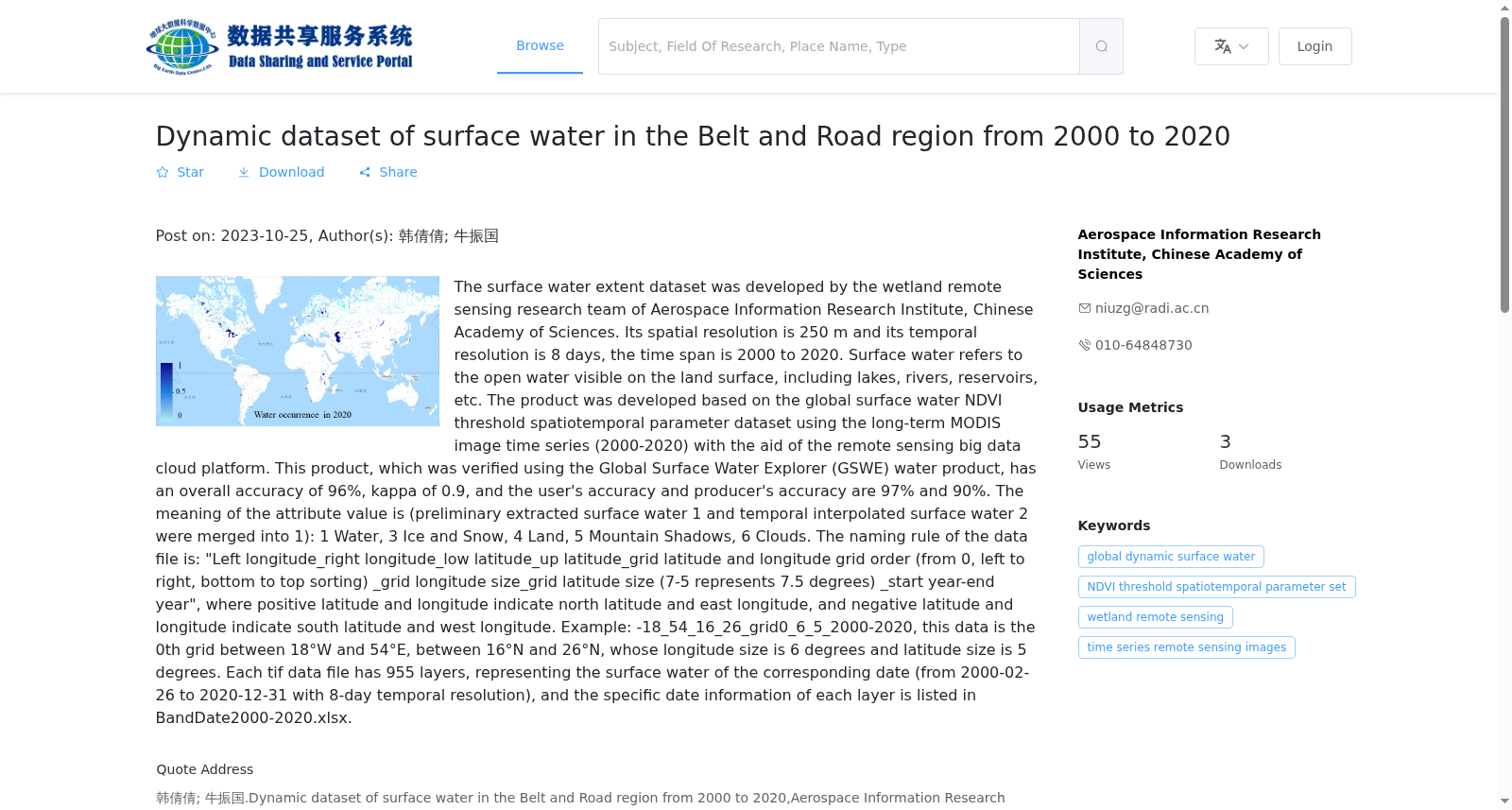
地表动态水体产品由中国科学院空天信息创新研究院湿地与环境遥感研究团队制作而成,空间分辨率为250米,时间分辨率为8天,时间跨度为2000–2020年。地表水体是指陆地表面可见的开放性水体,包括湖泊、河流、水库等。本数据集是基于MODIS数据构建了一套全球地表水体NDVI阈值时空参数集,在此基础上使用遥感大数据云平台进行研发。利用Global Surface Water Explorer(GSWE)水体产品对数据集进行精度验证,总体精度为96%,kappa系数为0.9,用户精度和生产者精度分别为97%和90%。数据属性值的含义为(初步提取的水体1和时间插值的水体2合并为1):1水体,3冰雪,4陆地,5山体阴影,6云。数据文件的命名规则为:“左经度_右经度_下纬度_上纬度_grid经纬度范围内的网格顺序(从0开始,从左至右,从下至上排序)_网格的经度大小_网格的纬度大小(其中7-5代表7.5度)_起始年份-终止年份”,经纬度为正值表示北纬和东经,经纬度为负值表示南纬和西经。例如:-18_54_16_26_grid0_6_5_2000-2020,该数据是位于西经18度至东经54度之间,北纬16度至北纬26度之间的第0个网格,网格大小为经度6度、纬度5度。每个tif数据文件有955个图层,分别代表对应日期的地表水体(2000-02-26至2020-12-31,时间分辨率为8天),具体每个图层的日期信息参见BandDate2000-2020.xlsx。
The Surface Dynamic Water Body Dataset was developed by the Wetland and Environmental Remote Sensing Research Team, Aerospace Information Research Institute, Chinese Academy of Sciences. It has a spatial resolution of 250 m, temporal resolution of 8 days, and covers the period from 2000 to 2020. Surface water bodies refer to visible open water bodies on land surfaces, including lakes, rivers, reservoirs, etc. This dataset was developed by first constructing a global spatiotemporal parameter set of NDVI thresholds for surface water bodies using MODIS data, and then utilizing a remote sensing big data cloud platform. The dataset was validated using the Global Surface Water Explorer (GSWE) water body product, achieving an overall accuracy of 96%, a Kappa coefficient of 0.9, user's accuracy of 97%, and producer's accuracy of 90%. The meanings of the data attribute values are as follows (the initially extracted water body 1 and temporally interpolated water body 2 are merged into 1): 1 represents water body, 3 represents ice and snow, 4 represents land, 5 represents mountain shadow, and 6 represents cloud. The naming convention for data files is: "left_longitude_right_longitude_lower_latitude_upper_latitude_grid_grid_order_within_the_latitude_and_longitude_range_sorted_from_left_to_right_and_bottom_to_top_starting_from_0_grid_longitude_size_grid_latitude_size_where_7-5_represents_7.5_degrees_start_year-end_year". Positive longitude and latitude values indicate north latitude and east longitude, while negative values indicate south latitude and west longitude. For example: "-18_54_16_26_grid0_6_5_2000-2020" refers to the 0th grid located between 18°W to 54°E and 16°N to 26°N, with a grid size of 6° in longitude and 5° in latitude. Each TIFF data file contains 955 layers, each representing the surface water body on the corresponding date (from 2000-02-26 to 2020-12-31, with a temporal resolution of 8 days). For the specific date information of each layer, please refer to the file BandDate2000-2020.xlsx.
提供机构:
中国科学院空天信息创新研究院
搜集汇总
数据集介绍
背景与挑战
背景概述
该数据集是一个覆盖2000年至2020年、针对“一带一路”区域的地表水体动态监测数据集,由中国科学院空天信息创新研究院开发,具有250米空间分辨率和8天时间分辨率,基于MODIS遥感影像和NDVI阈值方法生成,整体精度高达96%,适用于长期水体和湿地变化分析。数据集以GeoTiff格式提供,包含全球范围的网格化数据,总容量72.23 GB,属性值区分了水体、冰雪、陆地等多种地表类型,支持环境研究和可持续发展目标应用。
以上内容由遇见数据集搜集并总结生成


