新疆维吾尔族自治区100米分辨率土地覆被数据(1980s)
收藏国家地球系统科学数据中心2017-03-25 更新2024-03-04 收录
下载链接:
https://www.geodata.cn/data/datadetails.html?dataguid=1663576&docId=29670
下载链接
链接失效反馈官方服务:
资源简介:
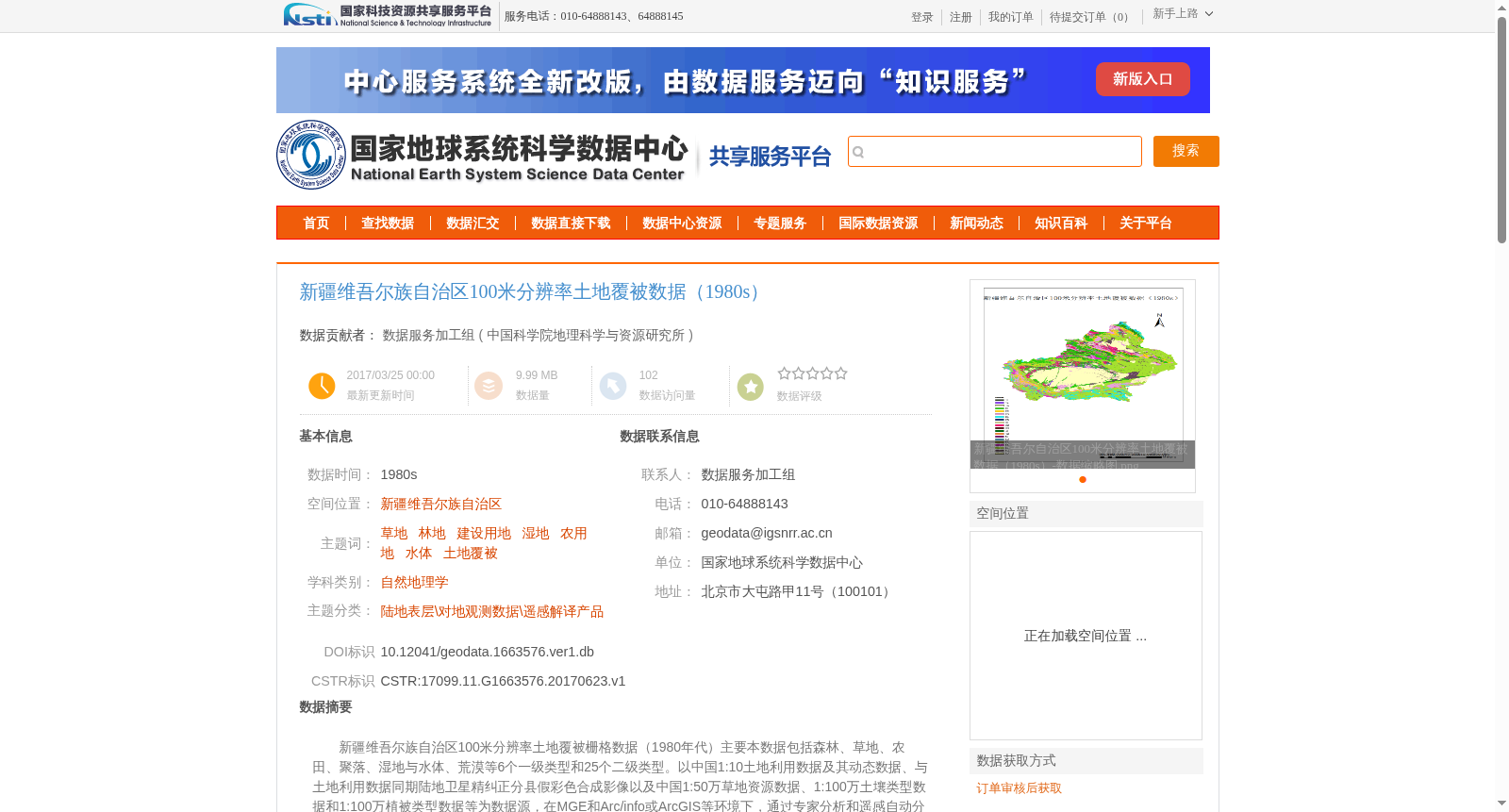
新疆维吾尔族自治区100米分辨率土地覆被栅格数据(1980年代)主要本数据包括森林、草地、农田、聚落、湿地与水体、荒漠等6个一级类型和25个二级类型。以中国1:10土地利用数据及其动态数据、与土地利用数据同期陆地卫星精纠正分县假彩色合成影像以及中国1:50万草地资源数据、1:100万土壤类型数据和1:100万植被类型数据等为数据源,在MGE和Arc/info或ArcGIS等环境下,通过专家分析和遥感自动分类相结合的方法,按照内容和区域,采用专题制图的方式完成的。各类型的定义和代码见本数据集文档。该数据集比较系统、全面地反映了全国陆地区域及其近海岛屿的土地覆被状况及其1980年代以来的变化情况。
100-meter Resolution Land Cover Raster Dataset of Xinjiang Uygur Autonomous Region (1980s)
This dataset primarily covers 6 first-level land cover categories and 25 second-level subcategories, including forest, grassland, cropland, settlement, wetland and water body, desert, etc.
The dataset was developed using multiple data sources, including China's 1:10 scale land use data and its supporting dynamic data, county-level precisely corrected false-color composite Landsat images synchronized with the land use data, China's 1:500,000 scale grassland resource data, 1:1,000,000 scale soil type data, and 1:1,000,000 scale vegetation type data.
It was generated via thematic mapping based on content and regional characteristics, through the combination of expert analysis and automated remote sensing classification in software environments such as MGE, Arc/Info or ArcGIS.
The definitions and codes of each category are provided in the dataset documentation.
This dataset systematically and comprehensively reflects the land cover conditions of China's terrestrial regions and offshore islands, as well as the changes that have occurred since the 1980s.
提供机构:
中国科学院地理科学与资源研究所
创建时间:
2017-06-23
搜集汇总
数据集介绍
背景与挑战
背景概述
该数据集为新疆维吾尔族自治区1980年代的100米分辨率土地覆被栅格数据,包含森林、草地、农田、聚落、湿地与水体、荒漠等6个一级类型和25个二级类型。数据源包括1980年代土地利用数据、陆地卫星影像及多种辅助数据,通过专家分析和遥感自动分类方法制作,反映了该地区土地覆被状况及其变化。
以上内容由遇见数据集搜集并总结生成


