祁连山国家公园Landsat8卫星影像镶嵌(2021)
收藏国家青藏高原科学数据中心2023-05-31 更新2024-03-06 收录
下载链接:
https://data.tpdc.ac.cn/zh-hans/data/c62bbc20-ca71-4559-96a5-60cdfc241fc7
下载链接
链接失效反馈官方服务:
资源简介:
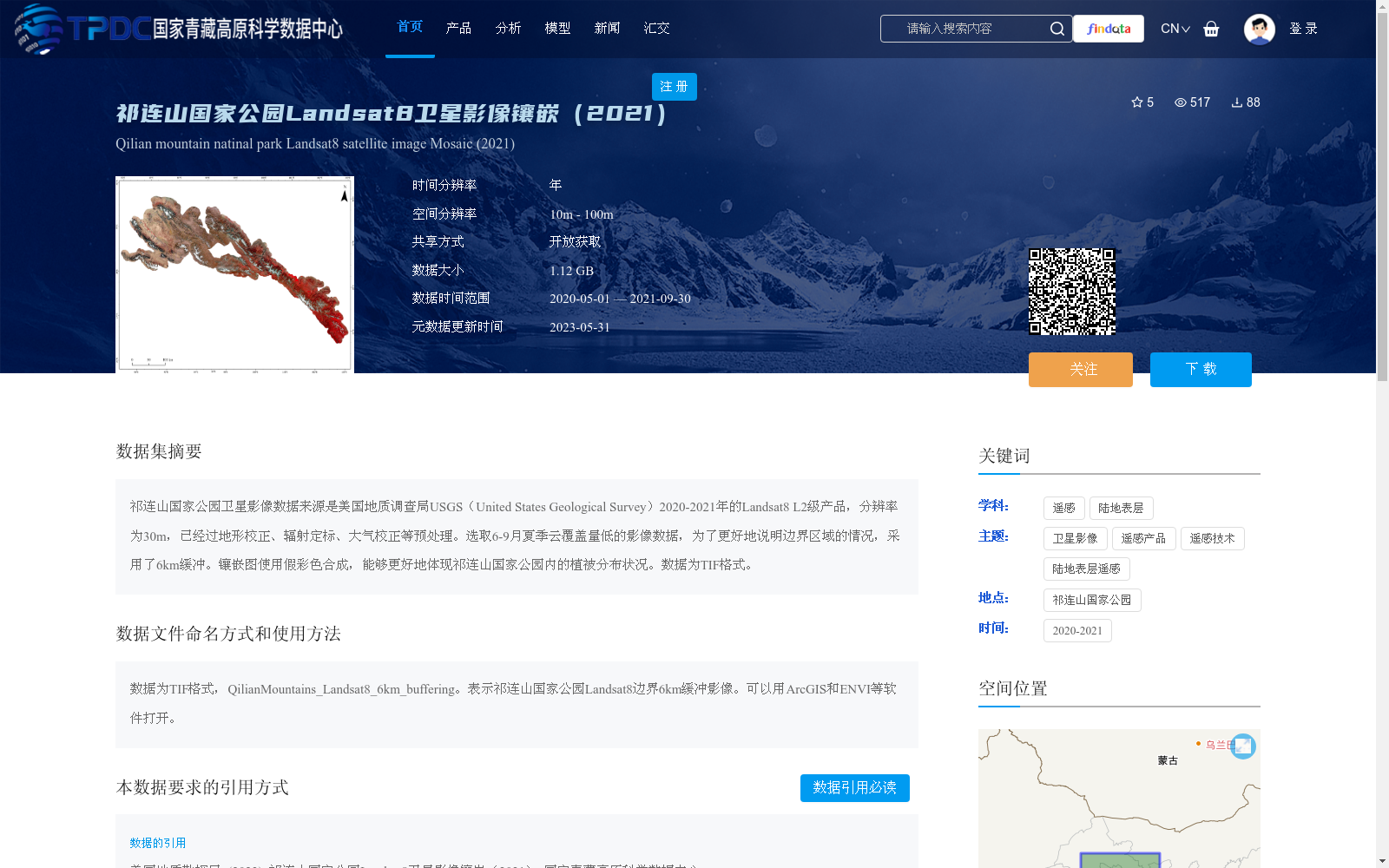
祁连山国家公园卫星影像数据来源是美国地质调查局USGS(United States Geological Survey)2020-2021年的Landsat8 L2级产品,分辨率为30m,已经过地形校正、辐射定标、大气校正等预处理。选取6-9月夏季云覆盖量低的影像数据,为了更好地说明边界区域的情况,采用了6km缓冲。镶嵌图使用假彩色合成,能够更好地体现祁连山国家公园内的植被分布状况。数据为TIF格式。
The satellite image dataset of Qilian Mountain National Park is sourced from the Landsat 8 L2 products provided by the United States Geological Survey (USGS) spanning the years 2020 to 2021, with a spatial resolution of 30 m. The dataset has been preprocessed with operations including topographic correction, radiometric calibration, and atmospheric correction. Image data with low cloud cover during the summer period from June to September was selected for this dataset. To better characterize the boundary regions, a 6 km buffer was adopted. The mosaic images were generated using false-color composite, which enables clearer visualization of the vegetation distribution within Qilian Mountain National Park. All data are stored in TIF format.
提供机构:
美国地质勘探局
创建时间:
2023-04-19
搜集汇总
数据集介绍
背景与挑战
背景概述
该数据集是祁连山国家公园2020-2021年的Landsat8卫星影像镶嵌产品,源自美国地质调查局(USGS)的L2级数据,经过预处理如地形校正和大气校正,空间分辨率为30米。数据选取夏季低云覆盖影像,采用6km缓冲和假彩色合成,旨在清晰展示公园边界区域的植被分布状况,适用于遥感分析和生态研究。
以上内容由遇见数据集搜集并总结生成


