祁连山区域基于 Landsat 反射率数据的月度30m植被指数数据(V1.0,2021)
收藏国家青藏高原科学数据中心2022-06-21 更新2024-02-29 收录
下载链接:
https://data.tpdc.ac.cn/zh-hans/data/f0371dae-6d5b-46c3-a108-78d2c5c2ad55
下载链接
链接失效反馈官方服务:
资源简介:
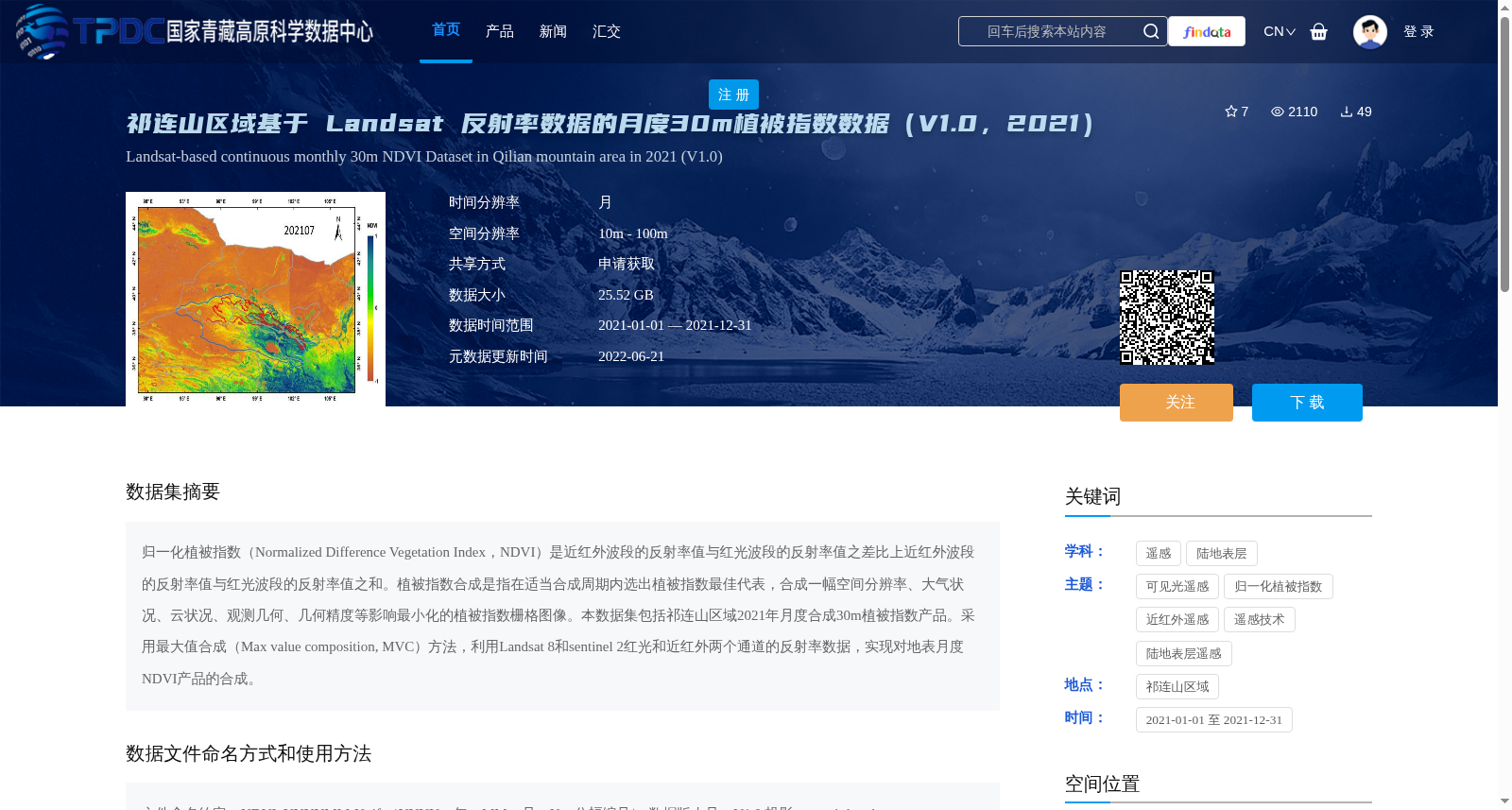
归一化植被指数(Normalized Difference Vegetation Index,NDVI)是近红外波段的反射率值与红光波段的反射率值之差比上近红外波段的反射率值与红光波段的反射率值之和。植被指数合成是指在适当合成周期内选出植被指数最佳代表,合成一幅空间分辨率、大气状况、云状况、观测几何、几何精度等影响最小化的植被指数栅格图像。本数据集包括祁连山区域2021年月度合成30m植被指数产品。采用最大值合成(Max value composition, MVC)方法,利用Landsat 8和sentinel 2红光和近红外两个通道的反射率数据,实现对地表月度NDVI产品的合成。
The Normalized Difference Vegetation Index (NDVI) is calculated as the ratio of the difference between the reflectance values of the near-infrared (NIR) band and the red band to the sum of the reflectance values of the two bands. Vegetation index composition refers to the process of selecting the optimal representative vegetation index within an appropriate synthesis cycle, to generate a vegetation index raster image with minimized impacts from factors including spatial resolution, atmospheric conditions, cloud cover, observation geometry and geometric accuracy. This dataset contains the monthly composite 30m vegetation index products for the Qilian Mountains region in 2021. It adopts the Max Value Composition (MVC) method to synthesize surface monthly NDVI products using reflectance data from the red and near-infrared bands of Landsat 8 and Sentinel 2.
提供机构:
吴俊君,李艺, 仲波
创建时间:
2022-06-14
搜集汇总
数据集介绍
背景与挑战
背景概述
该数据集提供了祁连山区域2021年全年的月度30米分辨率归一化植被指数产品,基于Landsat 8和Sentinel 2的反射率数据,采用最大值合成方法生成,用于监测植被动态变化。数据具有较高的时空分辨率,覆盖祁连山区域,适用于生态环境和遥感研究,需通过申请方式获取。
以上内容由遇见数据集搜集并总结生成


