
FHNW Muttenz dataset
收藏资源简介:
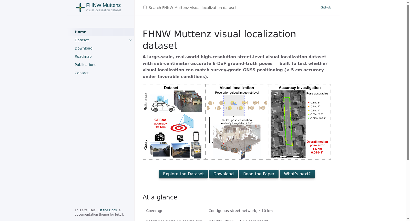
FHNW Muttenz数据集是由瑞士西北应用科学与艺术大学等机构联合创建的大规模真实世界街景视觉定位数据集,旨在填补高精度室外定位数据空白。该数据集覆盖连续10公里街道网络,包含两次移动测绘活动采集的高分辨率参考图像和由四种不同相机在五个代表性场景获取的查询序列,所有图像均经过精确配准,提供亚厘米级精度的六自由度真实姿态。数据创建过程涉及专业移动测绘系统采集和严格的多传感器协同配准技术,确保几何一致性。该数据集主要应用于视觉定位算法评估,旨在解决城市环境中全球导航卫星系统信号受限时的高精度互补定位问题,推动消费级设备在测绘级地理空间数据获取和自动化地理配准中的应用。
The FHNW Muttenz Dataset is a large-scale real-world street-view visual localization dataset jointly created by Northwestern Switzerland University of Applied Sciences and Arts and other institutions, aiming to fill the gap in high-precision outdoor localization data. This dataset covers a continuous 10-kilometer street network, containing high-resolution reference images collected via two mobile mapping campaigns and query sequences acquired by four different cameras across five representative scenarios. All images have undergone precise registration, providing true 6-degree-of-freedom (6-DoF) poses with sub-centimeter accuracy. The dataset creation process involves professional mobile mapping system data collection and strict multi-sensor cooperative registration techniques to ensure geometric consistency. This dataset is mainly applied for visual localization algorithm evaluation, aiming to address the high-precision complementary localization issue when global navigation satellite system (GNSS) signals are limited in urban environments, and promote the application of consumer-grade devices in surveying-grade geospatial data acquisition and automated georegistration.
- 1Accuracy potential of visual localization exploiting high-end street-level imagery瑞士西北应用科学与艺术大学·地理信息研究所; 斯图加特大学·摄影测量与地理信息研究所; iNovitas AG · 2026年


