中亚-西亚地区典型流域荒漠化关键要素数据集(阿姆河流域)
收藏地球大数据科学工程2024-04-21 收录
下载链接:
https://data.casearth.cn/sdo/detail/5feae825819aec33049b7bfa
下载链接
链接失效反馈官方服务:
资源简介:
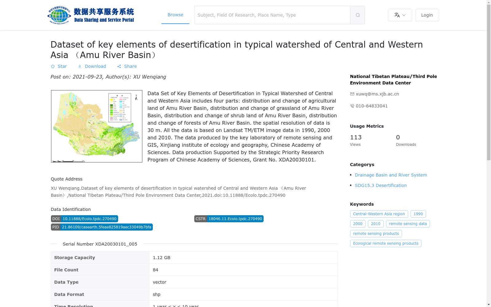
中亚-西亚地区典型流域荒漠化关键要素数据集由4部分组成,分别是阿姆河流域农用地分布及变化、阿姆河流域草地分布及变化、阿姆河流域灌丛分布及变化和阿姆河流域森林分布及变化,数据空间分辨率为30m。由中国科学院新疆生态与地理研究所遥感与GIS重点实验室生产,数据生产费用由“中国科学院战略性先导科技专项XDA20030101资助”。阿姆河流域荒漠化关键要素数据集由1990年、2000年和、2010年三期数据组成,是基于TM/ETM遥感影像解译获得。
The Dataset of Key Desertification Factors in Typical Basins of Central Asia and West Asia consists of four components: the distribution and changes of agricultural land, grassland, shrubland and forest in the Amu Darya River Basin. The data has a spatial resolution of 30 m. It was produced by the Key Laboratory of Remote Sensing and GIS, Xinjiang Institute of Ecology and Geography, Chinese Academy of Sciences. The data production was funded by the Strategic Priority Research Program of the Chinese Academy of Sciences (Grant No. XDA20030101). The dataset of key desertification factors for the Amu Darya River Basin includes three phases of data from 1990, 2000 and 2010, which was obtained through interpretation of TM/ETM remote sensing images.
提供机构:
国家青藏高原科学数据中心
搜集汇总
数据集介绍
背景与挑战
背景概述
该数据集聚焦中亚-西亚地区阿姆河流域的荒漠化关键要素,包括农业用地、草地、灌木地和森林在1990、2000和2010年的分布与变化,空间分辨率为30米,基于Landsat TM/ETM影像数据。数据由中国科学院新疆生态与地理研究所遥感与GIS重点实验室生产,并得到中国科学院战略性先导科技专项支持,旨在为荒漠化研究提供高精度、多时相的矢量数据支撑。
以上内容由遇见数据集搜集并总结生成


