2001-2020年黄土高原1km分辨率逐月平均TVDI数据集
收藏国家地球系统科学数据中心2023-07-20 更新2024-03-04 收录
下载链接:
https://www.geodata.cn/data/datadetails.html?dataguid=98439349010545&docId=4638
下载链接
链接失效反馈官方服务:
资源简介:
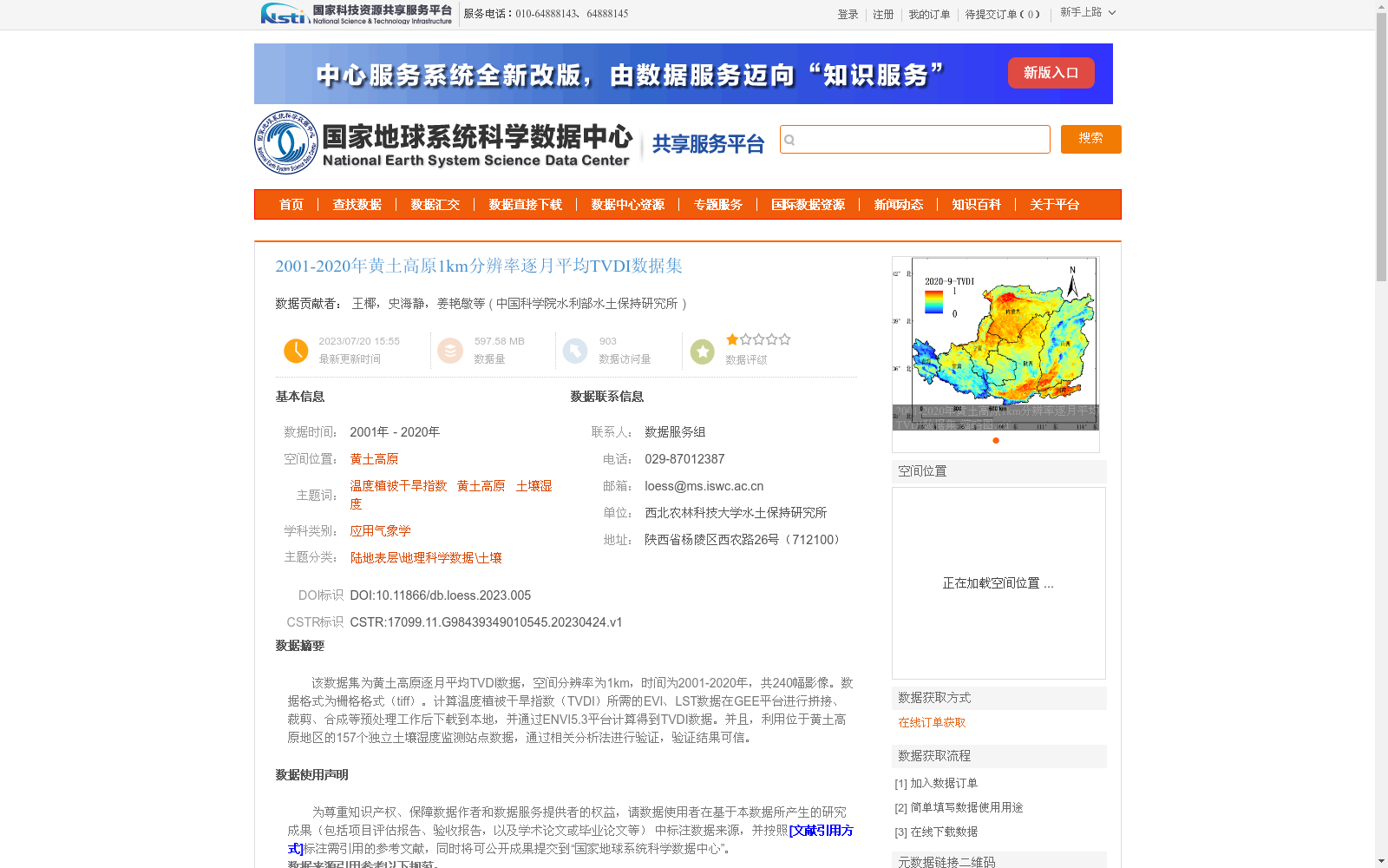
该数据集为黄土高原逐月平均TVDI数据,空间分辨率为1km,时间为2001-2020年,共240幅影像。数据格式为栅格格式(tiff)。计算温度植被干旱指数(TVDI)所需的EVI、LST数据在GEE平台进行拼接、裁剪、合成等预处理工作后下载到本地,并通过ENVI5.3平台计算得到TVDI数据。并且,利用位于黄土高原地区的157个独立土壤湿度监测站点数据,通过相关分析法进行验证,验证结果可信。
This dataset consists of monthly mean Temperature Vegetation Dryness Index (TVDI) data over the Loess Plateau, with a spatial resolution of 1 km, spanning the period from 2001 to 2020, and containing a total of 240 image scenes. The data is stored in raster format (TIFF). The Enhanced Vegetation Index (EVI) and Land Surface Temperature (LST) data required for calculating TVDI were preprocessed (including mosaicking, clipping, and compositing) on the Google Earth Engine (GEE) platform, then downloaded locally, and finally used to derive the TVDI data via ENVI 5.3 software. Additionally, the dataset was validated using data from 157 independent soil moisture monitoring stations located in the Loess Plateau through correlation analysis, and the validation results are reliable.
提供机构:
中国科学院水利部水土保持研究所
创建时间:
2023-04-24
搜集汇总
数据集介绍
背景与挑战
背景概述
该数据集提供了2001年至2020年黄土高原地区逐月平均温度植被干旱指数(TVDI)数据,空间分辨率为1公里,共包含240幅栅格影像。数据基于GEE平台的EVI和LST数据计算生成,并通过157个土壤湿度监测站点验证,结果可信,适用于土壤湿度和干旱监测研究。
以上内容由遇见数据集搜集并总结生成


