全球湖泊水库水面静态数据集V1.2
收藏地球大数据科学工程2025-09-17 更新2025-12-20 收录
下载链接:
https://data.casearth.cn/dataset/68c127759418b437b224d37a
下载链接
链接失效反馈官方服务:
资源简介:
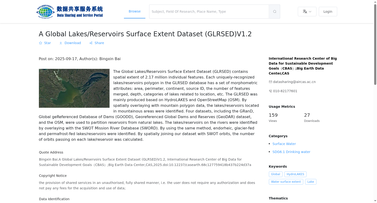
全球湖泊/水库水面空间范围数据集(A Global Lakes/Reservoirs Surface Extent Dataset,GLRSED)基于HydroLAKES、OpenStreetMap(OSM)等数据构建,包含217万个湖泊/水库的空间范围数据。GLRSED的属性包括源数据ID、面积、周长、所属大陆、合并的特征数量、深度、与位置相关的湖泊类别等。GLRSED主要基于HydroLAKES和OpenStreetMap(OSM)生产。通过与山区多边形数据进行空间叠加,确定了位于山区的湖泊/水库。全球水库和大坝数据库(GRanD)、全球大坝参考数据库(GOODD)、全球大坝和储量地理参考数据集(GeoDAR)和OSM,用于将水库与天然湖泊进行划分。通过与SWOT任务河流数据库(SWORD)叠加来识别河流上的湖泊/水库。通过使用相同的方法,确定了内陆湖泊/水库、位于冰川区和永久冻土区的湖泊/水库。通过将我们的数据集与SWOT轨道进行空间连接,计算了通过每个湖泊/水库的轨道数量。
A Global Lakes/Reservoirs Surface Extent Dataset (GLRSED) is constructed using datasets including HydroLAKES and OpenStreetMap (OSM), and contains spatial extent data for 2.17 million lakes and reservoirs. Attributes of GLRSED include source data ID, area, perimeter, associated continent, number of merged features, depth, and location-related lake category, among others. This dataset is primarily developed based on HydroLAKES and OpenStreetMap (OSM). Mountainous lakes and reservoirs are identified through spatial overlay with mountainous polygon datasets. The Global Reservoir and Dam Database (GRanD), Global Dam Reference Database (GOODD), Georeferenced Dataset of Global Dams and Reservoirs (GeoDAR), and OSM are employed to differentiate reservoirs from natural lakes. Lakes and reservoirs situated on rivers are identified via spatial overlay with the SWOT River Database (SWORD). Using the same methodology, inland lakes and reservoirs, as well as those located in glacial and permafrost regions, are identified. The number of SWOT satellite tracks passing through each lake or reservoir is calculated through spatial joining between this dataset and SWOT orbits.
创建时间:
2025-09-10
搜集汇总
数据集介绍
背景与挑战
背景概述
该数据集是一个全球湖泊和水库水面静态数据集V1.2,包含217万个独立湖泊/水库多边形,提供面积、深度等形态属性。数据基于HydroLAKES和OpenStreetMap生产,通过整合多个数据库区分水库与天然湖泊,并识别山区、河流等特殊类型,覆盖全球范围,时间分辨率为2022年。
以上内容由遇见数据集搜集并总结生成


