Spatial distribution data of cultural sites from the Paleolithic to Bronze Age in Xinjiang, China
收藏国家青藏高原科学数据中心2022-06-02 更新2024-03-01 收录
下载链接:
https://data.tpdc.ac.cn/zh-hans/data/bb49a6da-bfd4-4355-9d0c-988eef793ee1
下载链接
链接失效反馈官方服务:
资源简介:
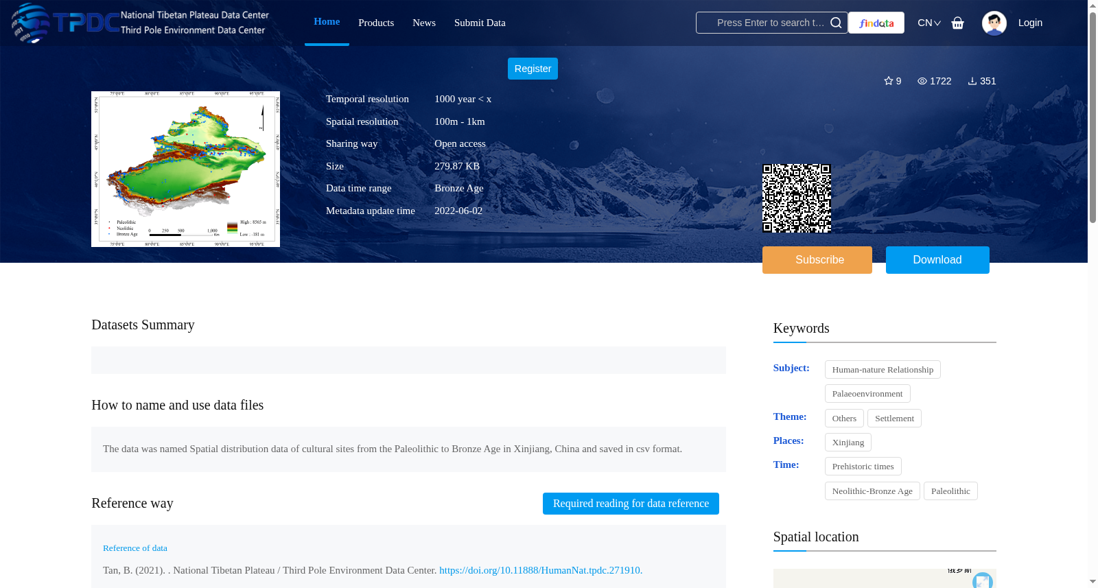
The site data used in this study are mainly from many years of archaeological excavations in Xinjiang. Based on publications such as “China Cultural Relics Atlas · Xinjiang Volume”, “A compilation of cultural relics and archaeological materials in Xinjiang”, “China Statistical Yearbook on Archaeology” and the third national cultural relics survey results, site data in the study area were collected, and the sites with unknown dates were eliminated. In this study, the name, latitude and longitude coordinates, site type, civilization and cultural age, time elapsed, area, altitude, slope, aspect, soil type, vegetation type, landform type and other information on the site were collected.
Digital elevation model (DEM) elevation data with a resolution of 30 m were obtained from the geospatial data cloud website (http://www.gcloud.cn), and 1:1 million-scale vegetation type spatial distribution data for China come from the Chinese Academy of Sciences Resource and Environmental Science Data Center (http://www.resdc.cn/Default.aspx). Chinese soil attribute data come from the National Qinghai-Tibet Plateau Science Data Center (http://data.tpdc.ac.cn/zh-hans/), and Chinese landform type data come from the geographical conditions detection cloud platform (http://www.dsac.cn/). Based on the above data, ArcGIS10.2 was used to extract and produce data on elevation, slope, water system, slope, slope direction, soil type and landform type for each site.
提供机构:
谈波
创建时间:
2021-12-20
搜集汇总
数据集介绍
背景与挑战
背景概述
该数据集提供了中国新疆地区从旧石器时代到青铜时代的文化遗址空间分布数据,以CSV格式存储,覆盖东经73.67°至95.31°和北纬32°至50°的地理范围。数据具有100米至1公里的空间分辨率和1000年以上的时间分辨率,适用于研究早期人类定居偏好、古环境与人类活动关系,并遵循开放获取和署名-非商业性使用-相同方式共享许可协议。
以上内容由遇见数据集搜集并总结生成


