黑河流域生态水文综合地图集:黑河流域行政区划图
收藏国家青藏高原科学数据中心2021-04-20 更新2024-03-07 收录
下载链接:
https://data.tpdc.ac.cn/zh-hans/data/b3f95f72-c7cf-435e-ac8d-be7e39201300
下载链接
链接失效反馈官方服务:
资源简介:
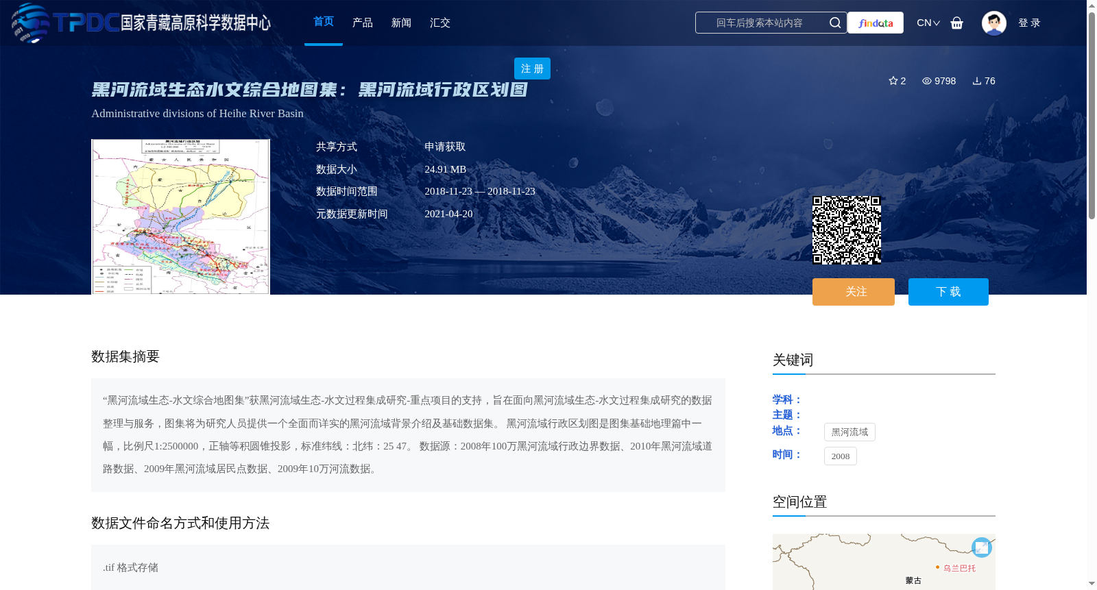
“黑河流域生态-水文综合地图集”获黑河流域生态-水文过程集成研究-重点项目的支持,旨在面向黑河流域生态-水文过程集成研究的数据整理与服务,图集将为研究人员提供一个全面而详实的黑河流域背景介绍及基础数据集。
黑河流域行政区划图是图集基础地理篇中一幅,比例尺1:2500000,正轴等积圆锥投影,标准纬线:北纬:25 47。
数据源:2008年100万黑河流域行政边界数据、2010年黑河流域道路数据、2009年黑河流域居民点数据、2009年10万河流数据。
The Comprehensive Eco-hydrological Atlas of the Heihe River Basin is supported by the Key Project of Integrated Research on Eco-hydrological Processes in the Heihe River Basin. It is intended for data organization and service oriented towards integrated research on eco-hydrological processes in the Heihe River Basin, and will provide researchers with comprehensive and detailed background introductions and basic datasets related to the Heihe River Basin.
The administrative division map of the Heihe River Basin is a part of the basic geography section of this atlas, with a scale of 1:2500000, adopting the normal aspect equal-area conic projection, and its standard parallels are 25°N and 47°N.
Data sources: 2008 1:1,000,000 administrative boundary data of the Heihe River Basin; 2010 road data of the Heihe River Basin; 2009 settlement data of the Heihe River Basin; 2009 1:100,000 river data of the Heihe River Basin.
提供机构:
王建华,赵军,王小敏
创建时间:
2013-07-27
搜集汇总
数据集介绍
背景与挑战
背景概述
该数据集是黑河流域生态水文综合地图集的一部分,提供了黑河流域的行政区划信息,比例尺为1:2500000,采用正轴等积圆锥投影。数据来源于2008年至2010年的多种地理数据,包括行政边界、道路、居民点和河流数据,以.tif格式存储。
以上内容由遇见数据集搜集并总结生成


