丝绸之路沿线国家多年平均温度数据集(2010)V1.0
收藏地球大数据科学工程2024-05-01 收录
下载链接:
https://data.casearth.cn/sdo/detail/5feae825819aec33049b7bcd
下载链接
链接失效反馈官方服务:
资源简介:
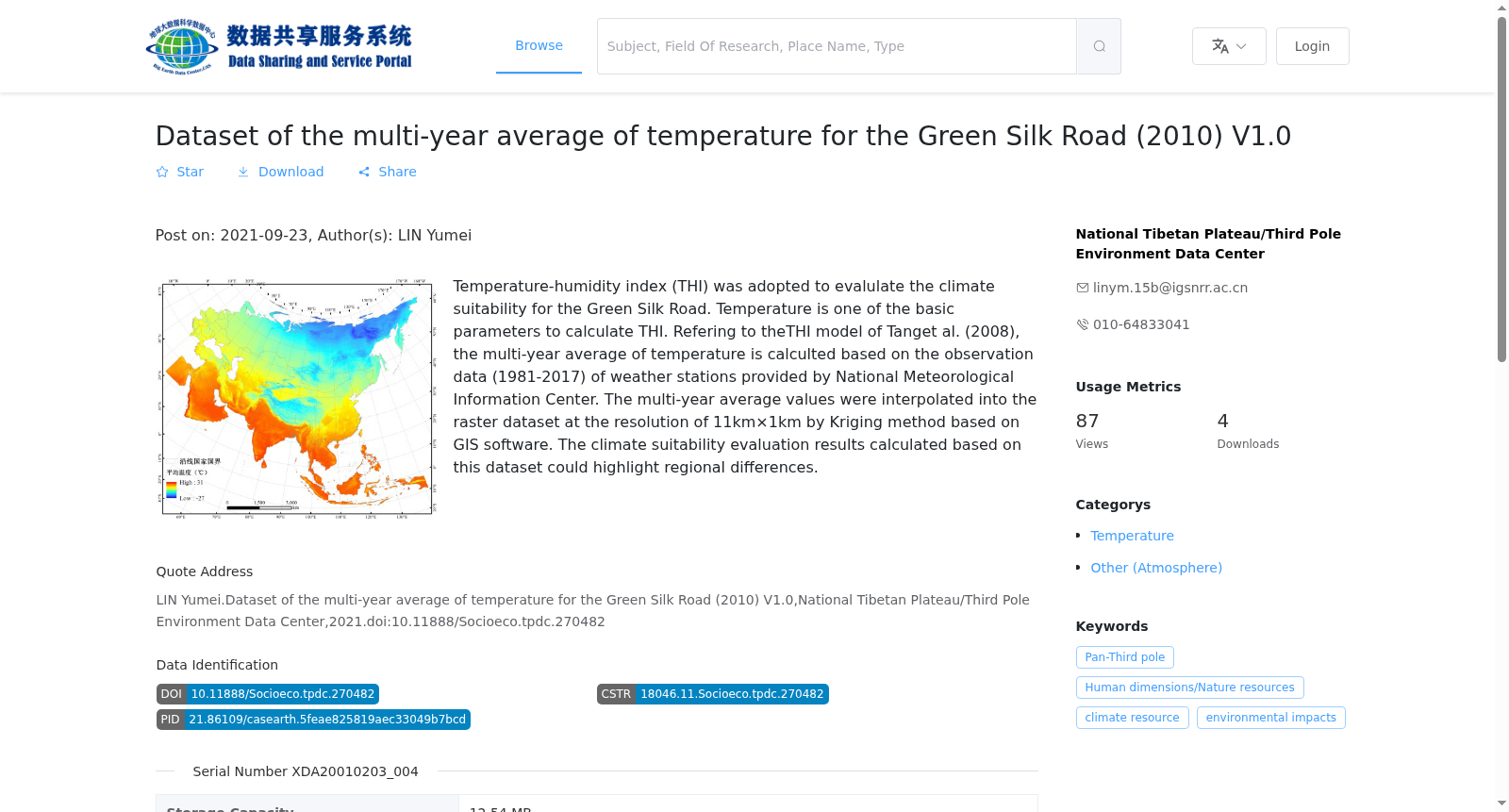
采用温湿指数开展绿色丝绸之路沿线国家气候适宜性评价。温度是计算温湿指数的基础参数之一。在参考唐焰等(2008)计算温湿指数公式的基础上,基于国家气象信息中心提供的1981-2017年气象站点观测数据,计算各站点温度的多年平均数据。基于GIS技术,在考虑海拔、经纬度要素对温度影响的基础上,采用克里格方法对分布在绿色丝绸之路沿线国家的气象站点多年平均数据进行插值,得到1km×1km的栅格数据集。该数据集空间分辨率高,基于该数据集计算得到的气候适宜性评价结果更能凸显区域差异。
Climate suitability assessment for countries along the Green Silk Road was performed using the Temperature Humidity Index (THI). Temperature is one of the fundamental parameters for THI calculation. Referencing the THI calculation formula proposed by Tang et al. (2008), we computed the multi-year average temperature at each meteorological station using in-situ observational data from 1981 to 2017 provided by the National Meteorological Information Center. Leveraging Geographic Information System (GIS) technology and accounting for the effects of elevation, longitude, and latitude on temperature, we interpolated the multi-year average temperature data of meteorological stations across countries along the Green Silk Road via the Kriging interpolation method, generating a 1km×1km raster dataset. This dataset boasts a high spatial resolution, enabling the climate suitability assessment results derived from it to better reveal regional disparities.
提供机构:
国家青藏高原科学数据中心
搜集汇总
数据集介绍
背景与挑战
背景概述
该数据集提供了丝绸之路沿线国家多年平均温度的栅格数据,分辨率为11km×1km,基于1981-2017年的气象站观测数据生成,主要用于气候适宜性评估和温湿度指数(THI)计算。
以上内容由遇见数据集搜集并总结生成


