泛第三极(65国)土壤可蚀性因子(K)图(2021)
收藏国家青藏高原科学数据中心2021-12-09 更新2024-03-06 收录
下载链接:
https://data.tpdc.ac.cn/zh-hans/data/7885dcc7-7085-49e4-99b4-6e7e447653df
下载链接
链接失效反馈官方服务:
资源简介:
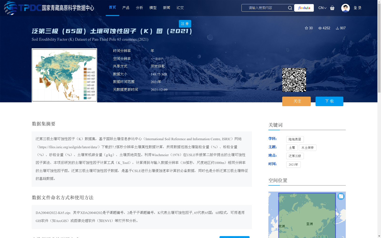
泛第三极土壤可蚀性因子(K)数据集,基于国际土壤信息参比中心(International Soil Reference and Information Centre, ISRIC)网站(https://files.isric.org/soilgrids/latest/data/)下载的7.5弧秒分辨率土壤属性数据计算,所用数据包括土壤黏粒含量(%)、粉粒含量(%)、砂粒含量(%)、土壤有机碳含量(g/kg)、土壤质地类型。利用Wischmeier(1978)在USLE手册第二版中提出的土壤可蚀性因子算法、本项目研发的土壤可蚀性因子计算工具(K_Tool),计算得到与输入数据分辨率(30弧秒,尺度地区约1000m)相同分辨率的土壤可蚀性因子图。泛第三极土壤可蚀性因子数据,是基于CSLE进行土壤侵蚀速率计算的必备数据,同时也是分析泛第三极土壤特征的基础数据。
Pan-Third Pole Soil Erodibility Factor (K) Dataset. This dataset was calculated using 7.5-arcsecond resolution soil attribute data downloaded from the official website of the International Soil Reference and Information Centre (ISRIC) (https://files.isric.org/soilgrids/latest/data/). The utilized data include soil clay content (%), silt content (%), sand content (%), soil organic carbon content (g/kg), and soil texture type. Leveraging the soil erodibility factor algorithm proposed by Wischmeier (1978) in the second edition of the Universal Soil Loss Equation (USLE) manual and the soil erodibility factor calculation tool (K_Tool) developed in this project, we generated soil erodibility factor maps matching the resolution of the input data (30 arcseconds, approximately 1000m per pixel in the study region). The Pan-Third Pole soil erodibility factor dataset is a mandatory dataset for calculating soil erosion rate based on the Chinese Soil Loss Equation (CSLE), and also a fundamental dataset for analyzing soil characteristics of the Pan-Third Pole region.
提供机构:
杨勤科
创建时间:
2021-11-26
搜集汇总
数据集介绍
背景与挑战
背景概述
该数据集是2021年泛第三极地区65个国家的土壤可蚀性因子(K)图,基于国际土壤信息参比中心(ISRIC)的土壤属性数据,采用Wischmeier算法和专用计算工具生成,空间分辨率约为1000米(30弧秒)。它主要用于支持土壤侵蚀速率计算和土壤特征分析,数据格式为TIFF,可通过GIS软件处理,并以开放获取方式共享。
以上内容由遇见数据集搜集并总结生成


