青藏高原融化季1km土壤水分数据集(2017-2021)
收藏国家青藏高原科学数据中心2024-03-18 更新2025-11-15 收录
下载链接:
https://data.tpdc.ac.cn/zh-hans/data/d659342b-5a30-4aa4-8ccf-0cc82cd17132
下载链接
链接失效反馈官方服务:
资源简介:
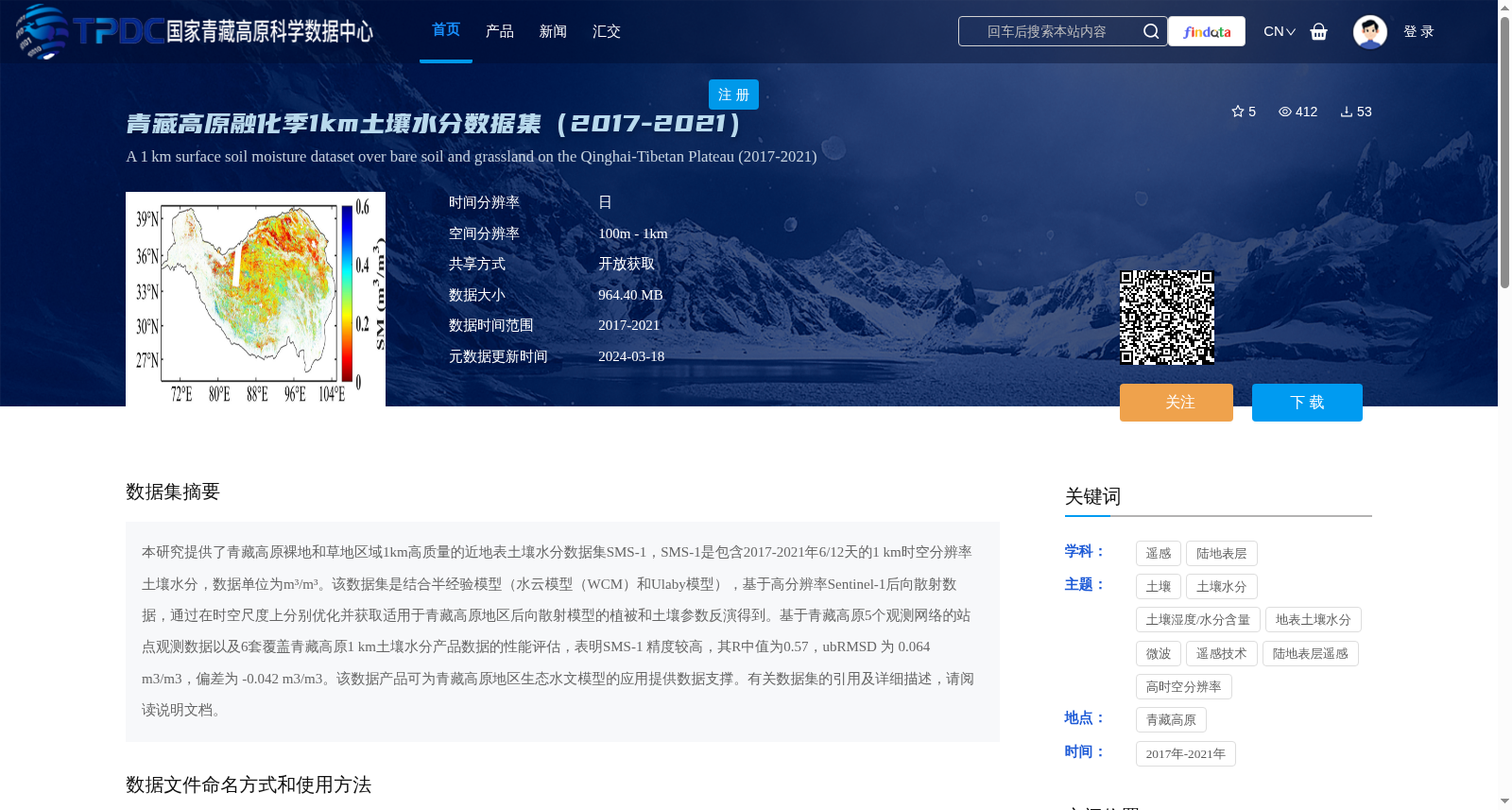
本研究提供了青藏高原裸地和草地区域1km高质量的近地表土壤水分数据集SMS-1,SMS-1是包含2017-2021年6/12天的1 km时空分辨率土壤水分,数据单位为m³/m³。该数据集是结合半经验模型(水云模型(WCM)和Ulaby模型),基于高分辨率Sentinel-1后向散射数据,通过在时空尺度上分别优化并获取适用于青藏高原地区后向散射模型的植被和土壤参数反演得到。基于青藏高原5个观测网络的站点观测数据以及6套覆盖青藏高原1 km土壤水分产品数据的性能评估,表明SMS-1 精度较高,其R中值为0.57,ubRMSD 为 0.064 m3/m3,偏差为 -0.042 m3/m3。该数据产品可为青藏高原地区生态水文模型的应用提供数据支撑。有关数据集的引用及详细描述,请阅读说明文档。
This study presents a high-quality 1 km near-surface soil moisture dataset SMS-1 for bare soil and grassland areas over the Tibetan Plateau. SMS-1 contains soil moisture data with 1 km spatiotemporal resolution at 6-day and 12-day intervals from 2017 to 2021, with the unit of m³/m³. This dataset was retrieved by combining semi-empirical models, namely the Water Cloud Model (WCM) and Ulaby model, using high-resolution Sentinel-1 backscattering data, and separately optimizing vegetation and soil parameters of the backscattering model tailored for the Tibetan Plateau region across temporal and spatial scales. Performance evaluations based on in-situ observation data from five observation networks over the Tibetan Plateau and six sets of 1 km soil moisture products covering the plateau show that SMS-1 has high accuracy, with a median R of 0.57, an unbiased root-mean-square deviation (ubRMSD) of 0.064 m³/m³, and a bias of -0.042 m³/m³. This dataset can provide data support for the application of ecohydrological models in the Tibetan Plateau region. Please refer to the accompanying documentation for dataset citations and detailed descriptions.
提供机构:
赵林,樊磊
创建时间:
2024-03-18
搜集汇总
数据集介绍
背景与挑战
背景概述
该数据集提供了2017-2021年青藏高原裸地和草地区域的近地表土壤水分数据,空间分辨率1公里,时间分辨率6/12天,基于Sentinel-1后向散射数据通过半经验模型反演生成,精度较高(R中值0.57,ubRMSD 0.064 m³/m³),适用于生态水文模型研究。
以上内容由遇见数据集搜集并总结生成


