陕西省50米分辨率土壤可蚀性因子图(2010年)
收藏国家地球系统科学数据中心2020-04-28 更新2024-04-21 收录
下载链接:
https://www.geodata.cn/data/datadetails.html?dataguid=87285061833748&docId=16003
下载链接
链接失效反馈官方服务:
资源简介:
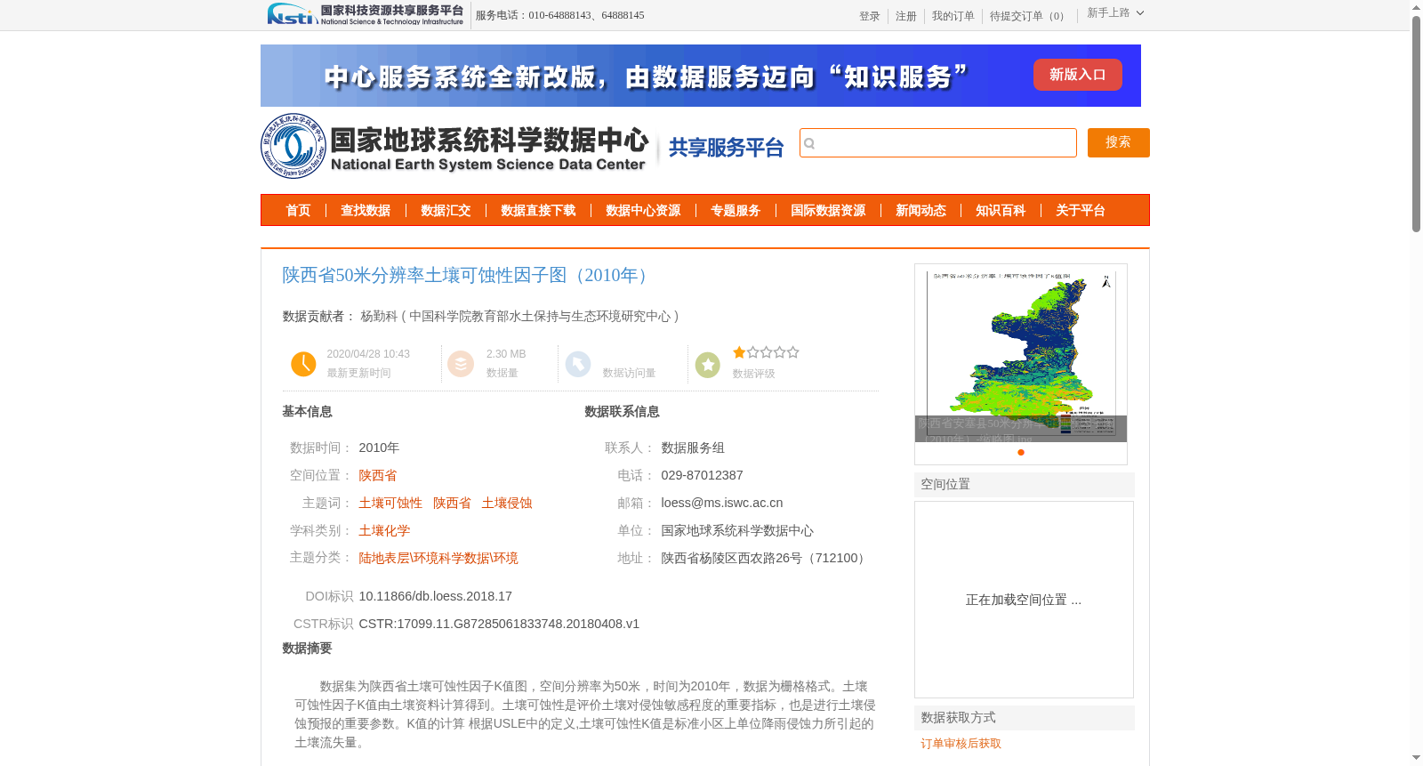
数据集为陕西省土壤可蚀性因子K值图,空间分辨率为50米,时间为2010年,数据为栅格格式。土壤可蚀性因子K值由土壤资料计算得到。土壤可蚀性是评价土壤对侵蚀敏感程度的重要指标,也是进行土壤侵蚀预报的重要参数。K值的计算 根据USLE中的定义,土壤可蚀性K值是标准小区上单位降雨侵蚀力所引起的土壤流失量。
This dataset is a soil erodibility factor K value map of Shaanxi Province, with a spatial resolution of 50 meters, covering the year 2010, and stored in raster format. The soil erodibility factor K values were calculated using soil survey data. Soil erodibility is an important indicator for evaluating soil sensitivity to erosion, and a critical parameter for soil erosion prediction. The calculation of K value follows the definition specified in the Universal Soil Loss Equation (USLE): the soil erodibility K value is defined as the amount of soil loss caused by unit rainfall erosivity on a standard runoff plot.
提供机构:
中国科学院教育部水土保持与生态环境研究中心
创建时间:
2018-04-08
搜集汇总
数据集介绍
背景与挑战
背景概述
该数据集提供了陕西省2010年50米分辨率的土壤可蚀性因子K值图,用于评估土壤对侵蚀的敏感性和进行土壤侵蚀预报。数据由陕西省土壤资料计算生成,适用于环境科学和土壤化学研究。
以上内容由遇见数据集搜集并总结生成


