亚洲高山区边界数据集
收藏国家青藏高原科学数据中心2025-02-14 更新2025-04-12 收录
下载链接:
https://data.tpdc.ac.cn/zh-hans/data/e089710a-93b6-4557-9016-e9f43ab4ded0
下载链接
链接失效反馈官方服务:
资源简介:
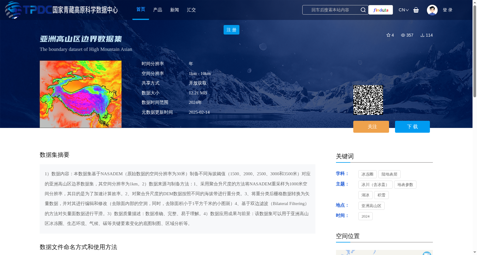
1)数据内容:本数据集基于NASADEM(原始数据的空间分辨率为30米)制备不同海拔阈值(1500、2000、2500、3000和3500米)对应的亚洲高山区边界数据集,其空间分辨率为1km。2)数据来源与制备方法:1、采用聚合升尺度的方法将NASADEM重采样为1000米空间分辨率,其目的是为了加速计算效率。2、对聚合升尺度的DEM数据按照不同的海拔带进行重分类。3、将重分类后栅格数据转换为矢量数据,并对其进行编辑和修改(去除面内部的空洞,同时,去除面积小于1平方千米的小图斑)4、基于双边滤波(Bilateral Filtering)的方法对矢量面数据进行平滑。3)数据质量描述:数据准确、完整、易于理解。4)数据应用成果与前景:该数据集可以用于亚洲高山区冰冻圈、生态环境、气候、碳等关键要素变化的底图制图、区域分析等。
1) Data Content: This dataset is developed based on NASADEM (the original spatial resolution is 30 meters) to generate boundary datasets for the high mountainous regions of Asia corresponding to different elevation thresholds (1500, 2000, 2500, 3000, and 3500 meters), with a spatial resolution of 1 km.
2) Data Source and Preparation Method:
1. Aggregation upscaling method was adopted to resample NASADEM to a spatial resolution of 1000 meters, aiming to accelerate computational efficiency.
2. The aggregated upscaled DEM data was reclassified according to different elevation zones.
3. The reclassified raster data was converted to vector data, followed by editing and modification (removing internal holes in polygons and eliminating small patches with an area less than 1 square kilometer).
4. The vector polygon data was smoothed using the Bilateral Filtering method.
3) Data Quality Description: The dataset is accurate, complete, and easy to understand.
4) Data Application Achievements and Prospects: This dataset can be used for base mapping, regional analysis and other related research on changes in key elements such as the cryosphere, ecological environment, climate, and carbon in the high mountainous regions of Asia.
提供机构:
赵宏宇
创建时间:
2025-01-06
搜集汇总
数据集介绍
背景与挑战
背景概述
该数据集是基于NASADEM制备的亚洲高山区边界数据,提供1500米至3500米不同海拔阈值的矢量边界,空间分辨率为1km,数据时间为2024年。它通过聚合升尺度和双边滤波等方法处理,适用于冰冻圈、生态环境等领域的区域分析和底图制图。
以上内容由遇见数据集搜集并总结生成


