青藏高原数字土壤制图产品数据集(2015-2024)
收藏资源简介:
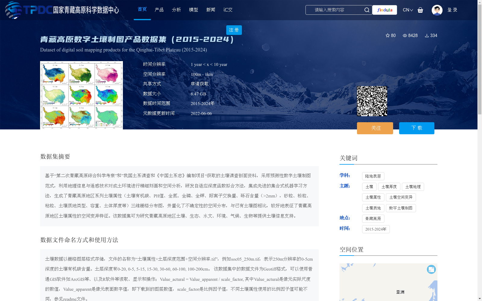
基于“第二次青藏高原综合科学考察”和”我国土系调查和《中国土系志》编制项目“获取的土壤调查剖面资料,采用预测性数字土壤制图范式,利用地理信息与遥感技术对成土环境进行精细刻画和空间分析,研发自适应深度函数拟合方法,集成先进的集合式机器学习方法,生成了青藏高原地区系列土壤属性(土壤有机碳、PH值、全氮、全磷、全钾、阳离子交换量、砾石含量(>2mm),砂粒、粉粒、粘粒、土壤质地类型、容重、土体厚度等)三维栅格分布图,并量化了不确定性的空间分布,与已有土壤图相比,较好地表征了青藏高原地区土壤属性的空间变异特征。该数据集可为研究青藏高原地区土壤、生态、水文、环境、气候、生物等提供土壤信息支持。
This dataset is developed based on soil survey profile data collected from the Second Tibetan Plateau Comprehensive Scientific Expedition and the National Soil Series Survey and Compilation Project of *Soil Series of China*. Adopting the predictive digital soil mapping paradigm, it uses geographic information and remote sensing technologies to finely characterize and spatially analyze soil-forming environments, develops an adaptive deep function fitting method, and integrates advanced ensemble machine learning approaches to generate three-dimensional raster maps of multiple soil properties in the Tibetan Plateau, including soil organic carbon, pH value, total nitrogen, total phosphorus, total potassium, cation exchange capacity, gravel content (>2 mm), sand, silt, clay, soil texture type, bulk density, soil thickness, and more. It also quantifies the spatial distribution of associated uncertainties. Compared with existing soil maps, this dataset better characterizes the spatial variability of soil properties across the Tibetan Plateau. This dataset can provide reliable soil information support for research related to soil, ecology, hydrology, environment, climate, biology and other fields in the Tibetan Plateau.