东亚10m分辨率湿地空间分布数据集(2021年)
收藏国家地球系统科学数据中心2024-11-26 更新2024-03-04 收录
下载链接:
https://www.geodata.cn/data/datadetails.html?dataguid=58876863818267&docId=2193
下载链接
链接失效反馈官方服务:
资源简介:
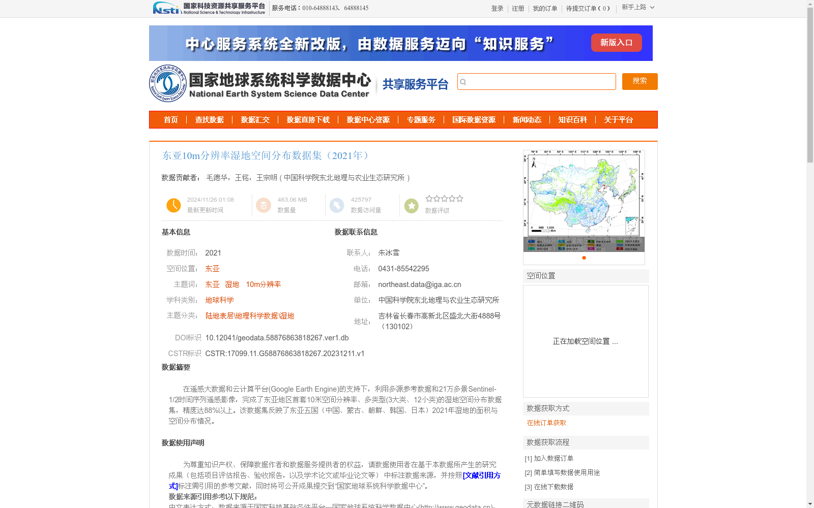
在遥感大数据和云计算平台(Google Earth Engine)的支持下,利用多源参考数据和21万多景Sentinel-1/2时间序列遥感影像,完成了东亚地区首套10米空间分辨率、多类型(3大类、12小类)的湿地空间分布数据集,精度达88%以上。该数据集反映了东亚五国(中国、蒙古、朝鲜、韩国、日本)2021年湿地的面积与空间分布情况。
Supported by remote sensing big data and the cloud computing platform Google Earth Engine, this study developed the first 10-meter spatial resolution wetland spatial distribution dataset in East Asia using multi-source reference data and more than 210,000 scenes of Sentinel-1 and Sentinel-2 time-series remote sensing imagery. The dataset covers 3 major categories and 12 sub-categories of wetlands, with an overall accuracy of over 88%. It reflects the area and spatial distribution of wetlands in the five East Asian countries (China, Mongolia, the Democratic People's Republic of Korea, the Republic of Korea, and Japan) in 2021.
提供机构:
中国科学院东北地理与农业生态研究所
创建时间:
2023-12-11
搜集汇总
数据集介绍
背景与挑战
背景概述
该数据集是2021年东亚地区首套10米分辨率湿地空间分布数据,覆盖中国、蒙古、朝鲜、韩国和日本,包含3大类12小类湿地类型,总体精度超过88%。
以上内容由遇见数据集搜集并总结生成


