青藏高原卫星遥感降水再分析数据集(1998-2018)
收藏国家青藏高原科学数据中心2023-01-11 更新2024-02-29 收录
下载链接:
https://data.tpdc.ac.cn/zh-hans/data/2878df07-851c-4ff6-80c6-a5466491a8a7
下载链接
链接失效反馈官方服务:
资源简介:
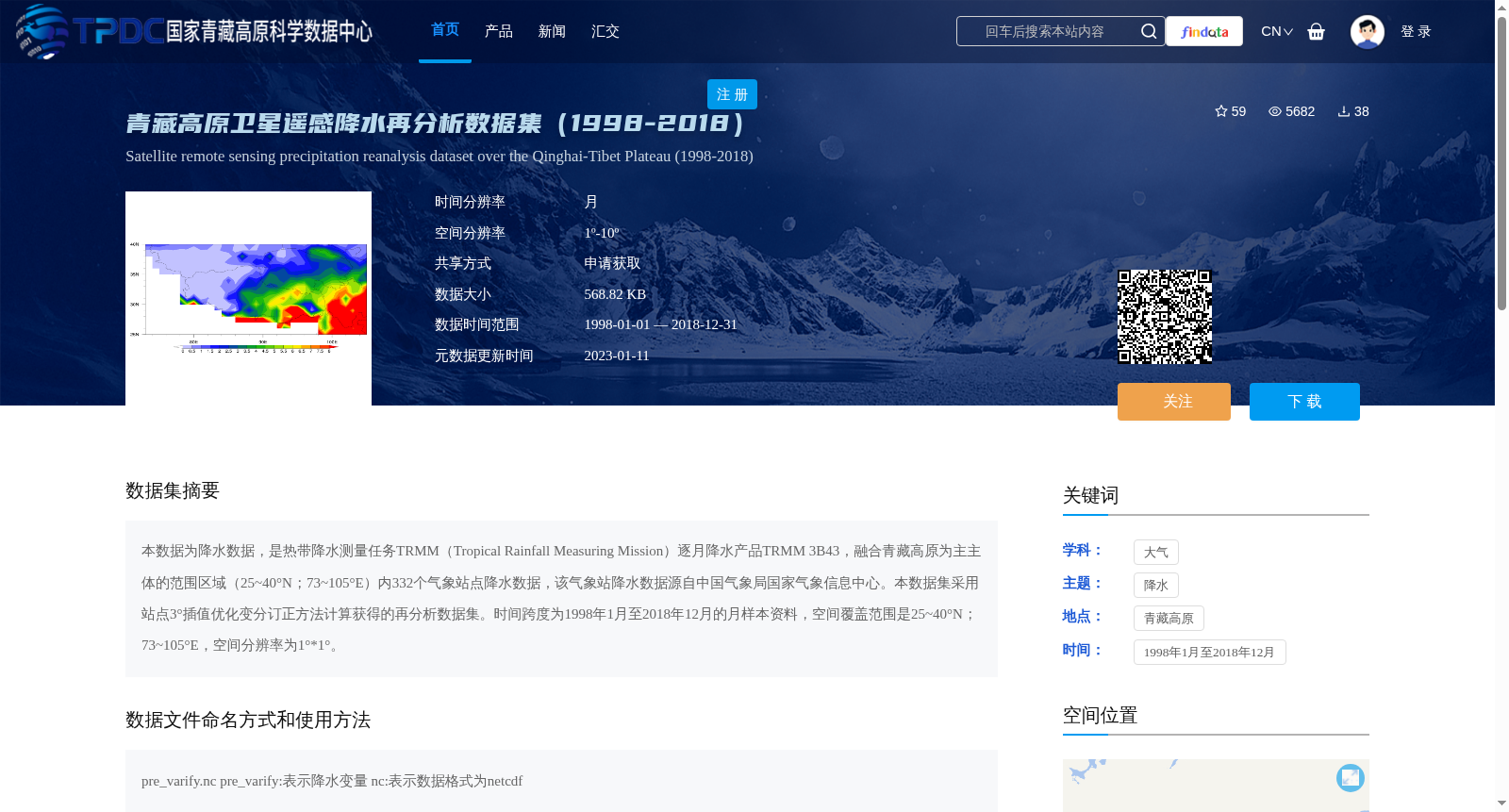
本数据为降水数据,是热带降水测量任务TRMM(Tropical Rainfall Measuring Mission)逐月降水产品TRMM 3B43,融合青藏高原为主主体的范围区域(25~40°N;73~105°E)内332个气象站点降水数据,该气象站降水数据源自中国气象局国家气象信息中心。本数据集采用站点3°插值优化变分订正方法计算获得的再分析数据集。时间跨度为1998年1月至2018年12月的月样本资料,空间覆盖范围是25~40°N;73~105°E,空间分辨率为1°*1°。
This is a precipitation dataset based on the TRMM 3B43 monthly precipitation product from the Tropical Rainfall Measuring Mission (TRMM). It integrates precipitation observations from 332 meteorological stations within the region predominantly centered on the Qinghai-Tibet Plateau, with geographic bounds of 25–40°N and 73–105°E. These station data were obtained from the National Meteorological Information Center of the China Meteorological Administration (CMA). This reanalysis dataset was generated using the 3° interpolation-optimized variational correction method incorporating in-situ station measurements. The temporal coverage includes monthly sample data from January 1998 to December 2018, with a spatial resolution of 1°×1° over the aforementioned geographic bounds.
提供机构:
徐祥德,孙婵
创建时间:
2021-07-20
搜集汇总
数据集介绍
背景与挑战
背景概述
该数据集为青藏高原卫星遥感降水再分析数据,时间跨度为1998年1月至2018年12月,空间覆盖范围为25~40°N;73~105°E,空间分辨率为1°*1°。数据融合了TRMM逐月降水产品和青藏高原区域内332个气象站点的降水数据,采用站点3°插值优化变分订正方法计算获得。
以上内容由遇见数据集搜集并总结生成


