缅甸水文地质数据(1:100万地质图)
收藏地球大数据科学工程2024-03-04 收录
下载链接:
https://data.casearth.cn/sdo/detail/653f3bb3819aec42f022744b
下载链接
链接失效反馈官方服务:
资源简介:
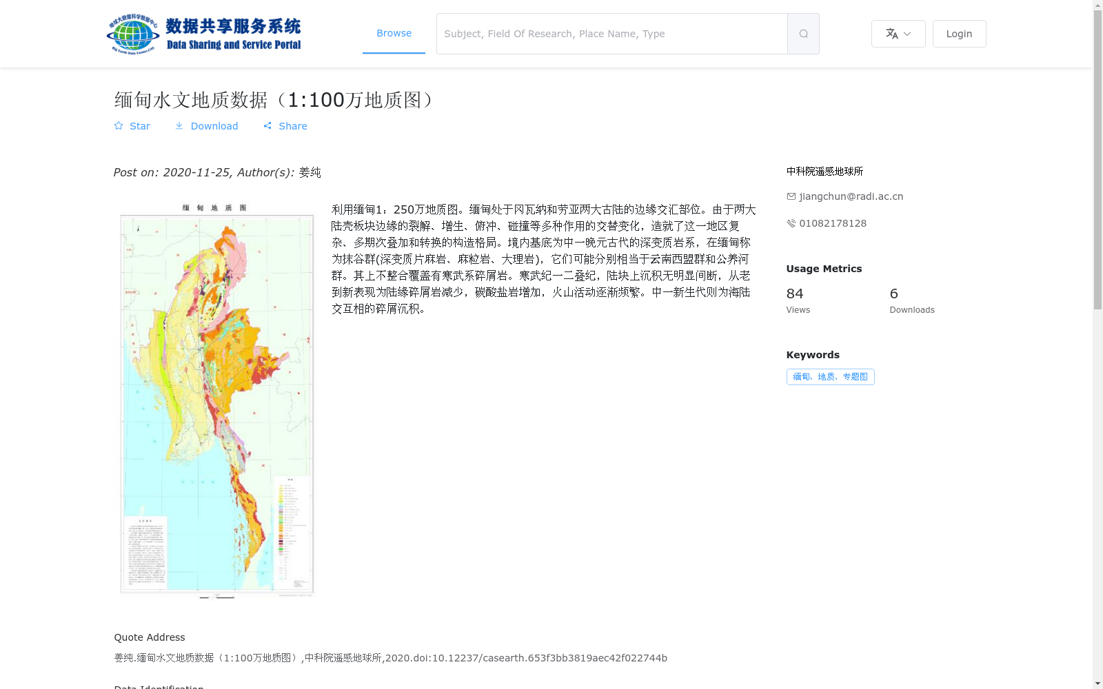
利用缅甸1:250万地质图。缅甸处于冈瓦纳和劳亚两大古陆的边缘交汇部位。由于两大陆壳板块边缘的裂解、增生、俯冲、碰撞等多种作用的交替变化,造就了这一地区复杂、多期次叠加和转换的构造格局。境内基底为中一晚元古代的深变质岩系,在缅甸称为抹谷群(深变质片麻岩、麻粒岩、大理岩),它们可能分别相当于云南西盟群和公养河群。其上不整合覆盖有寒武系碎屑岩。寒武纪一二叠纪,陆块上沉积无明显间断,从老到新表现为陆缘碎屑岩减少,碳酸盐岩增加,火山活动逐渐频繁。中一新生代则为海陆交互相的碎屑沉积。
This dataset is developed based on the 1:2,500,000 geological map of Myanmar. Myanmar lies at the convergent boundary between the margins of two ancient paleocontinents, Gondwana and Laurasia. Alternating geological processes such as rifting, accretion, subduction and collision along the margins of these two continental crust plates have formed a complex, multi-phase superimposed and transcurrent tectonic framework in this region.
The basement beneath Myanmar's territory consists of middle-late Proterozoic high-grade metamorphic rock series, locally named the Mogok Group in Myanmar, which includes highly metamorphic gneisses, granulites and marbles. These rock series may respectively correspond to the Ximeng Group and Gongyanghe Group in Yunnan Province, China. Cambrian clastic rocks unconformably overlie this basement.
From the Cambrian to the Permian, there were no distinct sedimentary hiatuses on this continental block, showing a temporal trend from older to younger strata: declining epicontinental clastic rocks, increasing carbonate rocks, and gradually more frequent volcanic activities. During the Mesozoic-Cenozoic period, the sediments were clastic deposits formed in alternating marine and continental environments.
提供机构:
中科院遥感地球所
搜集汇总
数据集介绍
背景与挑战
背景概述
该数据集是基于缅甸1:250万地质图生成的1:100万比例尺水文地质栅格数据,以jpg格式提供,文件大小为1.74 MB。它主要描述缅甸的地质构造历史,包括基底变质岩、沉积序列和构造演化,适用于地质研究,但技术规格如空间分辨率未明确标注,且产品类型列为社会经济数据可能存在不一致。
以上内容由遇见数据集搜集并总结生成


