日喀则坡面径流小区径流泥沙观测数据(2021)
收藏国家青藏高原科学数据中心2025-04-09 更新2024-03-07 收录
下载链接:
https://data.tpdc.ac.cn/zh-hans/data/0dd4470a-9c76-4791-8ce0-74bda6625283
下载链接
链接失效反馈官方服务:
资源简介:
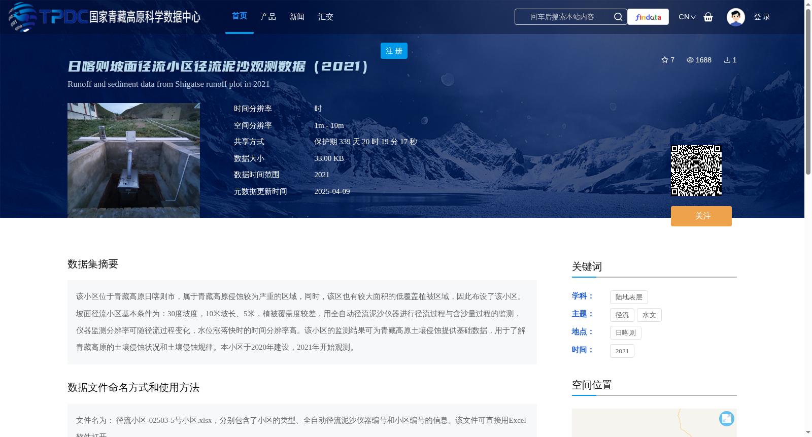
该小区位于青藏高原日喀则市,属于青藏高原侵蚀较为严重的区域,同时,该区也有较大面积的低覆盖植被区域,因此布设了该小区。坡面径流小区基本条件为:30度坡度,10米坡长、5米,植被覆盖度较差,用全自动径流泥沙仪器进行径流过程与含沙量过程的监测,仪器监测分辨率可随径流过程变化,水位涨落快时的时间分辨率高。该小区的监测结果可为青藏高原土壤侵蚀提供基础数据,用于了解青藏高原的土壤侵蚀状况和土壤侵蚀规律。本小区于2020年建设,2021年开始观测。
This slope runoff plot is situated in Xigazê City, Qinghai-Tibet Plateau, a severely eroded region of the plateau that also features extensive low-coverage vegetation areas. Consequently, this plot was deployed for monitoring activities. Basic specifications of the plot are as follows: 30° slope gradient, 10-meter slope length, 5-meter width, and poor vegetation coverage. Fully automatic runoff and sediment monitoring instruments are used to conduct real-time monitoring of the runoff process and sediment concentration process. The monitoring resolution of the instrument can be dynamically adjusted according to the runoff process, with higher temporal resolution during periods of rapid water level fluctuations. The monitoring data obtained from this plot can provide fundamental datasets for soil erosion research on the Qinghai-Tibet Plateau, facilitating the understanding of the status and underlying regularity of soil erosion in this region. The plot was constructed in 2020 and commenced formal observations in 2021.
提供机构:
符素华
创建时间:
2022-06-06
搜集汇总
数据集介绍
背景与挑战
背景概述
该数据集记录了2021年青藏高原日喀则市坡面径流小区的径流和泥沙观测数据,用于研究该区域的土壤侵蚀状况和规律。数据以Excel格式存储,包含全自动径流泥沙仪器的监测结果,时间分辨率可随径流过程变化。
以上内容由遇见数据集搜集并总结生成


