1976年青藏高原60m Landsat MSS/TM冰川面积数据集(TPG1976_V1.0)
收藏地球大数据科学工程2024-05-01 收录
下载链接:
https://data.casearth.cn/sdo/detail/65389bc2819aec0f261126fc
下载链接
链接失效反馈官方服务:
资源简介:
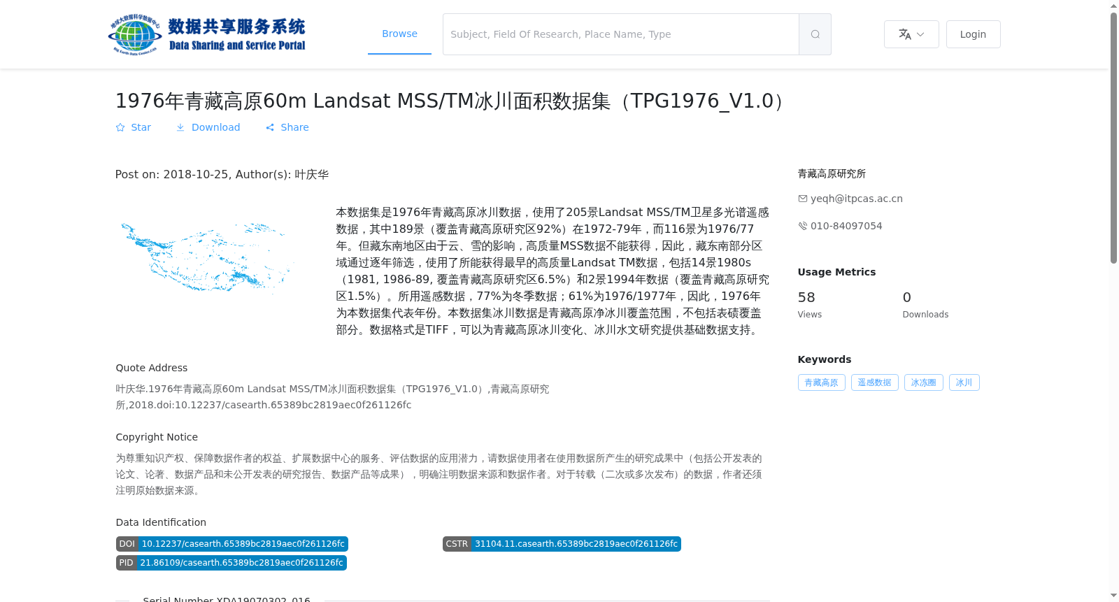
本数据集是1976年青藏高原冰川数据,使用了205景Landsat MSS/TM卫星多光谱遥感数据,其中189景(覆盖青藏高原研究区92%)在1972-79年,而116景为1976/77年。但藏东南地区由于云、雪的影响,高质量MSS数据不能获得,因此,藏东南部分区域通过逐年筛选,使用了所能获得最早的高质量Landsat TM数据,包括14景1980s(1981, 1986-89, 覆盖青藏高原研究区6.5%)和2景1994年数据(覆盖青藏高原研究区1.5%)。所用遥感数据,77%为冬季数据;61%为1976/1977年,因此,1976年为本数据集代表年份。本数据集冰川数据是青藏高原净冰川覆盖范围,不包括表碛覆盖部分。数据格式是TIFF,可以为青藏高原冰川变化、冰川水文研究提供基础数据支持。
This dataset is a glacier dataset for the Tibetan Plateau corresponding to the year 1976. A total of 205 Landsat MSS/TM multispectral remote sensing satellite scenes were utilized for this dataset. Among them, 189 scenes (covering 92% of the study area on the Tibetan Plateau) were acquired between 1972 and 1979, and 116 scenes were captured in 1976/1977. However, due to interference from clouds and snow, high-quality MSS data were unavailable for the southeastern Tibetan Plateau. Therefore, for partial regions in the southeastern Tibetan Plateau, the earliest available high-quality Landsat TM data were selected year by year, including 14 scenes from the 1980s (1981, 1986–1989, covering 6.5% of the study area) and 2 scenes acquired in 1994 (covering 1.5% of the study area). Of all the utilized remote sensing data, 77% were winter datasets, and 61% were captured in 1976/1977. Thus, the year 1976 is adopted as the representative year of this dataset. This dataset records the net glacier coverage of the Tibetan Plateau, excluding areas covered by supraglacial debris. The data are stored in TIFF format, providing fundamental data support for research on glacier changes and glacial hydrology on the Tibetan Plateau.
提供机构:
青藏高原研究所
搜集汇总
数据集介绍
背景与挑战
背景概述
该数据集是1976年青藏高原60米分辨率的冰川面积数据,主要基于Landsat MSS/TM卫星遥感影像,覆盖青藏高原大部分区域(藏东南部分区域使用1980s和1994年数据补充)。数据以TIFF格式存储,为研究青藏高原冰川变化和水文提供了基础数据支持。
以上内容由遇见数据集搜集并总结生成


